Category:Kings Arms, York
Jump to navigation
Jump to search
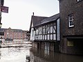
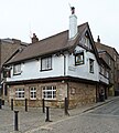
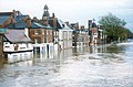
English: The Kings Arms is an iconic Samuel Smiths public house in York, North Yorkshire. The pub is known for its tendancy to regularly flood. Grade II listed.
| Object location | | View all coordinates using: OpenStreetMap |
|---|
pub in York, North Yorkshire, England, UK  | |||||
| Upload media | |||||
| Instance of | |||||
|---|---|---|---|---|---|
| Location | York, City of York, North Yorkshire, Yorkshire and the Humber, England | ||||
| Street address |
| ||||
| Heritage designation |
| ||||
 | |||||
This is a category about listed building number 1257523. |
Media in category "Kings Arms, York"
The following 52 files are in this category, out of 52 total.
-
 Flood in King Street - geograph.org.uk - 667883.jpg 544 × 640; 85 KB
-
 Floods in York 22 Feb 2022 01.jpg 4,608 × 3,456; 4.25 MB
-
 Floods in York 22 Feb 2022 03.jpg 4,608 × 3,456; 3.66 MB
-
 It's a New Record^ - geograph.org.uk - 4863868.jpg 799 × 799; 126 KB
-
 King Street - geograph.org.uk - 1606665.jpg 640 × 426; 73 KB
-
 King's Arms - geograph.org.uk - 1606684.jpg 640 × 426; 72 KB
-
 King's Arms, King's Staith, York (5509707825).jpg 2,808 × 3,121; 4.91 MB
-
 King's Arms, York (Taken by Flickr user 19th December 2014).jpg 3,270 × 3,270; 6.99 MB
-
 King's Staith - geograph.org.uk - 1606636.jpg 640 × 426; 73 KB
-
 Kings Arm public house Sept 2012.jpg 1,200 × 1,600; 1.39 MB
-
 Kings Arms - geograph.org.uk - 266179.jpg 640 × 512; 115 KB
-
 Kings Arms from Ouse Bridge, York (12th June 2013).JPG 3,872 × 2,176; 3.6 MB
-
 Kings Arms on the banks of the Ouse, York - geograph.org.uk - 4314459.jpg 1,600 × 1,062; 822 KB
-
 Kings Arms pub - geograph.org.uk - 1515333.jpg 640 × 480; 68 KB
-
 Kings Arms pub sign 1.jpg 1,536 × 2,048; 910 KB
-
 Kings Arms pub sign 2.jpg 1,536 × 2,048; 648 KB
-
 Kings Arms York - geograph.org.uk - 583995.jpg 640 × 425; 88 KB
-
 Kings Arms, King's Staith, York - geograph.org.uk - 6000304.jpg 1,280 × 1,280; 552 KB
-
 Kings Arms, York - geograph.org.uk - 4130390.jpg 1,590 × 2,089; 1.15 MB
-
 Kings Head, King's Staith, York - geograph.org.uk - 6410517.jpg 5,456 × 3,632; 2.79 MB
-
 King’s Arms, York.jpg 3,072 × 2,304; 4.07 MB
-
 King’s Staith, York Aug 2016.jpg 3,264 × 2,448; 2.48 MB
-
 Please Use Side Door - geograph.org.uk - 930043.jpg 640 × 488; 107 KB
-
 River Ouse In Flood - geograph.org.uk - 2455678.jpg 800 × 1,067; 539 KB
-
 River Ouse in York - geograph.org.uk - 3271424.jpg 1,500 × 1,125; 1.33 MB
-
 Sign of the Kings Arms - geograph.org.uk - 6130374.jpg 1,280 × 1,251; 1.04 MB
-
 The flooded River Ouse, York.jpg 2,048 × 1,536; 467 KB
-
 The King's Arms - geograph.org.uk - 2455683.jpg 800 × 533; 315 KB
-
 The King's Arms - geograph.org.uk - 6130362.jpg 1,280 × 1,219; 1.13 MB
-

-
 The King's Arms flooded again..... - geograph.org.uk - 3272626.jpg 3,264 × 2,448; 3.17 MB
-
 The Kings Arms - geograph.org.uk - 1987523.jpg 800 × 600; 220 KB
-
 The Kings Arms - geograph.org.uk - 1987535.jpg 600 × 800; 188 KB
-
 The Kings Arms, King's Staith - geograph.org.uk - 1597361.jpg 480 × 640; 86 KB
-
 The Kings Arms, York (geograph 3240727).jpg 600 × 800; 138 KB
-
 The Kings Arms, York - geograph.org.uk - 2639485.jpg 800 × 600; 316 KB
-
 The Kings Arms, York - geograph.org.uk - 3240406.jpg 800 × 600; 146 KB
-
 The Kings Arms, York - geograph.org.uk - 3240411.jpg 800 × 600; 162 KB
-
 The Kings Arms, York - geograph.org.uk - 3240412.jpg 800 × 600; 141 KB
-
 The Kings Arms, York - geograph.org.uk - 3240422.jpg 800 × 600; 138 KB
-
 The Kings Arms, York - geograph.org.uk - 4057607.jpg 640 × 480; 317 KB
-
 The Kings Arms, York - geograph.org.uk - 4131352.jpg 1,600 × 1,175; 862 KB
-
 The Ouse in flood. York - geograph.org.uk - 126451.jpg 592 × 391; 41 KB
-
 UK - York (30574654671).jpg 2,500 × 1,667; 1.3 MB
-
 York - The King's Arms Public House, King's Staithe - geograph.org.uk - 6452801.jpg 1,800 × 1,200; 346 KB
-
 York along the river 8617.jpg 2,400 × 1,602; 4.2 MB
-
 York Floods - King's Arms Public House - geograph.org.uk - 6479217.jpg 1,799 × 1,199; 352 KB
-
 York Kings Arms - geograph.org.uk - 644982.jpg 640 × 479; 108 KB
-
 York, a beer garden underwater - geograph.org.uk - 2731018.jpg 480 × 640; 59 KB
-

-

-


.jpg)
.jpg)


.JPG)


.jpg)


.jpg)


