Category:Kingholm Quay
Jump to navigation
Jump to search
architectural structure in Dumfries and Galloway, Scotland, UK  | |||||
| Upload media | |||||
| Instance of | |||||
|---|---|---|---|---|---|
| Location |
| ||||
| Heritage designation |
| ||||
 | |||||
A 19th century port on the River Nith near Dumfries.
Media in category "Kingholm Quay"
The following 42 files are in this category, out of 42 total.
-
 Core Path 37 - geograph.org.uk - 6472901.jpg 4,032 × 1,960; 3.68 MB
-
 Cycling at Kingholm Quay - geograph.org.uk - 3797348.jpg 640 × 424; 109 KB
-
 Glencaple Road near Kingholm Quay - geograph.org.uk - 3367798.jpg 640 × 480; 475 KB
-
 High tide at Kingholm Quay - geograph.org.uk - 3797282.jpg 640 × 375; 111 KB
-
 Kingholm - geograph.org.uk - 949907.jpg 640 × 383; 30 KB
-
 Kingholm Bank Cottage, Dumfries.jpg 3,299 × 2,490; 1.72 MB
-
 Kingholm Quay - geograph.org.uk - 1330331.jpg 640 × 480; 89 KB
-
 Kingholm Quay - geograph.org.uk - 43597.jpg 640 × 421; 135 KB
-
 Kingholm Quay - geograph.org.uk - 87313.jpg 640 × 426; 90 KB
-
 Kingholm Quay basin, the dock and warehouse. River Nith. Dumfries & Galloway.jpg 4,896 × 2,752; 2.92 MB
-
 Kingholm Quay docked boat and old warehouses, River Nith. Dumfries & Galloway.jpg 4,896 × 2,752; 4.81 MB
-
 Kingholm Quay from Laghall Quay, River Nith. Dumfries.jpg 4,896 × 2,752; 5.04 MB
-
 Kingholm Quay from the new slipway River Nith. Dumfries & Galloway.jpg 4,896 × 2,752; 5.68 MB
-
 Kingholm Quay from the riverside walk. River Nith. Dumfries & Galloway.jpg 4,896 × 2,752; 2.08 MB
-
 Kingholm Quay from the riverside walkway, River Nith. Dumfries & Galloway.jpg 4,599 × 2,013; 2.07 MB
-
 Kingholm Quay near Dumfries - geograph.org.uk - 1204665.jpg 640 × 480; 56 KB
-
 Kingholm Quay old sluice control, River Nith. Dumfries & Galloway.jpg 4,896 × 2,752; 7 MB
-
 Kingholm Quay old warehouses. River Nith. Dumfries & Galloway.jpg 4,457 × 2,410; 1.69 MB
-
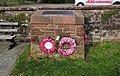 Kingholm Quay War Memorial. River Nith. Dumfries & Galloway.jpg 3,985 × 2,527; 2.82 MB
-
 Kingholm Quay with new slipway. River Nith. Dumfries & Galloway.jpg 3,603 × 2,689; 2.74 MB
-
 Kingholm Quay with steps. River Nith. Dumfries & Galloway.jpg 3,924 × 2,548; 1.92 MB
-
 Kingholm Quay, boat and warehouses. River Nith. Dumfries & Galloway.jpg 4,287 × 2,325; 1.88 MB
-
 Kingholm Quay, Boats - geograph.org.uk - 2112735.jpg 1,920 × 1,280; 517 KB
-
 Kingholm Quay, Bore scour, River Nith. Dumfries & Galloway.jpg 4,655 × 2,475; 2.12 MB
-
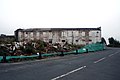
 Kingholm Quay, Derelict houses - geograph.org.uk - 2112673.jpg 1,920 × 1,280; 594 KB
-
 Kingholm Quay, Derelict potato storehouse - geograph.org.uk - 2111820.jpg 1,920 × 1,280; 465 KB
-
 Kingholm Quay, Derelict potato storehouse - geograph.org.uk - 2112655.jpg 1,920 × 1,280; 484 KB
-
 Kingholm Quay, old tavern and warehouse. River Nith. Dumfries & Galloway.jpg 4,428 × 2,136; 1.43 MB
-
 Kingholm Quay, pen (dam) and reservoir. River Nith. Dumfries & Galloway.jpg 4,896 × 2,752; 3.43 MB
-
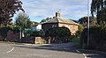 Kingholm Quay, The Lodge. River Nith. Dumfries & Galloway.jpg 4,126 × 2,257; 1.97 MB
-
 Kingholm Quay. View downstream from the walkway. Dumfries. River Nith.jpg 4,896 × 2,752; 2.86 MB
-
 Kingholme Quay - geograph.org.uk - 1660138.jpg 640 × 358; 25 KB
-
 Laghall Quay area, River Nith. Shingle standing area. Dumfries.jpg 4,896 × 2,752; 3.49 MB
-
 Merse Footbridge - geograph.org.uk - 6472898.jpg 4,032 × 1,960; 3.94 MB
-
 Mud flats on the River Nith - geograph.org.uk - 6473572.jpg 4,032 × 1,960; 4.1 MB
-
 Nith near Kingholm Quay - geograph.org.uk - 1737117.jpg 600 × 800; 177 KB
-
 Old Kingholm Quay from Laghall Quay, River Nith. Dumfries.jpg 4,875 × 2,124; 1.92 MB
-
 Quayside - geograph.org.uk - 1843275.jpg 1,200 × 1,600; 576 KB
-
 River Nith at Kingholm Quay - geograph.org.uk - 1204666.jpg 640 × 480; 42 KB
-
 River Nith at Kingholm Quay - geograph.org.uk - 1204670.jpg 640 × 480; 54 KB
-
 River Nith path - geograph.org.uk - 6446713.jpg 1,600 × 778; 470 KB
-
 The River Nith at Kingholm, Dumfries. View upstream.jpg 4,896 × 2,752; 4.68 MB


_and_reservoir._River_Nith._Dumfries_%26_Galloway.jpg)


