Category:King's Park, Glasgow
Jump to navigation
Jump to search
district in Glasgow, Scotland, UK  | |||||
| Upload media | |||||
| Instance of | |||||
|---|---|---|---|---|---|
| Location | Glasgow City, Scotland | ||||
 | |||||
Subcategories
This category has the following 6 subcategories, out of 6 total.
Media in category "King's Park, Glasgow"
The following 42 files are in this category, out of 42 total.
-
 2018 European Mountain Bike Championships DSCF6205 (43193681244).jpg 1,980 × 1,485; 343 KB
-
 2018 European Mountain Bike Championships DSCF6218 (30042744718).jpg 1,980 × 1,485; 373 KB
-
 Aikenhead Road (geograph 1920463).jpg 640 × 480; 65 KB
-
 Aikenhead Sundial (geograph 7264118).jpg 576 × 1,024; 161 KB
-
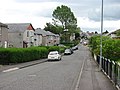
 Aitkenhead Road (geograph 5699204).jpg 1,600 × 1,105; 263 KB
-
 Bus stop, Castlemilk Road - geograph.org.uk - 2483221.jpg 640 × 480; 227 KB
-
 Carmunnock Road (geograph 2637436).jpg 640 × 480; 140 KB
-
 Carmunnock Road - geograph.org.uk - 2637430.jpg 640 × 480; 103 KB
-
 Carmunnock Road by Kings Park (geograph 3527876).jpg 640 × 481; 97 KB
-
 Clydesdale Bank - geograph.org.uk - 2605172.jpg 640 × 612; 97 KB
-
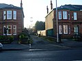
 Crossroads near King's Park Station - geograph.org.uk - 3241424.jpg 640 × 480; 65 KB
-
 Down the hill (geograph 6045490).jpg 2,000 × 1,333; 1.69 MB
-
 Elmore Avenue (geograph 2637453).jpg 640 × 480; 83 KB
-
 Glasgow wards 2017 no07 Langside.png 2,000 × 2,040; 504 KB
-
 Hampden Park Glasgow - panoramio (cropped).jpg 1,820 × 1,365; 1.69 MB
-
 Hampden Park Glasgow - panoramio.jpg 3,072 × 2,304; 4.72 MB
-
 King's Park Avenue (geograph 5410049).jpg 640 × 480; 133 KB
-
 King's Park Avenue - geograph.org.uk - 1138174.jpg 640 × 480; 102 KB
-
 King's Park Avenue - geograph.org.uk - 5410051.jpg 640 × 437; 126 KB
-
 Kings Park Avenue (geograph 6882665).jpg 3,000 × 2,000; 4.21 MB
-

-
 Kings Park Secondary School (geograph 3438835).jpg 640 × 417; 119 KB
-
 Kings Park Secondary School - geograph.org.uk - 2140205.jpg 640 × 480; 146 KB
-
 Kingsbarns Drive, Mount Florida (geograph 2638018).jpg 640 × 480; 119 KB
-
 Kingsbridge Drive (geograph 2602507).jpg 4,000 × 3,000; 5.98 MB
-
 Kingsbridge Drive (geograph 3275748).jpg 640 × 480; 120 KB
-
 Kingsbridge Drive - geograph.org.uk - 3275769.jpg 640 × 480; 135 KB
-
-
 Living in the shadow of Hampden Park - geograph.org.uk - 1138166.jpg 640 × 480; 119 KB
-
 Looking along Menock Road (geograph 2932011).jpg 480 × 640; 49 KB
-
 Looking Towards Kings Park From Behind Hampden Park - panoramio.jpg 1,600 × 1,200; 426 KB
-
 Manse Brae Bridges - geograph.org.uk - 733702.jpg 640 × 480; 62 KB
-
 Map of Lanarkshire Sheet 010, Ordnance Survey, 1863-1865.jpg 10,680 × 7,158; 7.6 MB
-
 Map of Lanarkshire Sheet 010, Ordnance Survey, 1863-1865.tiff 10,680 × 7,158; 218.72 MB
-
 Montford Avenue (geograph 2483214).jpg 640 × 480; 275 KB
-
 North entrance to Kings Park (geograph 2932031).jpg 480 × 640; 83 KB
-
 Railway arch over Carmunnock Road - geograph.org.uk - 1138181.jpg 640 × 480; 127 KB
-
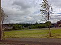
 Scene in Kings Park (geograph 2932350).jpg 640 × 480; 92 KB
-
 The A728 near Mount Florida (geograph 6139645).jpg 1,600 × 900; 349 KB
-
 Traffic Lights - geograph.org.uk - 1138176.jpg 640 × 480; 101 KB
-
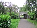 Underpass, Kings Park (geograph 2483224).jpg 640 × 480; 327 KB
-
 View from Kings Park (geograph 2635837).jpg 640 × 480; 100 KB
.jpg)
.jpg)
.jpg)
.jpg)
.jpg)

.jpg)

.jpg)


.jpg)
.jpg)

.jpg)

.jpg)


.jpg)
.jpg)

.jpg)
.jpg)
.jpg)


.jpg)


.jpg)
.jpg)

.jpg)
.jpg)

.jpg)
.jpg)