Category:Kineton
Jump to navigation
Jump to search
village and civil parish in Warwickshire, United Kingdom  | |||||
| Upload media | |||||
| Instance of | |||||
|---|---|---|---|---|---|
| Location | Stratford-on-Avon, Warwickshire, West Midlands, England | ||||
| Population |
| ||||
| Area |
| ||||
 | |||||
English: Kineton is a large village and civil parish on the River Dene in south-eastern Warwickshire, England. The village is part of Stratford-on-Avon district
Subcategories
This category has the following 4 subcategories, out of 4 total.
K
- Kineton War Memorial (4 F)
P
- Pittern Hill Windmill (4 F)
Media in category "Kineton"
The following 190 files are in this category, out of 190 total.
-
 'I think they mean it' - geograph.org.uk - 1491994.jpg 640 × 428; 77 KB
-
 'Keep left at the chimney' - geograph.org.uk - 1490056.jpg 428 × 640; 55 KB
-
 17th century house, Kineton - geograph.org.uk - 1490315.jpg 640 × 428; 67 KB
-
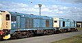
 20 032 and 20138 at Kineton BAD - The Edgehill 130394.jpg 4,117 × 1,805; 1.52 MB
-
 20 117 and 190 Kineton BAD - The Edgehill 130394.jpg 4,309 × 2,245; 2.04 MB
-
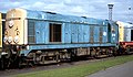 20 121 Kineton BAD - The Edgehill 130394.jpg 4,309 × 2,505; 2.28 MB
-
 20 138 and 20 256 at Kineton BAD - The Edgehill 130394.jpg 4,177 × 1,661; 1.45 MB
-
 20104 Kineton BAD - The Edgehill 130394.jpg 4,253 × 2,537; 2.25 MB
-
 3-6 Bridge Street, Kineton (geograph 7351368).jpg 1,024 × 768; 128 KB
-
 307 125, 131, 105 and 107 in store at Kineton BAD - The Edgehill 130394.jpg 4,271 × 2,449; 2.33 MB
-
 323 213 at Kineton BAD - The Edgehill 130394.jpg 3,925 × 2,269; 1.61 MB
-

-
 9 and 10 Market Place, Kineton (geograph 7352222).jpg 1,024 × 768; 126 KB
-
 A touch of Venice - geograph.org.uk - 1490125.jpg 640 × 428; 65 KB
-
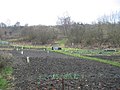 Allotments, Kineton - geograph.org.uk - 99387.jpg 640 × 480; 107 KB
-
 Ammunition train^ from footpath to Gaydon - geograph.org.uk - 1864229.jpg 2,000 × 1,508; 168 KB
-
 Battleton Holt - geograph.org.uk - 3438302.jpg 2,000 × 1,500; 570 KB
-
 Booster station and crab apples - geograph.org.uk - 2049800.jpg 1,500 × 2,000; 324 KB
-
 Bridge near Kineton - geograph.org.uk - 6013952.jpg 640 × 427; 217 KB
-
 Bridge on S^MJR, Kineton - geograph.org.uk - 1832685.jpg 2,000 × 1,492; 294 KB
-

-
 Bridge St Kineton - geograph.org.uk - 6013971.jpg 640 × 427; 185 KB
-
 Bridge St Kineton - geograph.org.uk - 6020016.jpg 640 × 427; 213 KB
-
 Can't Catch Us^ - geograph.org.uk - 4932708.jpg 4,000 × 3,000; 3.9 MB
-
 Castle Road, Kineton - geograph.org.uk - 6560784.jpg 1,280 × 851; 557 KB
-
 Chadshunt House - geograph.org.uk - 98959.jpg 640 × 480; 80 KB
-
 Chicken Charge - geograph.org.uk - 4932661.jpg 1,600 × 1,079; 658 KB
-
 Coffee House Cottage, Kineton (geograph 7352218).jpg 1,024 × 768; 129 KB
-

-

-
 Cottages, Market Place, Kineton (geograph 7352216).jpg 1,024 × 768; 168 KB
-
 Cottages, Southam Street, Kineton (geograph 7352226).jpg 1,024 × 768; 159 KB
-
 Countryside near Kineton - geograph.org.uk - 6013960.jpg 640 × 427; 218 KB
-

-

-

-
 Doctor's surgery, Kineton - geograph.org.uk - 1490299.jpg 640 × 428; 74 KB
-
 Doorway, Market Square, Kineton - geograph.org.uk - 451487.jpg 480 × 640; 105 KB
-
 Drinking trough near Red House Farm - geograph.org.uk - 2835847.jpg 2,000 × 1,502; 418 KB
-
 Driveway to Hardwick Farm - geograph.org.uk - 185590.jpg 640 × 480; 123 KB
-
 Driveway to Kent's Farm - geograph.org.uk - 6023143.jpg 640 × 427; 205 KB
-
 Edgehill Monument - geograph.org.uk - 1556467.jpg 640 × 480; 138 KB
-
 Edgehill Plaque - geograph.org.uk - 1556461.jpg 480 × 640; 112 KB
-
 Entrance drive to Windmill Farm, Kineton - geograph.org.uk - 1832656.jpg 2,000 × 1,494; 200 KB
-
 Farmland by the Tysoe Road - geograph.org.uk - 184225.jpg 640 × 480; 84 KB
-
 Field alongside B4086, Kineton - geograph.org.uk - 1832702.jpg 2,000 × 1,503; 173 KB
-
 Field Near Rising fields Farm - geograph.org.uk - 2495479.jpg 640 × 480; 76 KB
-
 Fields near Battleton Holt - geograph.org.uk - 3441127.jpg 2,000 × 1,500; 524 KB
-
 Footpath to Gaydon from Kineton - geograph.org.uk - 1864185.jpg 2,000 × 1,491; 171 KB
-
 Footpath to Gaydon from Kineton - geograph.org.uk - 1864203.jpg 2,000 × 1,505; 182 KB
-
 Footpath to Gaydon, Banbury Road, Kineton - geograph.org.uk - 1862297.jpg 2,000 × 1,498; 183 KB
-
 Footpath to Kent's Farm - geograph.org.uk - 184792.jpg 640 × 480; 93 KB
-
 Footpath to Kent's Farm - geograph.org.uk - 184793.jpg 640 × 480; 90 KB
-
 Footpath to Kent's Farm - geograph.org.uk - 185662.jpg 640 × 480; 91 KB
-
 Footpath to Kineton from Gaydon - geograph.org.uk - 1862305.jpg 2,000 × 1,498; 198 KB
-
 Former mill buildings - geograph.org.uk - 2350290.jpg 6,048 × 4,032; 1.32 MB
-
 Fyfe Lodge and Cottage, Kineton (geograph 7351707).jpg 1,024 × 768; 192 KB
-
 Gate on footpath to Pittern Hill, Kineton - geograph.org.uk - 1832626.jpg 2,000 × 1,502; 247 KB
-
 Green Farm End, Kineton - geograph.org.uk - 2607692.jpg 2,000 × 1,500; 288 KB
-
 Green Lane to "Thistle Farm" - geograph.org.uk - 184789.jpg 640 × 480; 90 KB
-
 Greenhill's Stores, Kineton - geograph.org.uk - 4930529.jpg 3,123 × 2,473; 1.37 MB
-
 Hay field - geograph.org.uk - 1512739.jpg 640 × 428; 62 KB
-
 Horse Chestnuts. Little Kineton - geograph.org.uk - 729800.jpg 480 × 640; 113 KB
-
 Horses Near Kent's Farm - geograph.org.uk - 6023142.jpg 640 × 427; 219 KB
-
 House and shop, Bridge Street, Kineton (geograph 7349247).jpg 1,024 × 768; 122 KB
-
 Houses, Banbury Street, Kineton (geograph 7351514).jpg 1,024 × 768; 134 KB
-
 Houses, Bridge Street, Kineton (geograph 7351502).jpg 1,024 × 768; 156 KB
-

-
 Junction on Tysoe Road - geograph.org.uk - 2048720.jpg 2,000 × 1,496; 233 KB
-
 Kineton - Banbury Road - geograph.org.uk - 37624.jpg 640 × 480; 101 KB
-
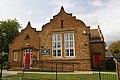
 Kineton - Former Kineton Library and Information Centre - 20201130111311.jpg 4,032 × 3,024; 16.73 MB
-

-
 Kineton Church - geograph.org.uk - 6560479.jpg 851 × 1,280; 750 KB
-
 Kineton churchyard - geograph.org.uk - 451484.jpg 480 × 640; 107 KB
-
 Kineton Fish And Chip Shop - geograph.org.uk - 3951211.jpg 1,024 × 900; 230 KB
-
 Kineton Garage - geograph.org.uk - 100568.jpg 640 × 480; 62 KB
-
 Kineton Methodist Church - geograph.org.uk - 3938166.jpg 1,024 × 810; 175 KB
-
 Kineton station site geograph-3722358-by-Ben-Brooksbank.jpg 2,396 × 1,532; 3.44 MB
-
 Kineton Village Centre.jpg 1,200 × 800; 364 KB
-
 Kineton Village Hall - geograph.org.uk - 3951207.jpg 1,024 × 768; 163 KB
-
 Kineton water pump (geograph 6735259).jpg 2,304 × 3,072; 2.48 MB
-
 Kineton, Carpenters Arms - geograph.org.uk - 1275180.jpg 480 × 640; 50 KB
-
 Kineton, Dene bridge - geograph.org.uk - 1275096.jpg 640 × 480; 129 KB
-
 Kineton, post office - geograph.org.uk - 1275125.jpg 640 × 480; 68 KB
-
 Kineton, village pump - geograph.org.uk - 1275210.jpg 480 × 640; 79 KB
-
 Kineton, Warwickshire ... Post Office. (5656714277).jpg 2,455 × 3,421; 5.64 MB
-
 Kineton-Greenhill's Stores - geograph.org.uk - 3950490.jpg 1,024 × 768; 194 KB
-
 Kineton-River Dene - geograph.org.uk - 3938190.jpg 1,024 × 768; 304 KB
-
 Kineton.jpg 640 × 480; 83 KB
-
 King John's Castle - geograph.org.uk - 6560794.jpg 851 × 1,280; 960 KB
-
 King John's Castle - geograph.org.uk - 6560820.jpg 1,280 × 851; 1 MB
-
 King John's Castle, Kineton - geograph.org.uk - 1491948.jpg 640 × 428; 116 KB
-
 Lane to Radway - geograph.org.uk - 184795.jpg 640 × 480; 66 KB
-
 Last chance to see - geograph.org.uk - 2350275.jpg 6,048 × 4,032; 1.17 MB
-
 Level crossing east of Kineton - geograph.org.uk - 1825272.jpg 640 × 480; 418 KB
-
 Lilac Cottage, Kineton (geograph 7352217).jpg 1,024 × 768; 138 KB
-
 Little Kineton - geograph.org.uk - 1491952.jpg 640 × 428; 85 KB
-
 Little Kineton - geograph.org.uk - 6056702.jpg 1,600 × 1,200; 401 KB
-
 Little Kineton Pond - geograph.org.uk - 1779420.jpg 2,000 × 1,428; 179 KB
-
 Little Kineton post box - geograph.org.uk - 6734076.jpg 2,138 × 2,508; 2.61 MB
-
 Market Square, Kineton - geograph.org.uk - 1490288.jpg 640 × 428; 65 KB
-
 Mellow in the sunshine - geograph.org.uk - 1198999.jpg 640 × 428; 96 KB
-
 Milepost at Kineton - geograph.org.uk - 1832673.jpg 1,500 × 2,011; 188 KB
-
 Milk Race at Kineton - geograph.org.uk - 240369.jpg 640 × 422; 108 KB
-
 Mill cottages^ - geograph.org.uk - 2350299.jpg 6,048 × 4,032; 1.47 MB
-
 Mill Street, Kineton - geograph.org.uk - 2364174.jpg 640 × 480; 94 KB
-
 Ministry of Defence Road - geograph.org.uk - 6013941.jpg 640 × 480; 195 KB
-
 MOD level crossing - geograph.org.uk - 1491963.jpg 640 × 428; 77 KB
-

-

-
 Old cutting on S^MJR, Kineton - geograph.org.uk - 1832696.jpg 1,500 × 2,007; 303 KB
-

-

-
 Pittern Hill Stables from Pittern Hill, Kineton - geograph.org.uk - 1832633.jpg 2,000 × 1,497; 172 KB
-
 Pond, Little Kineton - geograph.org.uk - 1491957.jpg 640 × 428; 67 KB
-
 Post box and commemorative plaque, Little Kineton - geograph.org.uk - 1779449.jpg 1,500 × 2,103; 194 KB
-
 Protected Field - geograph.org.uk - 2495457.jpg 640 × 480; 105 KB
-
 Red Road - geograph.org.uk - 1512727.jpg 640 × 428; 76 KB
-
 Red Road - green lane - geograph.org.uk - 343673.jpg 640 × 480; 113 KB
-
 Reservoir on Pittern Hill - geograph.org.uk - 1832641.jpg 2,000 × 1,509; 194 KB
-
 Rookery on Pittern Hill, Kineton - geograph.org.uk - 1818363.jpg 2,000 × 1,496; 207 KB
-
 Shops, Kineton (geograph 7351506).jpg 1,024 × 768; 156 KB
-
 Shortacres, Kineton - geograph.org.uk - 2607677.jpg 2,000 × 1,502; 245 KB
-
 Shortacres, Kineton - geograph.org.uk - 2607685.jpg 2,000 × 1,499; 295 KB
-

-
 Southam Street, Kineton (geograph 7352229).jpg 1,024 × 768; 160 KB
-
 St Peters Rd - geograph.org.uk - 2495421.jpg 640 × 434; 68 KB
-
 St Peters Rd - geograph.org.uk - 2495430.jpg 640 × 465; 81 KB
-
 Swan Hotel - geograph.org.uk - 1659983.jpg 480 × 640; 54 KB
-
 Swan Hotel - geograph.org.uk - 4029137.jpg 3,414 × 1,885; 2.14 MB
-
 Swan in danger - geograph.org.uk - 1490070.jpg 640 × 428; 54 KB
-
 Tent caterpillars, possibly Lackey Moth - geograph.org.uk - 1864172.jpg 2,000 × 1,502; 179 KB
-
 The Carpenters Arms - geograph.org.uk - 4930549.jpg 4,000 × 3,000; 2.24 MB
-
 The footpath stops here - geograph.org.uk - 2837711.jpg 2,000 × 1,333; 972 KB
-

-
 The line to Temple Herdewyke - geograph.org.uk - 1825284.jpg 640 × 480; 505 KB
-
 The Mew, Kineton (geograph 7349243).jpg 1,024 × 768; 217 KB
-
 The Old Post Office, Kineton - geograph.org.uk - 1490037.jpg 640 × 428; 75 KB
-
 The Presbytery, Kineton (geograph 7352212).jpg 1,024 × 768; 136 KB
-
 The Swan Hotel, Kineton - geograph.org.uk - 1934455.jpg 640 × 480; 80 KB
-
 The village green at Little Kineton - geograph.org.uk - 1935057.jpg 640 × 480; 126 KB
-
 Tree by footpath to Kineton - geograph.org.uk - 1864286.jpg 1,500 × 1,992; 174 KB
-
 Trees and pond - geograph.org.uk - 2837677.jpg 2,000 × 1,507; 507 KB
-
 Trees and pond - geograph.org.uk - 2837686.jpg 2,000 × 1,500; 625 KB
-
 Trig point on Pittern Hill, Kineton - geograph.org.uk - 1818395.jpg 2,000 × 1,495; 184 KB
-
 Tysoe Rd near Hall Farm - geograph.org.uk - 6022086.jpg 640 × 427; 232 KB
-
 Uh-oh, here they come - geograph.org.uk - 4932690.jpg 4,000 × 3,000; 2.62 MB
-
 Unexpected April snow - geograph.org.uk - 6734097.jpg 2,304 × 3,072; 2.93 MB
-
 Village Green, Little Kineton - geograph.org.uk - 1779433.jpg 2,000 × 1,506; 214 KB
-
 Village pond at Little Kineton - geograph.org.uk - 450847.jpg 640 × 480; 155 KB
-
 Vintage bookshop - geograph.org.uk - 2350284.jpg 6,048 × 4,032; 1.17 MB
-
 Walton House, Kineton (geograph 7267628).jpg 1,024 × 768; 125 KB
-
 Warwick Road, Kineton - geograph.org.uk - 4930854.jpg 3,841 × 2,694; 2.02 MB
-
 Warwick Road, Kineton - geograph.org.uk - 6560706.jpg 1,280 × 851; 715 KB
-
 WD42 Overlord at Kineton BAD - The Edgehill 130394.jpg 4,066 × 1,312; 1 MB
-
 We're right behind you - geograph.org.uk - 4932696.jpg 4,000 × 3,000; 3.52 MB
-
 White Gate ^ Windmill - geograph.org.uk - 4932668.jpg 4,000 × 3,000; 3.32 MB
-
 Windmill on Pittern Hill - geograph.org.uk - 4932674.jpg 4,000 × 3,000; 2.49 MB
-

-
 Woodfield, Kineton (geograph 7352210).jpg 1,024 × 768; 249 KB
-
 Battleton Holt - geograph.org.uk - 326099.jpg 640 × 480; 83 KB
-
 Brick watchtower - geograph.org.uk - 343623.jpg 640 × 480; 65 KB
-
 Bridleway to Westcote Farm - geograph.org.uk - 343620.jpg 640 × 480; 97 KB
-
 Byway to Kineton - geograph.org.uk - 186011.jpg 640 × 480; 85 KB
-
 Central Kineton - geograph.org.uk - 1490046.jpg 640 × 428; 58 KB
-
 Communications tower by Red Road - geograph.org.uk - 343642.jpg 640 × 480; 109 KB
-
 Cottages at Little Kineton - geograph.org.uk - 343680.jpg 640 × 480; 68 KB
-
 Development at Walton Farm - geograph.org.uk - 100931.jpg 640 × 480; 85 KB
-
 Disused outbuildings at Westcote Farm - geograph.org.uk - 343628.jpg 640 × 480; 89 KB
-
 Graveground Coppice - geograph.org.uk - 326116.jpg 640 × 480; 74 KB
-
 Hardwick Farm - geograph.org.uk - 184226.jpg 640 × 480; 70 KB
-
 Hardwick Farm - geograph.org.uk - 343640.jpg 640 × 480; 55 KB
-
 Herd Hill Farm - geograph.org.uk - 184829.jpg 640 × 480; 61 KB
-
 Industrial estate, Kineton - geograph.org.uk - 100956.jpg 640 × 480; 67 KB
-
 Level Crossing - geograph.org.uk - 110149.jpg 640 × 480; 48 KB
-
 Little Kineton - geograph.org.uk - 185587.jpg 640 × 480; 83 KB
-
 Little Kineton radio mast - geograph.org.uk - 343648.jpg 640 × 480; 36 KB
-
 MoD signs - geograph.org.uk - 110151.jpg 640 × 480; 71 KB
-
 Old lane to Kineton - geograph.org.uk - 186035.jpg 640 × 480; 102 KB
-
 Old tower at Westcote Farm - geograph.org.uk - 186027.jpg 640 × 480; 72 KB
-
 Outbuildings, Chadshunt House - geograph.org.uk - 98954.jpg 640 × 480; 89 KB
-
 Overgrown footpath - geograph.org.uk - 185658.jpg 640 × 480; 165 KB
-

-
 Radio mast near Little Kineton - geograph.org.uk - 186018.jpg 480 × 640; 67 KB
-
 Rusty shed near Tysoe Road - geograph.org.uk - 184224.jpg 640 × 480; 56 KB
-
 Shortacres, Kineton - geograph.org.uk - 99382.jpg 640 × 480; 78 KB
-
 Supply line - geograph.org.uk - 343663.jpg 640 × 480; 127 KB
-
 The Oaks - geograph.org.uk - 343654.jpg 640 × 480; 73 KB
-
 Westcote Farm - geograph.org.uk - 185671.jpg 640 × 480; 76 KB
-
 Westcote Farm - geograph.org.uk - 343356.jpg 640 × 480; 88 KB


.jpg)


.jpg)


.jpg)


.jpg)
.jpg)


,_Kineton_from_the_air_-_geograph.org.uk_-_2355847.jpg)


.jpg)


.jpg)
.jpg)
.jpg)


_And_Area_Railings_-_20201130110952.jpg)


.jpg)


.jpg)


.jpg)


.jpg)


.jpg)


.jpg)


.jpg)

.jpg)


.jpg)


.jpg)


