Category:Kilton Thorpe
Jump to navigation
Jump to search
village in United Kingdom  | |||||
| Upload media | |||||
| Instance of | |||||
|---|---|---|---|---|---|
| Location | Lockwood, Redcar and Cleveland, North Yorkshire, North East England, England | ||||
 | |||||
English: Kilton Thorpe is a village in the borough of Redcar and Cleveland and the ceremonial county of North Yorkshire, England.
Media in category "Kilton Thorpe"
The following 32 files are in this category, out of 32 total.
-
 Barn, Stank House Farm - geograph.org.uk - 682200.jpg 640 × 426; 207 KB
-
 Cottages, Kilton Thorpe - geograph.org.uk - 3979336.jpg 640 × 480; 52 KB
-
 Dismantled bridge near Kilton Thorpe - geograph.org.uk - 1720603.jpg 2,048 × 1,536; 627 KB
-
 Farm buildings, Kilton Thorpe - geograph.org.uk - 3979330.jpg 640 × 480; 45 KB
-
 Forest track near Kilton Thorpe - geograph.org.uk - 1720588.jpg 2,048 × 1,536; 2.55 MB
-
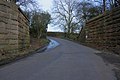
 Kilton Thorpe Lane into Kilton Thorpe - geograph.org.uk - 3709185.jpg 4,000 × 3,000; 3.27 MB
-
 Postbox at Kilton Thorpe - geograph.org.uk - 679821.jpg 640 × 480; 148 KB
-
 Site of the Medieval Settlement at Kilton Thorpe - geograph.org.uk - 3709144.jpg 4,000 × 3,000; 2.5 MB
-
 Stank House Farm - geograph.org.uk - 682016.jpg 640 × 426; 162 KB
-
 The old school-house at Kilton Thorpe - geograph.org.uk - 1723128.jpg 3,084 × 2,056; 3.13 MB
-
 Track Junction - geograph.org.uk - 682197.jpg 640 × 426; 211 KB
-
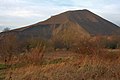
 View from Kilton Hill - geograph.org.uk - 682014.jpg 640 × 426; 227 KB
-
 Buck Rush Farm - geograph.org.uk - 216683.jpg 640 × 480; 80 KB
-
 Farm buildings at Kilton Thorpe - geograph.org.uk - 679860.jpg 640 × 480; 114 KB
-
 Farmland, Kilton Lane - geograph.org.uk - 42585.jpg 640 × 480; 97 KB
-
 Former School House - geograph.org.uk - 682025.jpg 640 × 426; 206 KB
-
 Former Water Meter Building - geograph.org.uk - 682183.jpg 640 × 426; 273 KB
-
 House Near Kilton Castle - geograph.org.uk - 216690.jpg 640 × 480; 98 KB
-
 Interior of Former Water Meter Building - geograph.org.uk - 682186.jpg 426 × 640; 266 KB
-
 Kilton Ironstone Mine - geograph.org.uk - 681980.jpg 640 × 426; 46 KB
-
 Kilton Ironstone Mine - geograph.org.uk - 681993.jpg 640 × 426; 45 KB
-
 Kilton Ironstone Mine - geograph.org.uk - 682000.jpg 640 × 426; 206 KB
-
 Kilton Ironstone Mine - geograph.org.uk - 682003.jpg 640 × 426; 52 KB
-
 Kilton Ironstone Mine - geograph.org.uk - 682008.jpg 640 × 426; 52 KB
-
 Kilton Thorpe - geograph.org.uk - 679816.jpg 640 × 480; 100 KB
-
 Kilton Thorpe Lane - geograph.org.uk - 670493.jpg 640 × 427; 53 KB
-
 Kilton Thorpe Lane - geograph.org.uk - 679847.jpg 640 × 480; 88 KB
-
 Merrys Wood - geograph.org.uk - 679926.jpg 640 × 480; 184 KB
-
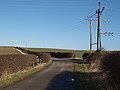
 Remains of Mineral Railway Bridge - geograph.org.uk - 670483.jpg 640 × 427; 70 KB
-
 Stank House Farm - geograph.org.uk - 670468.jpg 640 × 427; 66 KB
-
 Stile, Back Street - geograph.org.uk - 670487.jpg 427 × 640; 68 KB
-
 Track leading to Greenhills Farm - geograph.org.uk - 679930.jpg 640 × 480; 108 KB


