Category:Kiltarlity
Jump to navigation
Jump to search
village in Highland, Scotland, UK  | |||||
| Upload media | |||||
| Instance of | |||||
|---|---|---|---|---|---|
| Location |
| ||||
 | |||||
English: Kiltarlity (Scottish Gaelic: Cill Targhlain) is a small village in the Highland council area of Scotland. It is 12 miles (19 km) west of Inverness, and 2.5 miles (4.0 km) south of Beauly, on the Bruiach Burn. It has a population of under 1000 people, and a primary school, Tomnacross Primary. Lovat Shinty Club play at Kiltarlity, on a pitch on the main street, Balgate Drive.
Subcategories
This category has the following 2 subcategories, out of 2 total.
B
- Beaufort Castle, Scotland (13 F)
C
- Camault Muir (6 F)
Media in category "Kiltarlity"
The following 27 files are in this category, out of 27 total.
-
 A view to Ben Wyvis - geograph.org.uk - 265217.jpg 640 × 480; 54 KB
-
 A833 road junction - geograph.org.uk - 1539957.jpg 640 × 480; 62 KB
-
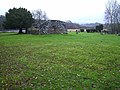
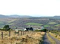
 Balgate Park, Kiltarlity - geograph.org.uk - 2927695.jpg 3,200 × 1,897; 2 MB
-
 Barn at Belladrum Farm - geograph.org.uk - 1540026.jpg 640 × 458; 63 KB
-
 Belladrum Chapel - geograph.org.uk - 147041.jpg 640 × 480; 135 KB
-
 Belladrum Mill - geograph.org.uk - 274374.jpg 640 × 480; 286 KB
-
 Bus stop, Hughton - geograph.org.uk - 446357.jpg 640 × 480; 76 KB
-
 Bus stop, Kiltarlity - geograph.org.uk - 3077262.jpg 1,024 × 681; 184 KB
-
 Culburnie - geograph.org.uk - 446369.jpg 640 × 440; 57 KB
-

-
 Free Church Manse, Kiltarlity - geograph.org.uk - 3811949.jpg 3,210 × 2,000; 2.07 MB
-
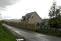
 Houses at Kiltarlity - geograph.org.uk - 2225503.jpg 800 × 531; 173 KB
-
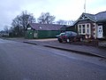 Kiltarlity Garage - geograph.org.uk - 87471.jpg 640 × 480; 234 KB
-
 Kiltarlity war memorial (geograph 3278662).jpg 2,488 × 3,150; 2.09 MB
-
 Kiltarlity-Geograph-4382837.jpg 4,608 × 3,456; 5.16 MB
-
 Old Kiltarlity Church Yard - geograph.org.uk - 87460.jpg 640 × 480; 281 KB
-
 Road junction sign - geograph.org.uk - 1541129.jpg 640 × 454; 69 KB
-
 Tom na Croiseige - geograph.org.uk - 1555002.jpg 640 × 480; 103 KB
-
 Tomnacross Farm - geograph.org.uk - 1554977.jpg 640 × 479; 40 KB
-
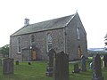 Tomnacross kirk - geograph.org.uk - 1555015.jpg 640 × 480; 55 KB
-
 Tomnacross Primary School - geograph.org.uk - 1554993.jpg 640 × 535; 42 KB
-
 Tomnacross school - geograph.org.uk - 1555032.jpg 640 × 480; 75 KB
-
-
 Driveway to Moniack Mhor Writing Centre - geograph.org.uk - 277291.jpg 640 × 480; 128 KB
-
 Femnock Wood - geograph.org.uk - 92486.jpg 640 × 419; 121 KB
-

-
 Pretty cottage - geograph.org.uk - 502924.jpg 640 × 392; 96 KB


.jpg)


.jpg)


