Category:Kilnsea
Jump to navigation
Jump to search
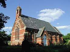
English: Kilnsea is a hamlet in the East Riding of Yorkshire, England, in an area known as Holderness. It is situated approximately 2 miles (3.2 km) south of the village of Easington, on the north bank of the Humber estuary.
village in United Kingdom | |||||
| Upload media | |||||
| Instance of | |||||
|---|---|---|---|---|---|
| Location | Easington, East Riding of Yorkshire, Yorkshire and the Humber, England | ||||
 | |||||
Subcategories
This category has the following 5 subcategories, out of 5 total.
C
- Crown and Anchor, Kilnsea (11 F)
G
- Godwin Battery (33 F)
K
- Kilnsea Acoustic Mirror (6 F)
- Kilnsea beach (107 F)
S
Media in category "Kilnsea"
The following 148 files are in this category, out of 148 total.
-
A Kilnsea Pond - geograph.org.uk - 6600545.jpg 3,456 × 4,608; 6.87 MB
-
Above Kilnsea - geograph.org.uk - 1196074.jpg 640 × 427; 332 KB
-
Admiring the view from Kilnsea Warren - geograph.org.uk - 4986000.jpg 5,087 × 3,736; 4.33 MB
-
Angler on Kilnsea Beach - geograph.org.uk - 3534854.jpg 2,979 × 2,390; 1.88 MB
-
Anglers on Kilnsea Beach - geograph.org.uk - 3534856.jpg 3,533 × 2,625; 1.64 MB
-
Anglers on the beach at Kilnsea Warren - geograph.org.uk - 5298242.jpg 1,024 × 682; 141 KB
-
Anglers on the beach at Kilnsea Warren - geograph.org.uk - 5298264.jpg 1,024 × 682; 112 KB
-
Approaching Cliff Farm, Kilnsea - geograph.org.uk - 5635568.jpg 1,024 × 768; 188 KB
-
Barred Warbler (Sylvia nisoria) - geograph.org.uk - 1036172.jpg 640 × 480; 113 KB
-
Bathtime^ - geograph.org.uk - 290088.jpg 640 × 480; 104 KB
-
Beach and dunes at Kilnsea Warren - geograph.org.uk - 5552186.jpg 800 × 600; 119 KB
-
Beacon Lagoons, Kilnsea - geograph.org.uk - 5720278.jpg 1,024 × 683; 161 KB
-
Beacon Lane at Kilnsea - geograph.org.uk - 2399967.jpg 3,648 × 2,736; 2.7 MB
-
Blue Bell Cafe gets ever closer to the sea - geograph.org.uk - 4498716.jpg 1,024 × 627; 334 KB
-
Blue Bell Cottage - geograph.org.uk - 3050224.jpg 1,600 × 1,200; 503 KB
-
Blue Bell Cottage - geograph.org.uk - 666450.jpg 640 × 480; 69 KB
-
Blue Bell information centre - geograph.org.uk - 3050228.jpg 1,600 × 1,114; 303 KB
-
Blue Bell information centre - geograph.org.uk - 3050240.jpg 1,600 × 1,200; 397 KB
-
Blue Bell information centre - geograph.org.uk - 666460.jpg 640 × 480; 83 KB
-
Bluebell Carpark, Kilnsea - geograph.org.uk - 5298210.jpg 1,024 × 682; 211 KB
-
Boat on the Humber Mudflats - geograph.org.uk - 889826.jpg 640 × 524; 96 KB
-
Borrow Pit, Kilnsea - geograph.org.uk - 5298206.jpg 1,024 × 682; 308 KB
-
Borrow Pit, Kilnsea Warren - geograph.org.uk - 2734487.jpg 1,600 × 1,200; 813 KB
-
Building Boulder Bricks - geograph.org.uk - 2481675.jpg 3,539 × 2,578; 1.49 MB
-
Bus at Kilnsea Warren - geograph.org.uk - 6909017.jpg 1,024 × 683; 469 KB
-
Caravan site entrance - geograph.org.uk - 666514.jpg 640 × 480; 63 KB
-
Caravans and mud, Kilnsea - geograph.org.uk - 5635712.jpg 1,024 × 768; 190 KB
-
Cliff erosion at Kilnsea - geograph.org.uk - 5636185.jpg 1,024 × 768; 120 KB
-
Coastal erosion, Cliffs at Kilnsea - geograph.org.uk - 700630.jpg 640 × 480; 76 KB
-
Coastal protection work near Kilnsea - geograph.org.uk - 4498681.jpg 1,280 × 960; 1.2 MB
-
Coastal track - geograph.org.uk - 666551.jpg 640 × 480; 97 KB
-
Coastline near Kilnsea - geograph.org.uk - 6113783.jpg 4,602 × 3,083; 2.16 MB
-
Collapsed WW2 defence, Kilnsea - geograph.org.uk - 5635575.jpg 1,024 × 768; 219 KB
-
Concrete reef at Kilnsea - geograph.org.uk - 3805761.jpg 1,024 × 768; 153 KB
-
Cottages on Easington Road, Kilnsea - geograph.org.uk - 2407687.jpg 1,600 × 1,200; 442 KB
-
Crown and Anchor, Kilnsea - geograph.org.uk - 2407682.jpg 1,600 × 1,200; 298 KB
-
Crown ^ Anchor - Kilnsea - geograph.org.uk - 1996129.jpg 640 × 480; 69 KB
-
Crown ^ Anchor in Kilnsea - geograph.org.uk - 5551326.jpg 800 × 705; 192 KB
-
Crown ^ Anchor in Kilnsea - geograph.org.uk - 5556522.jpg 800 × 472; 76 KB
-
Dawn over Kilnsea - geograph.org.uk - 95023.jpg 640 × 425; 60 KB
-
Digging for Worms - geograph.org.uk - 1265705.jpg 480 × 640; 106 KB
-
Documentary Evidence - geograph.org.uk - 290086.jpg 640 × 296; 37 KB
-
Dunes at Kilnsea Warren - geograph.org.uk - 6909022.jpg 1,024 × 683; 423 KB
-
Dusk at Spurn Road, Kilnsea - geograph.org.uk - 5298215.jpg 1,024 × 684; 87 KB
-
Easington Road at Kilnsea - geograph.org.uk - 5558855.jpg 800 × 558; 116 KB
-
Easington Road, Kilnsea - geograph.org.uk - 2200749.jpg 800 × 600; 235 KB
-
Easington Road, Kilnsea - geograph.org.uk - 3852887.jpg 1,200 × 798; 446 KB
-
Easington Road, Kilnsea - geograph.org.uk - 6114095.jpg 1,600 × 981; 546 KB
-
End of the road, Kilnsea - geograph.org.uk - 2407549.jpg 1,600 × 1,200; 391 KB
-
Entering Kilnsea - geograph.org.uk - 4101957.jpg 1,024 × 683; 139 KB
-
Entering Kilnsea - geograph.org.uk - 6377975.jpg 800 × 573; 71 KB
-
Eroding cliff near Kilnsea - geograph.org.uk - 4498701.jpg 1,280 × 922; 1.01 MB
-
Eroding coastline, Kilnsea Warren - geograph.org.uk - 2734491.jpg 1,600 × 1,200; 587 KB
-
Farm Buildings TA40341758 - geograph.org.uk - 28456.jpg 640 × 480; 97 KB
-
Farm track - geograph.org.uk - 666614.jpg 640 × 480; 114 KB
-
Fields near Kilnsea Grange - geograph.org.uk - 1472523.jpg 640 × 480; 60 KB
-
Gallinago media kilnsea.jpg 265 × 320; 38 KB
-
High tide at dusk at Warren Head, Kilnsea - geograph.org.uk - 5298222.jpg 1,024 × 682; 95 KB
-
Humber Bank near Kilnsea - geograph.org.uk - 5748874.jpg 640 × 480; 73 KB
-
Humber mud flats near Kilnsea - geograph.org.uk - 55.jpg 640 × 480; 30 KB
-
Humber mud flats, Kilnsea - geograph.org.uk - 6377980.jpg 800 × 600; 78 KB
-
Humber mudflats at Kilnsea - geograph.org.uk - 5298198.jpg 1,024 × 682; 158 KB
-
Humber Mudflats, Kilnsea - geograph.org.uk - 278290.jpg 640 × 480; 83 KB
-
Kilnsea - Spurn Road - geograph.org.uk - 21768.jpg 640 × 480; 65 KB
-
Kilnsea Beach edge - geograph.org.uk - 290083.jpg 640 × 480; 70 KB
-
Kilnsea car park - geograph.org.uk - 3805705.jpg 1,024 × 768; 198 KB
-
Kilnsea car park toilets - geograph.org.uk - 3805708.jpg 640 × 480; 45 KB
-
Kilnsea Caravan Park from the Air - geograph.org.uk - 6854836.jpg 4,000 × 2,250; 2.79 MB
-
Kilnsea caravan site, Holderness - geograph.org.uk - 3847560.jpg 1,200 × 798; 254 KB
-
Kilnsea Church gates - geograph.org.uk - 1257037.jpg 640 × 431; 148 KB
-
Kilnsea Clays - geograph.org.uk - 316473.jpg 640 × 480; 101 KB
-
Kilnsea Clays towards Spurn Head - geograph.org.uk - 1472517.jpg 640 × 480; 47 KB
-
Kilnsea Grange - geograph.org.uk - 305235.jpg 640 × 481; 78 KB
-
Kilnsea Grange Farm, Kilnsea - geograph.org.uk - 2201646.jpg 800 × 600; 259 KB
-
Kilnsea Grange farm, Kilnsea - geograph.org.uk - 3852903.jpg 1,200 × 798; 391 KB
-
Kilnsea lane - geograph.org.uk - 666512.jpg 640 × 480; 81 KB
-
Kilnsea River Bank - geograph.org.uk - 290063.jpg 640 × 480; 85 KB
-
Kilnsea Triangle circular walk - geograph.org.uk - 2697474.jpg 1,600 × 1,343; 751 KB
-
Kilnsea Warren - geograph.org.uk - 5800962.jpg 640 × 480; 56 KB
-
Kilnsea Warren - geograph.org.uk - 693545.jpg 640 × 346; 53 KB
-
Kilnsea Warren, aerial 2018 (2) - geograph.org.uk - 5718866.jpg 640 × 427; 52 KB
-
Kilnsea Warren, aerial 2018 - geograph.org.uk - 5718857.jpg 427 × 640; 42 KB
-
Kilnsea Wetlands - geograph.org.uk - 5603639.jpg 1,024 × 768; 196 KB
-
Kilnsea Wetlands Nature Reserve - geograph.org.uk - 6113780.jpg 4,852 × 3,049; 1.57 MB
-
Kilnsea Wetlands, aerial 2018 - geograph.org.uk - 5718894.jpg 800 × 533; 76 KB
-
Kilnsea's Mudflats - geograph.org.uk - 914562.jpg 640 × 455; 68 KB
-
Lake Kilnsea^ - geograph.org.uk - 3777485.jpg 3,448 × 4,592; 3.33 MB
-
Long Bank, Kilnsea - geograph.org.uk - 305251.jpg 640 × 439; 77 KB
-
Marshland near Kilnsea - geograph.org.uk - 4498682.jpg 1,280 × 954; 1.08 MB
-
More erosion at Kilnsea - geograph.org.uk - 3805747.jpg 1,024 × 768; 241 KB
-
More erosion at Kilnsea - geograph.org.uk - 3805749.jpg 1,024 × 768; 245 KB
-
Muddy shoreline at Kilnsea - geograph.org.uk - 5551331.jpg 800 × 539; 121 KB
-
Nature Reserve - geograph.org.uk - 290058.jpg 640 × 480; 85 KB
-
New extension - geograph.org.uk - 666547.jpg 640 × 480; 92 KB
-
Path to the nature reserve - geograph.org.uk - 666648.jpg 640 × 480; 113 KB
-
Pillbox at Kilnsea - geograph.org.uk - 1255376.jpg 640 × 429; 78 KB
-
Pond at Kilnsea - geograph.org.uk - 785935.jpg 640 × 480; 87 KB
-
Reeds and ditch - geograph.org.uk - 666601.jpg 640 × 480; 118 KB
-
Road ahead subject to coastal erosion - geograph.org.uk - 101213.jpg 640 × 480; 72 KB
-
Rocky shoreline at Kilnsea - geograph.org.uk - 5551333.jpg 800 × 637; 156 KB
-
Sandy Beaches, North Marsh Road, Kilnsea, Hull - geograph.org.uk - 5044435.jpg 1,280 × 853; 906 KB
-
Sandy Beaches, North Marsh Road, Kilnsea, Hull - geograph.org.uk - 5044444.jpg 1,280 × 853; 656 KB
-
Sandy Beaches, North Marsh Road, Kilnsea, Hull - geograph.org.uk - 5044606.jpg 1,280 × 853; 712 KB
-
Small lake - geograph.org.uk - 706557.jpg 600 × 400; 89 KB
-
Spurn Road towards Kilnsea - geograph.org.uk - 1472515.jpg 640 × 480; 46 KB
-
Storm Brewing over Spurn Point - geograph.org.uk - 290074.jpg 640 × 465; 35 KB
-
Storm Clouds over Spurn Point - geograph.org.uk - 290069.jpg 480 × 640; 44 KB
-
Storm damaged caravans at Kilnsea - geograph.org.uk - 3805755.jpg 1,024 × 768; 254 KB
-
Sunrise Cottage, Kilnsea - geograph.org.uk - 304976.jpg 640 × 480; 82 KB
-
Sunset across Kilnsea's Mudflats - geograph.org.uk - 914551.jpg 640 × 474; 48 KB
-
Sunset over Kilnsea mudflats - geograph.org.uk - 8767.jpg 640 × 480; 71 KB
-
The Blue Bell Cafe, Kilnsea - geograph.org.uk - 3805711.jpg 1,024 × 768; 118 KB
-
The Coast near Kilnsea - geograph.org.uk - 516238.jpg 640 × 480; 131 KB
-
The Crown and Anchor Kilnsea - geograph.org.uk - 4494352.jpg 4,814 × 3,158; 6.14 MB
-
The Crown ^ Anchor Public House, Kilnsea - geograph.org.uk - 5298199.jpg 1,024 × 682; 116 KB
-
The Crown ^ Anchor, Kilnsea - geograph.org.uk - 3852875.jpg 1,200 × 798; 225 KB
-
The Crown ^ Anchor, Kilnsea - geograph.org.uk - 3852882.jpg 1,200 × 798; 282 KB
-
The Humber at Kilnsea - geograph.org.uk - 5719672.jpg 1,024 × 682; 77 KB
-
The Humber shore at Kilnsea - geograph.org.uk - 5635534.jpg 1,024 × 723; 195 KB
-
The main road in Kilnsea - geograph.org.uk - 21892.jpg 640 × 480; 100 KB
-
The main road in Kilnsea - geograph.org.uk - 21894.jpg 640 × 480; 92 KB
-
The Minster Way north of Kilnsea (geograph 4510962).jpg 1,024 × 768; 222 KB
-
The river 'beach' near Kilnsea - geograph.org.uk - 290076.jpg 640 × 480; 78 KB
-
The river bank approaching Kilnsea - geograph.org.uk - 290067.jpg 640 × 489; 100 KB
-
The Riverside Hotel - geograph.org.uk - 817560.jpg 640 × 423; 60 KB
-
The Riverside Hotel. Kilnsea - geograph.org.uk - 2407685.jpg 1,600 × 1,200; 367 KB
-
The Road to Hull at Kilnsea - geograph.org.uk - 538436.jpg 640 × 399; 35 KB
-
Twilight falls at Kilnsea - geograph.org.uk - 5590680.jpg 640 × 480; 49 KB
-
Wild Ragwort Flowers near Kilnsea - geograph.org.uk - 516234.jpg 640 × 480; 147 KB
-
WW2 Pillbox, Kilnsea - geograph.org.uk - 1515212.jpg 640 × 480; 71 KB
-
Yellow-legged Gull (Larus michahellis) - geograph.org.uk - 1036168.jpg 640 × 480; 237 KB


