Category:Kilnaheery
Jump to navigation
Jump to search
Media in category "Kilnaheery"
The following 26 files are in this category, out of 26 total.
-
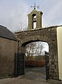 Archway, Kilnaheery Farmhouse - geograph.org.uk - 1596253.jpg 471 × 640; 84 KB
-
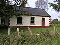 Cottage at Kilnaheery - geograph.org.uk - 577482.jpg 640 × 479; 82 KB
-
 Farmhouse, Kilnaheery - geograph.org.uk - 1596252.jpg 640 × 480; 58 KB
-
 Garvaghyhill Road - geograph.org.uk - 1254281.jpg 640 × 479; 67 KB
-
 Greenmount Road - geograph.org.uk - 1182386.jpg 640 × 479; 81 KB
-
 Greenmount Road, Kilnaheery - geograph.org.uk - 1596248.jpg 640 × 480; 38 KB
-
 House at Kilnaheery - geograph.org.uk - 100813.jpg 640 × 479; 108 KB
-
 Kilnaheery Townland - geograph.org.uk - 100819.jpg 640 × 479; 126 KB
-
 Kilnaheery Townland - geograph.org.uk - 1254154.jpg 640 × 479; 56 KB
-
 Kilnaheery Townland - geograph.org.uk - 1254263.jpg 640 × 479; 57 KB
-
 Kilnaheery Townland - geograph.org.uk - 1254271.jpg 640 × 479; 58 KB
-
 Kilnaheery Townland - geograph.org.uk - 1254289.jpg 640 × 479; 77 KB
-
 Kilnaheery Townland - geograph.org.uk - 1254303.jpg 640 × 479; 100 KB
-
 Kilnaheery Townland - geograph.org.uk - 1254307.jpg 640 × 479; 66 KB
-
 Kilnaheery Townland - geograph.org.uk - 1255962.jpg 640 × 479; 76 KB
-
 Kilnaheery Townland - geograph.org.uk - 1255965.jpg 640 × 479; 67 KB
-
 Kilnaheery Townland - geograph.org.uk - 1255972.jpg 640 × 479; 71 KB
-
 Lane, Kilnaheery - geograph.org.uk - 1254276.jpg 640 × 479; 66 KB
-
 Lane, Kilnaheery - geograph.org.uk - 1254298.jpg 640 × 479; 65 KB
-
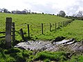 Mucky field, Kilnaheery - geograph.org.uk - 1254268.jpg 640 × 479; 78 KB
-
 Old Mill, Kilnaheery - geograph.org.uk - 1182453.jpg 640 × 479; 80 KB
-
 Plaque, Farmhouse at Kilnaheery - geograph.org.uk - 1596261.jpg 640 × 480; 30 KB
-
 Routingburn Road - geograph.org.uk - 1182457.jpg 640 × 479; 71 KB
-
 Routingburn Road - geograph.org.uk - 1254278.jpg 640 × 479; 60 KB
-
 Springfield Road, Kilnaheery - geograph.org.uk - 1255970.jpg 640 × 479; 82 KB
-
 The rush hour on the A5 - geograph.org.uk - 168153.jpg 640 × 479; 107 KB


