Category:Kilmuir, Black Isle
Jump to navigation
Jump to search
human settlement on Black Isle, in Highland, Scotland, UK  | |||||
| Upload media | |||||
| Instance of | |||||
|---|---|---|---|---|---|
| Location |
| ||||
 | |||||
Kilmuir is a village on the Black Isle, near North Kessock and Inverness, in the historic parish of Kilmuir Wester.
Media in category "Kilmuir, Black Isle"
The following 42 files are in this category, out of 42 total.
-
 A house on Kilmuir's main street - geograph.org.uk - 4753521.jpg 2,216 × 1,488; 1.57 MB
-

-
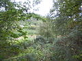
 Autumn colours near Kilmuir, Black Isle - geograph.org.uk - 596207.jpg 640 × 481; 136 KB
-
 Bay near Kilmuir - geograph.org.uk - 6089843.jpg 1,024 × 731; 269 KB
-
 Boundary fence reaches the shore at Kilmuir - geograph.org.uk - 2824720.jpg 1,600 × 1,118; 401 KB
-
 Car park and info box, Kilmuir - geograph.org.uk - 4753122.jpg 3,072 × 2,304; 1.3 MB
-
 Craigiehowe - geograph.org.uk - 345341.jpg 640 × 480; 343 KB
-
 Croft Downie Boat House - geograph.org.uk - 6036605.jpg 640 × 480; 100 KB
-
 Drynie Woodlands - geograph.org.uk - 345332.jpg 640 × 427; 248 KB
-
 Foot of Ord Hill - geograph.org.uk - 55267.jpg 480 × 640; 89 KB
-
 Forest, Scrub and Gorse - geograph.org.uk - 56577.jpg 640 × 480; 145 KB
-
 Kilmuir - geograph.org.uk - 296460.jpg 480 × 640; 65 KB
-
 Kilmuir - geograph.org.uk - 345348.jpg 640 × 480; 307 KB
-

-
 Kilmuir garden by the shore - geograph.org.uk - 4087268.jpg 1,400 × 1,052; 471 KB
-
 Kilmuir info Box - geograph.org.uk - 4753014.jpg 3,072 × 2,304; 1.35 MB
-
 Kilmuir main street - geograph.org.uk - 4753539.jpg 2,515 × 1,488; 1.4 MB
-
 Kilmuir main street - geograph.org.uk - 4753553.jpg 2,560 × 1,524; 1.67 MB
-
 Kilmuir shoreline - geograph.org.uk - 4753024.jpg 3,072 × 2,304; 1.45 MB
-
 Kilmuir sunset - geograph.org.uk - 6016834.jpg 640 × 379; 78 KB
-
 Kilmuir Telephone Box - geograph.org.uk - 1441980.jpg 640 × 480; 67 KB
-
 Kilmuir Telephone Box - geograph.org.uk - 1580584.jpg 640 × 480; 59 KB
-
 Kilmuir Village - geograph.org.uk - 2286970.jpg 3,072 × 2,048; 1.54 MB
-
 Kilmuir village - geograph.org.uk - 4753036.jpg 3,072 × 2,304; 1.46 MB
-
 Kilmuir Village - geograph.org.uk - 4882387.jpg 640 × 640; 140 KB
-
 Main Street, Kilmuir - geograph.org.uk - 4753748.jpg 2,452 × 1,527; 1.34 MB
-
 Mains of Drynie - geograph.org.uk - 345339.jpg 640 × 480; 279 KB
-
 Munlochy Bay and beyond - geograph.org.uk - 410106.jpg 640 × 334; 52 KB
-
 Old boat house below Croft Downie - geograph.org.uk - 6042779.jpg 640 × 457; 106 KB
-
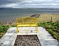 Public seat overlooking Moray Firth - geograph.org.uk - 2336577.jpg 1,024 × 807; 297 KB
-
 Recycled Phone Box - geograph.org.uk - 4882393.jpg 640 × 640; 137 KB
-
 Rock formation on the Moray Firth - geograph.org.uk - 6089881.jpg 640 × 480; 146 KB
-
 Shoreline by Kilmuir - geograph.org.uk - 4753029.jpg 3,072 × 2,304; 1.25 MB
-
 The bay at Kilmuir - geograph.org.uk - 6089834.jpg 640 × 457; 98 KB
-

-
 The seaside village of Kilmuir - geograph.org.uk - 4087235.jpg 1,400 × 1,050; 469 KB
-
 The shore at the end of Kilmuir - geograph.org.uk - 2824651.jpg 1,600 × 1,200; 540 KB
-
 Track to Craigiewood - geograph.org.uk - 345343.jpg 640 × 480; 359 KB
-

-
 Tree and Info Box - geograph.org.uk - 3823119.jpg 1,800 × 1,197; 1.69 MB
-
 Welcome to Kilmuir - geograph.org.uk - 4087276.jpg 1,400 × 1,050; 495 KB
-
 Ballone Farm - geograph.org.uk - 410104.jpg 640 × 341; 47 KB


_at_Kilmuir_-_geograph.org.uk_-_2100190.jpg)


