Category:Kieswerk Parey
Jump to navigation
Jump to search
|
Kieswerk Parey has an entry on OpenStreetMap (Kieswerk show). |
|
Kieswerk Parey has an entry on OpenStreetMap (Höchstspannungsleitung show). |
Source:
Gravel works near Parey / Elbe Vergrößerung Baggersee | |||||
| Upload media | |||||
| Instance of | |||||
|---|---|---|---|---|---|
| Location | Elbe-Parey, Jerichower Land, Saxony-Anhalt, Germany | ||||
| Located in or next to body of water |
| ||||
| Connects with | |||||
| Operator |
| ||||
| Inception |
| ||||
| Area |
| ||||
| Elevation above sea level |
| ||||
| official website | |||||
 | |||||
Subcategories
This category has the following 3 subcategories, out of 3 total.
- Conveyor system ship loading (16 F)
- Dredger gravel works Parey (10 F)
Media in category "Kieswerk Parey"
The following 35 files are in this category, out of 35 total.
-
 Angeln am Kiessee 01.jpg 756 × 886; 188 KB
-
 Angeln am Kiessee 02.jpg 2,148 × 536; 177 KB
-
 Angeln am Kiessee 03.jpg 1,843 × 567; 151 KB
-
 Angeln am Kiessee 04.jpg 3,836 × 567; 239 KB
-
 Baggersee von nordost 01.jpg 1,332 × 565; 139 KB
-
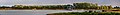
 Baggersee, Oktober 2020.jpg 4,148 × 567; 386 KB
-
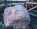
 Findling Kieswerk Parey T.jpg 964 × 756; 184 KB
-
 Findling Kieswerk Parey.jpg 712 × 567; 188 KB
-
 Kiesabbau am Unkenwäldchen 01.jpg 4,401 × 567; 218 KB
-
 Kieswerk Parey Lage.jpg 1,430 × 866; 383 KB
-
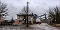
 Kieswerk Parey, August 2024 01.jpg 2,664 × 1,000; 625 KB
-
 Kieswerk Parey, August 2024 02.jpg 5,000 × 1,000; 1.24 MB
-
 Kieswerk Parey, August 2024 03.jpg 3,000 × 1,000; 924 KB
-
 Kieswerk Parey, Mai 2018.jpg 2,410 × 567; 133 KB
-
 Kieswerk Parey, Monte Kali Zielitz.jpg 1,286 × 415; 134 KB
-
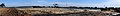
 Kieswerk Parey, Oktober 2020.jpg 3,211 × 567; 164 KB
-
 Kieswerk Parey, Waage.jpg 1,122 × 567; 183 KB
-
 Lubmin–Wolmirstedt, 68, See.jpg 2,374 × 567; 191 KB
-
 Lubmin–Wolmirstedt, 68.jpg 980 × 567; 89 KB
-
 Lubmin–Wolmirstedt, 69.jpg 1,160 × 567; 88 KB
-
 Masttrafo Bungalow-Siedlung 04.jpg 1,512 × 504; 125 KB
-
 Oberflächenabtragung, Mai 2018 01.jpg 1,510 × 491; 136 KB
-
 Oberflächenabtragung, Mai 2018.jpg 1,510 × 491; 136 KB
-
 Oberflächenabtragung, Oktober 2020.jpg 4,148 × 567; 386 KB
-
 Parey, zur Windmühle, Mai 2018 01.jpg 869 × 567; 95 KB
-
 Parey, zur Windmühle, Mai 2018.jpg 869 × 567; 95 KB
-
 Schwimmbagger, August 2021 01.jpg 2,118 × 509; 149 KB
-
 Schwimmbagger, August 2021 02.jpg 2,326 × 525; 175 KB
-
 Siebanlage, Juli 2021.jpg 1,701 × 567; 198 KB
-
 Siebanlage, Oktober 2020.jpg 1,269 × 567; 113 KB
-
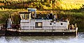 Tonja (tugboat, 1974) 01.jpg 571 × 289; 102 KB
-
 Tonja (tugboat, 1974) 02.jpg 1,008 × 567; 177 KB
-
 Tonja (tugboat, 1974) 03.jpg 1,188 × 567; 188 KB
-
 Tonja (tugboat, 1974) 04.jpg 1,286 × 540; 178 KB
-
 Unkenwäldchen Parey 02.jpg 3,704 × 567; 188 KB


_01.jpg)
_02.jpg)
_03.jpg)
_04.jpg)