Category:Kiental, Germany
Jump to navigation
Jump to search
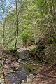
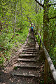
Deutsch: „Kiental“ in Oberbayern, Landkreis Starnberg. Teil des FFH-Gebietes „Ammerseeufer und Leitenwälder“ (7932-372) und des Landschaftsschutzgebietes „Westlicher Teil des Landkreises Starnberg“ (LSG-00542.01). Geotop 188R013.
valley in Andechs, Germany  | |||||
| Upload media | |||||
| Instance of |
| ||||
|---|---|---|---|---|---|
| Location | Andechs, Starnberg, Upper Bavaria, Bavaria, Germany | ||||
| Width |
| ||||
| Length |
| ||||
| Area |
| ||||
| Elevation above sea level |
| ||||
| official website | |||||
 | |||||
Media in category "Kiental, Germany"
The following 17 files are in this category, out of 17 total.
-
 Andechs, Kiental HB-01.JPG 3,303 × 2,251; 7.59 MB
-
 Andechs, Kiental HB-02.JPG 3,296 × 2,552; 8.05 MB
-
 Andechs, Kiental HB-03.JPG 3,263 × 2,296; 4.19 MB
-
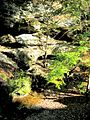
 Kienbach 02.jpg 600 × 800; 236 KB
-
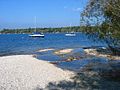 Kienbach Ammersee.jpg 800 × 600; 158 KB
-
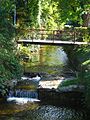
 Kienbach Erling.jpg 800 × 600; 216 KB
-
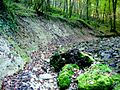 Kienbach Flinz.jpg 800 × 600; 231 KB
-
 Kienbach Herrsching.jpg 600 × 800; 237 KB
-
 Kienbach Nagelfluh.jpg 600 × 800; 239 KB
-
 Kienbach.png 504 × 825; 88 KB
-
 Kiental - zwischen Herrsching und Kloster Andechs -1.jpg 3,008 × 2,000; 6.15 MB
-
 Kiental - zwischen Herrsching und Kloster Andechs -2.jpg 3,008 × 2,000; 6.57 MB
-
 Kiental entre Herrsching y Andechs, Alemania 2012-05-01, DD 04.JPG 3,579 × 5,544; 11.13 MB
-
 Kiental entre Herrsching y Andechs, Alemania 2012-05-01, DD 07.JPG 3,453 × 5,179; 10.08 MB
-
 Kiental entre Herrsching y Andechs, Alemania 2012-05-01, DD 10.JPG 3,744 × 5,616; 9.99 MB
-
 Kiental entre Herrsching y Andechs, Alemania 2012-05-01, DD 11.JPG 5,616 × 3,744; 9.97 MB
-
 Kiental entre Herrsching y Andechs, Alemania 2012-05-01, DD 12.JPG 5,071 × 3,744; 10.51 MB


