Category:Kiel in the 18th century
Jump to navigation
Jump to search
Districts of Schleswig-Holstein:
Subcategories
This category has the following 8 subcategories, out of 8 total.
#
*
Media in category "Kiel in the 18th century"
The following 11 files are in this category, out of 11 total.
-
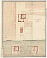
 167 of 'Alt-Kiel in Wort und Bild ... Mit ... Abbildungen und Plänen' (11252986085).jpg 3,672 × 2,795; 2.45 MB
-
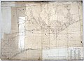
 Coldit‘sche Karte 1750 (DK008117).jpg 6,494 × 7,000; 8.72 MB
-
 Bütterley 1750 (DK008116).jpg 5,674 × 7,000; 6.1 MB
-
 Einwohnerentwicklung von Kiel bis 1900.svg 800 × 400; 31 KB
-
 Handzeichnung 1800.jpg 7,000 × 5,070; 24.08 MB
-
 Handzeichnung 1808 (DK008102).jpg 7,000 × 5,796; 17.85 MB
-
 Homann'sche Karte 1726 (DK008110).jpg 6,048 × 7,000; 11.6 MB
-
 Homann'sche Karte 1735 (fr52906).jpg 3,912 × 4,449; 5.79 MB
-
 Klessel'sche Karte 1793 (DK008101).jpg 3,859 × 3,077; 2.96 MB
-
 Klessel‘sche Karte 1786 (DK008100) (cropped).png 996 × 1,482; 2.7 MB
-
 Klessel‘sche Karte 1786 (DK008100).jpg 7,000 × 5,099; 9.01 MB
.jpg)
.jpg)
.jpg)


.jpg)
.jpg)
.jpg)
.jpg)
_(cropped).png)
.jpg)