Category:Kidlington
Jump to navigation
Jump to search
village and civil parish in Cherwell, Oxfordshire, England  | |||||
| Upload media | |||||
| Pronunciation audio | |||||
|---|---|---|---|---|---|
| Instance of | |||||
| Location | Cherwell, Oxfordshire, South East England, England | ||||
| Population |
| ||||
| Area |
| ||||
| Said to be the same as | Kidlington (Wikimedia duplicated page, civil parish) | ||||
| official website | |||||
 | |||||
English: Kidlington is a large village and civil parish between the River Cherwell and the Oxford Canal, southwest of Bicester.
Español: Kidlington es una localidad británica perteneciente al Condado de Oxon, 8 km al norte de Oxford. Tenía una población de 14.000 habitantes en 2001.
Français : Kidlington est un village dans l' Oxfordshire, en Angleterre. Il se trouve à 8 kilomètres de Oxford. L'aéroport d'Oxford se trouve à Kidlington.
Nederlands: Kidlington is een plaats in het Engelse graafschap Oxfordshire, ongeveer 8 km van Oxford. In het dorp staat de Church of St Mary the Virgin, die werd gebouwd omstreeks 1220.
Norsk bokmål: Kidlington er en landsby i distriktet Cherwell i Oxfordshire, England. Den ligger like nord for Oxford.
Polski: Kidlington - miasto w Wielkiej Brytanii, w Anglii, w regionie South East England, w hrabstwie Oxfordshire.
Română: Kidlington este o localitate în comitatul Oxfordshire, regiunea South East, Anglia. Oraşul se află în districtul Cherwell.
Subcategories
This category has the following 16 subcategories, out of 16 total.
B
- Kidlington Burial Ground (6 F)
K
- Kidlington Green Lock (8 F)
- Kidlington Methodist Church (2 F)
- Kidlington railway station (3 F)
L
M
O
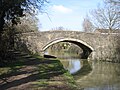
- Oxford Canal Bridge 226 (7 F)
- Oxford Canal Bridge 226A (2 F)
- Oxford Canal Bridge 227 (2 F)
- Oxford Canal Bridge 228 (8 F)
P
R
V
Media in category "Kidlington"
The following 200 files are in this category, out of 290 total.
(previous page) (next page)-
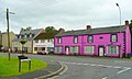
 82 and 84, Church Street, Kidlington.jpg 4,000 × 3,000; 1.4 MB
-
 86 and 88, Church Street, Kidlington.jpg 4,000 × 3,000; 1.72 MB
-

-
 A new house takes shape at ^3 Bicester Road - geograph.org.uk - 3241720.jpg 1,024 × 683; 174 KB
-
 A109 at Sunset - geograph.org.uk - 2953031.jpg 3,504 × 1,848; 210 KB
-
 A34 crosses the River Cherwell - geograph.org.uk - 5648456.jpg 640 × 426; 50 KB
-
 A34 near Gosford Farm - geograph.org.uk - 3102915.jpg 640 × 480; 47 KB
-
 A34 northbound - geograph.org.uk - 5637914.jpg 640 × 428; 74 KB
-

-
 A4095 Bladon Road, Bladon - geograph.org.uk - 4537556.jpg 1,024 × 647; 271 KB
-
 A4260 junction with Langford Lane - geograph.org.uk - 2689820.jpg 3,648 × 2,570; 1.44 MB
-
 A4260 junction with Lyne Road - geograph.org.uk - 2689842.jpg 3,648 × 2,736; 1.53 MB
-
 A44 - dead straight for Woodstock - geograph.org.uk - 2378572.jpg 640 × 480; 55 KB
-
 A44 approaching Bladon roundabout - geograph.org.uk - 2378575.jpg 640 × 480; 71 KB
-
-
 Airport Light in a Field - geograph.org.uk - 5727886.jpg 3,489 × 2,401; 2.64 MB
-
 AlexanderDennis Enviro400H HK11 OXF Kidlington.jpg 1,280 × 771; 548 KB
-
 AlexanderDennis Trident2 Enviro400 MMC SK15 HCY Kidlington.jpg 1,280 × 718; 483 KB
-
 Andersons Close, Kidlington - geograph.org.uk - 5222394.jpg 1,024 × 768; 120 KB
-

-
 Banbury Road - geograph.org.uk - 5251835.jpg 800 × 600; 145 KB
-
 Banbury Road Kidlington Co-op - geograph.org.uk - 6541049.jpg 1,280 × 851; 774 KB
-
 Banbury Road near Thrupp - geograph.org.uk - 4044976.jpg 1,500 × 979; 152 KB
-

-
 Banbury Road, Kidlington - geograph.org.uk - 4870773.jpg 2,000 × 1,333; 2.98 MB
-
 Banbury Road, Kidlington - geograph.org.uk - 4872366.jpg 2,000 × 1,333; 1.88 MB
-

-
 Benchmark on abandoned fence post beside A4260 - geograph.org.uk - 3214966.jpg 683 × 1,024; 357 KB
-
 Benchmark on Banbury Road milestone - geograph.org.uk - 4913396.jpg 683 × 1,024; 274 KB
-

-
 Benchmark on end of wall at Bladon Roundabout - geograph.org.uk - 4226814.jpg 653 × 1,024; 188 KB
-
 Benchmark on Kidlington Green Lock side wall - geograph.org.uk - 6021428.jpg 1,024 × 683; 273 KB
-
 Benchmark on railway bridge, Banbury Road - geograph.org.uk - 3214233.jpg 683 × 1,024; 299 KB
-
 Benchmark on side of Oxford Canal Bridge 229 - geograph.org.uk - 6021171.jpg 1,024 × 683; 303 KB
-
 Benchmark on Sparrowgap Bridge - geograph.org.uk - 3214799.jpg 683 × 1,024; 314 KB
-
 Benchmark on St Mary's Church, Kidlington - geograph.org.uk - 4912972.jpg 683 × 1,024; 247 KB
-
 Benchmark on Yarnton Court (^26 Yarnton Road) - geograph.org.uk - 3241881.jpg 683 × 1,024; 229 KB
-
 Benchmark on ^2 Manor Farm - geograph.org.uk - 3217560.jpg 683 × 1,024; 296 KB
-
 Benchmark on ^312 Oxford Road - geograph.org.uk - 4916398.jpg 644 × 1,024; 178 KB
-
 Benchmark on ^37 Banbury Road - geograph.org.uk - 4913358.jpg 683 × 1,024; 240 KB
-
 Benmead Road, Kidlington - geograph.org.uk - 4870895.jpg 2,000 × 1,333; 2.34 MB
-
 Benmead Road, Kidlington - geograph.org.uk - 4872354.jpg 2,000 × 1,333; 2.15 MB
-
 Bladon Roundabout on the A44 - geograph.org.uk - 3093016.jpg 1,600 × 1,200; 534 KB
-

-

-
 Bridge 224, Langford Lane Bridge - geograph.org.uk - 4526807.jpg 1,024 × 860; 329 KB
-
 Bridge 224A crossing the Oxford Canal - geograph.org.uk - 4526822.jpg 1,024 × 788; 285 KB
-
 Bridge 226, Roundham Bridge - geograph.org.uk - 4526857.jpg 1,024 × 830; 309 KB
-
 Bridge 226A, Kidlington Railway Bridge - geograph.org.uk - 4526861.jpg 1,024 × 860; 310 KB
-
 Bridge 226A, Oxford Canal - geograph.org.uk - 6546855.jpg 1,280 × 851; 675 KB
-
 Bridge 229, Oxford Canal - geograph.org.uk - 6547955.jpg 1,280 × 851; 693 KB
-
 Bridge carrying bridleway over A34 - geograph.org.uk - 6371427.jpg 1,024 × 768; 87 KB
-
 Bridge No 224a Oxford Canal - geograph.org.uk - 3373616.jpg 5,472 × 3,648; 4.79 MB
-
 Bridge over the Cherwell - geograph.org.uk - 4320630.jpg 3,852 × 2,904; 3.05 MB
-
 Brookwood House, Banbury Road - geograph.org.uk - 4712154.jpg 1,280 × 960; 313 KB
-
 Buller's Bridge (227) over the Oxford Canal - geograph.org.uk - 5125665.jpg 4,000 × 3,000; 3.52 MB
-
 Bullers Bridge, Oxford Canal - geograph.org.uk - 6546884.jpg 1,280 × 851; 656 KB
-
 Bungalows on Oxford Road, Kidlington - geograph.org.uk - 6058011.jpg 1,920 × 1,280; 957 KB
-

-

-

-
 Bus on Oxford Road, Kidlington - geograph.org.uk - 5222442.jpg 1,024 × 768; 132 KB
-

-

-
 Canal boat, Kidlington - geograph.org.uk - 3881040.jpg 2,048 × 1,536; 1.32 MB
-
 Canal Narrowboat - geograph.org.uk - 1853918.jpg 1,600 × 1,200; 569 KB
-
 Cemex Readymix Kidlington depot - geograph.org.uk - 3214207.jpg 1,024 × 683; 179 KB
-
 Cherwell Avenue, Kidlington - geograph.org.uk - 4320685.jpg 3,544 × 2,540; 1.73 MB
-
 Church House Oxford and Bio-Rad on Langford Locks - geograph.org.uk - 6168393.jpg 2,700 × 1,571; 299 KB
-
 Clock Tower, Kidlington - geograph.org.uk - 4870755.jpg 2,000 × 1,333; 1.94 MB
-
 Cottages along the Oxford Canal, Kidlington - geograph.org.uk - 4526808.jpg 1,024 × 897; 333 KB
-
 Crossroads, Kidlington - geograph.org.uk - 4872296.jpg 2,000 × 1,333; 2.15 MB
-
 Cul de sac off Grovelands, Kidlington - geograph.org.uk - 5222396.jpg 1,024 × 768; 138 KB
-

-
 Culverted ditch beside A44 Woodstock Road - geograph.org.uk - 4222700.jpg 683 × 1,024; 355 KB
-
 Cycle path on SW side of A44 - geograph.org.uk - 4222778.jpg 1,024 × 683; 200 KB
-
 Cycleway 51 to Bletchingdon - geograph.org.uk - 2791268.jpg 1,500 × 1,000; 254 KB
-
 DAF CF440 LN16 OJU GosfordHill.jpg 885 × 885; 574 KB
-
 Daffodils in the Ditch - geograph.org.uk - 5727890.jpg 3,599 × 2,587; 3.96 MB
-
 Daimler CVG6 Northampton Corporation JVV 267G Kidlington.jpg 1,280 × 1,280; 715 KB
-
 Elsevier headquarters building - geograph.org.uk - 321108.jpg 640 × 480; 85 KB
-
 Elsevier, Spires Business Park - geograph.org.uk - 3345884.jpg 1,024 × 768; 197 KB
-
 Entrance to Oxford Motor Park - geograph.org.uk - 3383909.jpg 1,750 × 1,219; 383 KB
-
 Exeter Hall - geograph.org.uk - 3372712.jpg 2,342 × 1,662; 894 KB
-
 Exeter hall, Kidlington - geograph.org.uk - 4870993.jpg 2,000 × 1,333; 3.07 MB
-
 Exeter House, Crown Road, Kidlington, Oxfordshire.jpg 3,232 × 1,940; 2.48 MB
-
 Flooded Path - geograph.org.uk - 3344628.jpg 1,600 × 1,074; 638 KB
-
 Footbridge No 229 on the Oxford Canal - geograph.org.uk - 4527380.jpg 1,024 × 749; 365 KB
-
 Footbridge No 229 on the Oxford Canal - geograph.org.uk - 4527384.jpg 749 × 1,024; 222 KB
-
 Footbridge over a drain - geograph.org.uk - 2791280.jpg 1,500 × 1,000; 354 KB
-
 Footbridge over River Cherwell at Manor Farm - geograph.org.uk - 5651495.jpg 1,024 × 683; 212 KB
-
 Footbridge over the drain - geograph.org.uk - 2791277.jpg 1,500 × 1,000; 326 KB
-

-
 Footpath by the Airfield - geograph.org.uk - 5727779.jpg 3,770 × 2,408; 4.37 MB
-
 Footpath leading to Begbroke - geograph.org.uk - 4526842.jpg 861 × 1,024; 369 KB
-
 Footpath to Hampton Poyle - geograph.org.uk - 2791271.jpg 1,500 × 1,000; 176 KB
-
 Footpath to Mill End - geograph.org.uk - 2793897.jpg 1,000 × 1,500; 295 KB
-
 Gateway across track from A4260 - geograph.org.uk - 3215004.jpg 1,024 × 683; 246 KB
-
 Gateway from field onto A4165 - geograph.org.uk - 4916396.jpg 1,024 × 683; 289 KB
-
 Grovelands, Kidlington - geograph.org.uk - 3881022.jpg 2,025 × 1,517; 731 KB
-
 Hazel Crescent, Kidlington - geograph.org.uk - 3342408.jpg 800 × 538; 76 KB
-

-
 High Street Kidlington - geograph.org.uk - 4712157.jpg 1,280 × 960; 303 KB
-
 High Street, Kidlington - geograph.org.uk - 4870888.jpg 2,000 × 1,333; 2.16 MB
-
 High Street, Kidlington - geograph.org.uk - 4872285.jpg 2,000 × 1,333; 2.26 MB
-
 High Street, Kidlington - geograph.org.uk - 5222358.jpg 1,024 × 768; 123 KB
-
 Houses beside the Oxford Canal, Kidlington - geograph.org.uk - 5125655.jpg 4,000 × 3,000; 1.77 MB
-
 Houses by the Oxford Canal - geograph.org.uk - 2780183.jpg 1,500 × 1,000; 170 KB
-
 Houses by the Oxford Canal - geograph.org.uk - 2787995.jpg 1,500 × 1,000; 254 KB
-
 Houses off Lyne Road, Kidlington - geograph.org.uk - 5222431.jpg 1,024 × 768; 163 KB
-
 Houses on Banbury Road - geograph.org.uk - 4712127.jpg 1,280 × 902; 257 KB
-
 Houses on Banbury Road, Kidlington - geograph.org.uk - 6058032.jpg 1,920 × 1,280; 861 KB
-
 In The Middle of Kidlington - geograph.org.uk - 3342381.jpg 1,024 × 704; 118 KB
-

-
 Back gardens run down to the Oxford Canal - geograph.org.uk - 946750.jpg 640 × 480; 112 KB
-
-
 Day-Glo in Kidlington - geograph.org.uk - 988103.jpg 640 × 385; 62 KB
-
 Exeter Hall. Kidlington - geograph.org.uk - 1742007.jpg 640 × 480; 147 KB
-
 Oxford Canal - geograph.org.uk - 1598481.jpg 640 × 480; 121 KB
-
 Railway Line to Birmingham - geograph.org.uk - 966660.jpg 640 × 480; 71 KB
-
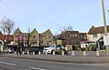
 Shops in Banbury Road, Kidlington - geograph.org.uk - 988169.jpg 640 × 372; 79 KB
-

-

-
 Sparrowgap Bridge over the railway - geograph.org.uk - 1322015.jpg 640 × 413; 72 KB
-
 The Oxford Canal by Yarnton Bridge - geograph.org.uk - 932938.jpg 640 × 480; 90 KB
-
 Kidlington - RH Transport 302 (16167229520).jpg 2,288 × 1,716; 1.17 MB
-
 Kidlington Ambulance Station - geograph.org.uk - 321104.jpg 640 × 480; 66 KB
-
 Kidlington Baptist Church - geograph.org.uk - 4872292.jpg 2,000 × 1,333; 2.13 MB
-
 Kidlington Barn being Renovated - geograph.org.uk - 966389.jpg 640 × 294; 43 KB
-
 Kidlington Castle - geograph.org.uk - 3342305.jpg 1,600 × 1,150; 350 KB
-
 Kidlington clock tower - geograph.org.uk - 4712159.jpg 1,280 × 949; 265 KB
-
 Kidlington clock tower - geograph.org.uk - 4872367.jpg 2,000 × 1,333; 1.91 MB
-
Kidlington en gb.ogg 1.5 s; 40 KB
-
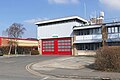 Kidlington fire station - geograph.org.uk - 4870791.jpg 2,000 × 1,333; 2.01 MB
-
 Kidlington fire station - geograph.org.uk - 583910.jpg 640 × 427; 212 KB
-
 Kidlington football ground on Yarnton Road - geograph.org.uk - 2796545.jpg 1,500 × 969; 137 KB
-
 Kidlington Garage - geograph.org.uk - 6057992.jpg 1,852 × 1,168; 1,008 KB
-
 Kidlington Green Lock - geograph.org.uk - 2780197.jpg 1,500 × 1,000; 319 KB
-
 Kidlington Green Lock - geograph.org.uk - 6540442.jpg 1,280 × 851; 851 KB
-
 Kidlington Green Lock bypass channel - geograph.org.uk - 3881219.jpg 1,997 × 1,498; 936 KB
-
 Kidlington Green Lock, Oxford Canal - geograph.org.uk - 6547883.jpg 1,280 × 851; 671 KB
-
 Kidlington High Street - geograph.org.uk - 3342344.jpg 1,600 × 1,200; 408 KB
-
 Kidlington High Street - geograph.org.uk - 4872358.jpg 2,000 × 1,333; 1.87 MB
-
 Kidlington HighSt PillarBox TypeK.jpg 1,500 × 3,000; 1.88 MB
-
 Kidlington SterlingCinema.JPG 2,450 × 1,960; 492 KB
-
 Kidlington Telephone Exchange, Oxon - geograph.org.uk - 5273878.jpg 2,592 × 1,944; 1.35 MB
-
 Kidlington village centre - geograph.org.uk - 4870996.jpg 2,000 × 1,333; 1.98 MB
-
 Kissing gate to Hampton Poyle - geograph.org.uk - 2791269.jpg 1,500 × 990; 241 KB
-
 Langford Hall (Oxford Aviation Academy) - geograph.org.uk - 3214103.jpg 1,024 × 683; 168 KB
-
 Langford Lane in Kidlington - geograph.org.uk - 4537586.jpg 1,024 × 634; 178 KB
-
 Langford Lane moorings, Kidlington - geograph.org.uk - 5125672.jpg 3,264 × 2,448; 3.51 MB
-
 Lyne Road, Kidlington - geograph.org.uk - 3390164.jpg 1,600 × 1,200; 379 KB
-
 Milestone beside Banbury Road, Kidlington - geograph.org.uk - 4913401.jpg 1,024 × 683; 201 KB
-
 Mill Street in Kidlington - geograph.org.uk - 2790393.jpg 1,500 × 1,000; 209 KB
-
 Narrowboat heading north along the Oxford Canal - geograph.org.uk - 4527358.jpg 1,024 × 849; 329 KB
-
 Narrowboat moored along the Oxford Canal - geograph.org.uk - 4527396.jpg 1,024 × 741; 255 KB
-
 Narrowboat on the Oxford Canal - geograph.org.uk - 2448162.jpg 640 × 480; 151 KB
-
 Narrowboat on the Oxford Canal - geograph.org.uk - 2780184.jpg 1,500 × 1,000; 203 KB
-
 Narrowboats on the Oxford Canal - geograph.org.uk - 6168432.jpg 2,700 × 2,025; 831 KB
-
 Narrowboats on the Oxford Canal - geograph.org.uk - 6168441.jpg 2,700 × 2,025; 763 KB
-
 Narrowboats on the Oxford Canal - geograph.org.uk - 6168448.jpg 2,700 × 2,025; 879 KB
-
 Narrowboats on the Oxford Canal - geograph.org.uk - 6168449.jpg 2,700 × 2,025; 548 KB
-
 Nature Reserve at Strafield Brake - geograph.org.uk - 2448143.jpg 640 × 216; 41 KB
-
 New Trees at Upper Campsfield Farm - geograph.org.uk - 5727782.jpg 1,600 × 1,030; 417 KB
-
 Normanhurst, Banbury Road - geograph.org.uk - 4712153.jpg 1,280 × 982; 326 KB
-
 North end of Evans Lane, Kidlington - geograph.org.uk - 5222349.jpg 1,024 × 768; 278 KB
-
 Nos. 107 and 109 Oxford Road - geograph.org.uk - 4919102.jpg 1,024 × 683; 152 KB
-
 Nos. 312 and 310 Oxford Road - geograph.org.uk - 4916422.jpg 1,024 × 676; 209 KB
-
 Old Priest's House, Kidlington.jpg 4,000 × 3,000; 4.79 MB
-
 Opposite Police HQ - geograph.org.uk - 3342396.jpg 1,024 × 700; 134 KB
-
 Ordnance Survey One-Inch Sheet 145 Banbury, Published 1953.jpg 8,349 × 9,987; 11.03 MB
-
 Ordnance Survey One-Inch Sheet 145 Banbury, Published 1968.jpg 8,330 × 9,889; 10.51 MB
-
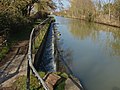
 Overflow sluice at Kidlington Green Lock - geograph.org.uk - 2780192.jpg 1,500 × 1,000; 295 KB
-
 Overflow sluice at Kidlington Green Lock - geograph.org.uk - 2780193.jpg 1,000 × 1,500; 217 KB
-
 Oxford Audi, 2 Oxford Road, Kidlington - geograph.org.uk - 2708297.jpg 1,024 × 686; 111 KB
-
 Oxford Canal - geograph.org.uk - 3297047.jpg 640 × 480; 82 KB
-
 Oxford Canal - geograph.org.uk - 3297081.jpg 640 × 480; 106 KB
-
 Oxford Canal above Kidlington Green Lock - geograph.org.uk - 6547720.jpg 1,280 × 851; 635 KB
-
 Oxford Canal and Banbury Road - geograph.org.uk - 4526801.jpg 1,024 × 723; 306 KB
-
 Oxford Canal footbridge - geograph.org.uk - 3881030.jpg 2,048 × 1,536; 1.49 MB
-
 Oxford Canal from Langford Locks Bridge - geograph.org.uk - 6168402.jpg 2,700 × 1,989; 609 KB
-
 Oxford Canal heading north - geograph.org.uk - 6168424.jpg 2,700 × 2,025; 860 KB
-
 Oxford Canal runs under Banbury Road Bridge - geograph.org.uk - 6168445.jpg 2,700 × 2,025; 613 KB
-
 Oxford Canal runs under Banbury Road Bridge - geograph.org.uk - 6168447.jpg 2,700 × 2,025; 706 KB
-
 Oxford Canal runs under Langford Locks Bridge - geograph.org.uk - 6168416.jpg 2,700 × 2,025; 747 KB
-
 Oxford Canal runs under Langford Locks Bridge - geograph.org.uk - 6168420.jpg 2,700 × 2,025; 725 KB
-
 Oxford Canal, bridge 227 - geograph.org.uk - 4867470.jpg 2,592 × 1,944; 2.03 MB
-
 Oxford Canal, Kidlington - geograph.org.uk - 6546873.jpg 1,280 × 851; 736 KB
-
 Oxford Canal, Kidlington - geograph.org.uk - 6546906.jpg 1,280 × 851; 728 KB
-
 Oxford Green Belt Way - geograph.org.uk - 3297117.jpg 640 × 480; 53 KB
-
 Oxford Green Belt Way - geograph.org.uk - 3297123.jpg 640 × 480; 145 KB
-
 Oxford Green Belt Way - geograph.org.uk - 3297131.jpg 640 × 480; 93 KB
-
 Oxford Road Shops - geograph.org.uk - 3342392.jpg 1,024 × 768; 150 KB
-
 Oxford Road, Kidlington - geograph.org.uk - 3342374.jpg 1,024 × 714; 141 KB
-
 Oxford Road, Kidlington - geograph.org.uk - 5222437.jpg 1,024 × 768; 106 KB
-
 Oxford Road, Kidlington - geograph.org.uk - 6058008.jpg 1,866 × 1,192; 1.14 MB
-
 Oxford Road, Kidlington - geograph.org.uk - 6058021.jpg 1,787 × 1,145; 1.06 MB
-
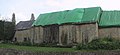
 Path by St Mary's churchyard, Kidlington - geograph.org.uk - 1346523.jpg 480 × 640; 130 KB
-
 Pedestrian access to Exeter Close, Kidlington - geograph.org.uk - 5222367.jpg 1,024 × 768; 219 KB
-
 Pipe bridge across the Oxford Canal - geograph.org.uk - 4527366.jpg 1,024 × 768; 244 KB


_-_geograph.org.uk_-_3241881.jpg)


_over_the_Oxford_Canal_-_geograph.org.uk_-_5125665.jpg)


_-_geograph.org.uk_-_5222388.jpg)
_-_geograph.org.uk_-_5222404.jpg)
_-_geograph.org.uk_-_5222412.jpg)


_-_geograph.org.uk_-_3214103.jpg)


.jpg)