Category:Khirbat Zawiya
Jump to navigation
Jump to search
Palestinian village, depopulated in 1948 | |||||
| Upload media | |||||
| Instance of | |||||
|---|---|---|---|---|---|
| Location | Baysan Subdistrict | ||||
 | |||||
Media in category "Khirbat Zawiya"
The following 4 files are in this category, out of 4 total.
-
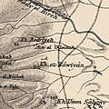 Historical map series for the area of Khirbat Zawiya (1870s).jpg 745 × 748; 212 KB
-

-
 Historical map series for the area of Khirbat Zawiya (1940s).jpg 745 × 748; 299 KB
-
 Historical map series for the area of Khirbat Zawiya (modern).jpg 745 × 748; 82 KB
.jpg)
.jpg)
.jpg)
.jpg)