Category:Khirbat Zakariyya
Jump to navigation
Jump to search
depopulated village in Ramle district | |||||
| Upload media | |||||
| Instance of | |||||
|---|---|---|---|---|---|
| Location | Ramle Subdistrict | ||||
 | |||||
Media in category "Khirbat Zakariyya"
The following 15 files are in this category, out of 15 total.
-
 Historical map series for the area of Khirbat Zakariyya (1870s).jpg 986 × 990; 406 KB
-
 Clermont-Ganneaup357.png 1,444 × 888; 737 KB
-
 Historical map series for the area of Khirbat Zakariyya (1940s).jpg 986 × 990; 462 KB
-

-
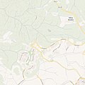 Historical map series for the area of Khirbat Zakariyya (modern).jpg 986 × 990; 236 KB
-
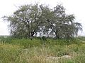
 Bikat-ha-Nezirim-39.jpg 2,592 × 1,944; 597 KB
-
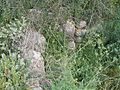
 Bikat-ha-Nezirim-45.jpg 2,592 × 1,944; 473 KB
-
 Bikat-ha-Nezirim-47.jpg 2,592 × 1,944; 894 KB
-
 Bikat-ha-Nezirim-51.jpg 2,592 × 1,944; 698 KB
-
 Bikat-ha-Nezirim-53.jpg 2,454 × 1,453; 645 KB
-
 Bikat-ha-Nezirim-55.jpg 2,592 × 1,944; 959 KB
-
 Bikat-ha-Nezirim-57.jpg 1,944 × 2,592; 882 KB
-
 Bikat-ha-Nezirim-58.jpg 2,592 × 1,944; 949 KB
-
 Bikat-ha-Nezirim-59.jpg 2,592 × 1,944; 846 KB
-
 Bikat-ha-Nezirim-61.jpg 1,944 × 2,592; 867 KB
.jpg)

.jpg)
.jpg)
.jpg)


