Category:Kgatleng District
Jump to navigation
Jump to search
district of Botswana   | |||||
| Upload media | |||||
| Instance of | |||||
|---|---|---|---|---|---|
| Location | Botswana | ||||
| Capital | |||||
| Population |
| ||||
| Area |
| ||||
| Elevation above sea level |
| ||||
 | |||||
Media in category "Kgatleng District"
The following 6 files are in this category, out of 6 total.
-
 Matsieng Footprints 20200620a.jpg 4,032 × 2,268; 4.95 MB
-
 Matsieng Footprints 20200620b.jpg 4,032 × 2,268; 5.64 MB
-
 Phuthadikobo Hill 20200620.jpg 4,032 × 2,268; 4.71 MB
-
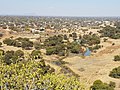 Phuthadikobo Hill, Ngotwane river, 20200620.jpg 1,978 × 1,484; 1.02 MB
-
 Phuthadikobo Museum 20200620.jpg 3,244 × 1,825; 2.14 MB
-
 Road to Modipane.jpg 3,670 × 2,312; 749 KB


