Category:Keys Court, Liverpool
Jump to navigation
Jump to search
| Object location | | View all coordinates using: OpenStreetMap |
|---|
Former location of St Peter's Church, after which the street was named, and demolished in 1922.
Media in category "Keys Court, Liverpool"
The following 7 files are in this category, out of 7 total.
-
 Keys Court arcade 1.jpg 4,700 × 3,402; 18.31 MB
-
 Keys Court arcade 2.jpg 4,886 × 3,312; 18.6 MB
-
 Keys Court, Church Street, Liverpool.jpg 1,440 × 1,890; 412 KB
-
 Keys Court, Liverpool 1.jpg 3,986 × 2,935; 13.33 MB
-
 Keys Court, Liverpool 2.jpg 4,756 × 3,356; 11.15 MB
-
 One-way system, Keys Court, Liverpool One.jpg 5,150 × 3,453; 20.61 MB
-
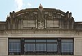 Pediment of Keys Court, Liverpool.jpg 4,219 × 2,896; 11.91 MB


