Category:Ketteringham
Jump to navigation
Jump to search
village in Norfolk, England, UK  | |||||
| Upload media | |||||
| Instance of | |||||
|---|---|---|---|---|---|
| Location | South Norfolk, Norfolk, East of England, England | ||||
| Population |
| ||||
| Area |
| ||||
 | |||||
Subcategories
This category has the following 3 subcategories, out of 3 total.
K
- Ketteringham War Memorial (2 F)
S
Media in category "Ketteringham"
The following 200 files are in this category, out of 370 total.
(previous page) (next page)-

-
 1942 - geograph.org.uk - 4352980.jpg 600 × 577; 312 KB
-
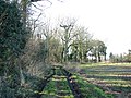
 A bay in the railway cutting - geograph.org.uk - 1608300.jpg 640 × 467; 156 KB
-
 A cold and wintry day - geograph.org.uk - 1625739.jpg 640 × 480; 100 KB
-
 A field boundary in autumn colours - geograph.org.uk - 1608306.jpg 640 × 480; 134 KB
-
 A patch of snowdrops - geograph.org.uk - 4352815.jpg 640 × 518; 560 KB
-

-
 A tall hedge - geograph.org.uk - 1625715.jpg 480 × 640; 161 KB
-
 A11 near Ketteringham - geograph.org.uk - 3365892.jpg 640 × 430; 51 KB
-
 A11 Norwichbound - geograph.org.uk - 5968796.jpg 4,608 × 3,456; 3.18 MB
-
 A11 through Smeeth Wood - geograph.org.uk - 3803136.jpg 640 × 430; 54 KB
-
 A11, Ketteringham Lane Bridge - geograph.org.uk - 3372339.jpg 640 × 443; 73 KB
-
 A11, Ketteringham Lane Bridge - geograph.org.uk - 3803399.jpg 640 × 430; 50 KB
-
 A11, London Rd - geograph.org.uk - 2595430.jpg 640 × 430; 54 KB
-
 A11, northbound - geograph.org.uk - 3365889.jpg 640 × 459; 65 KB
-
 A11, northbound - geograph.org.uk - 3803140.jpg 640 × 430; 50 KB
-
 A11, southbound - geograph.org.uk - 3372005.jpg 640 × 414; 54 KB
-
 A11, southbound - geograph.org.uk - 3372340.jpg 640 × 430; 93 KB
-
 A11, southbound - geograph.org.uk - 3803398.jpg 640 × 430; 48 KB
-
 A11, southbound - geograph.org.uk - 3803404.jpg 640 × 430; 50 KB
-
 A11, southbound - geograph.org.uk - 3803405.jpg 640 × 430; 51 KB
-
 A11, Thetford-bound - geograph.org.uk - 5968797.jpg 4,608 × 3,456; 3.18 MB
-
 A47, Norwich bypass - geograph.org.uk - 3757536.jpg 640 × 430; 36 KB
-
 A47, Norwich bypass - geograph.org.uk - 4272839.jpg 640 × 362; 43 KB
-
 A47, Norwich bypass - geograph.org.uk - 4272842.jpg 640 × 400; 46 KB
-
 Access road to the Cricket ground - geograph.org.uk - 4352805.jpg 640 × 480; 490 KB
-
 Aconites in Ketteringham Park - geograph.org.uk - 4845306.jpg 640 × 556; 543 KB
-
 Airtight Inspection Cover - geograph.org.uk - 4795732.jpg 640 × 566; 580 KB
-
 Ancient beech tree on the edge of a lake - geograph.org.uk - 4845231.jpg 640 × 360; 343 KB
-
 Animal sculpture in Ketteringham Park - geograph.org.uk - 4845279.jpg 457 × 640; 490 KB
-
 Animal sculpture in Ketteringham Park - geograph.org.uk - 4845282.jpg 640 × 631; 679 KB
-
 Animal sculpture in Ketteringham Park - geograph.org.uk - 4845288.jpg 640 × 522; 500 KB
-
 Animal sculpture in Ketteringham Park - geograph.org.uk - 4845291.jpg 640 × 565; 562 KB
-
 Animal sculpture in Ketteringham Park - geograph.org.uk - 4845292.jpg 640 × 617; 680 KB
-
 Animal sculptures in Ketteringham Park - geograph.org.uk - 4842524.jpg 603 × 640; 608 KB
-
 Approaching Cantley Lane - geograph.org.uk - 1608376.jpg 640 × 480; 148 KB
-
-
 Autumnal oak on field boundary - geograph.org.uk - 1608316.jpg 480 × 640; 154 KB
-
 Back gardens of Station Cottages - geograph.org.uk - 1608048.jpg 640 × 480; 150 KB
-
 Blimp - geograph.org.uk - 5968774.jpg 4,608 × 3,456; 3.54 MB
-
 Braithwaite water tank and pump house - geograph.org.uk - 4352985.jpg 640 × 542; 601 KB
-
 Breckland Line towards Wymondham - geograph.org.uk - 1824028.jpg 800 × 531; 79 KB
-
 Brick-built blast shelter on Site 6 - geograph.org.uk - 4795748.jpg 640 × 561; 625 KB
-
 Bridge 1630 - geograph.org.uk - 1608349.jpg 640 × 437; 180 KB
-
 Bridge 1630 viewed from Cantley Lane - geograph.org.uk - 1608369.jpg 640 × 450; 153 KB
-
 Bridge over Cantley Lane - geograph.org.uk - 1608363.jpg 640 × 455; 152 KB
-

-
 Bridge over the railway line - geograph.org.uk - 1625745.jpg 640 × 454; 149 KB
-
 Bridge over the railway line - geograph.org.uk - 1625767.jpg 640 × 458; 184 KB
-
 Broken window glass - geograph.org.uk - 4840730.jpg 407 × 640; 252 KB
-

-
 Bungalow in Low Street - geograph.org.uk - 4840676.jpg 640 × 480; 355 KB
-
 Capstan and rope-rollers - geograph.org.uk - 1608018.jpg 640 × 598; 189 KB
-
 Carthusian stained glass - geograph.org.uk - 4841138.jpg 640 × 629; 563 KB
-
 Carthusian stained glass - geograph.org.uk - 4841225.jpg 465 × 640; 465 KB
-
 Carthusian stained glass - geograph.org.uk - 4841231.jpg 615 × 640; 613 KB
-
 Carthusian stained glass - geograph.org.uk - 4841233.jpg 640 × 589; 560 KB
-
 Carthusian stained glass - geograph.org.uk - 4845317.jpg 640 × 205; 220 KB
-
 Carved bat - geograph.org.uk - 4842543.jpg 640 × 581; 561 KB
-

-
 Charity in the foyer - geograph.org.uk - 4840705.jpg 445 × 640; 362 KB
-
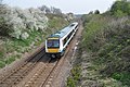
 Class 170 near Ketteringham - geograph.org.uk - 1931191.jpg 800 × 531; 169 KB
-
 Concrete hut platform on Site 5 - geograph.org.uk - 4795731.jpg 640 × 480; 532 KB
-
 Concreted hut base - geograph.org.uk - 4353012.jpg 640 × 480; 314 KB
-
 Concreted track covered with leaves - geograph.org.uk - 4795738.jpg 640 × 480; 575 KB
-
 Copse in field by Outerpark Wood - geograph.org.uk - 3895122.jpg 640 × 408; 182 KB
-
 Copse in field by Outerpark Wood - geograph.org.uk - 3895124.jpg 640 × 480; 231 KB
-
 Cottage in Cantley Lane - geograph.org.uk - 1608336.jpg 640 × 480; 148 KB
-
 Cottage in Ketteringham - geograph.org.uk - 5189159.jpg 640 × 557; 511 KB
-
 Cottage in Ketteringham High Street - geograph.org.uk - 4352730.jpg 640 × 533; 462 KB
-
 Cottages in Cantley Lane - geograph.org.uk - 1608383.jpg 640 × 453; 116 KB
-

-
 Cottages in Ketteringham - geograph.org.uk - 1843949.jpg 640 × 480; 133 KB
-
 Cricket ground at Ketteringham Hall - geograph.org.uk - 4352799.jpg 640 × 480; 391 KB
-
 Cricket pavilion - geograph.org.uk - 4845202.jpg 640 × 360; 332 KB
-
 Crop field beside Smeeth Wood - geograph.org.uk - 4600686.jpg 640 × 443; 56 KB
-
 Crop field near High View - geograph.org.uk - 4599228.jpg 640 × 385; 45 KB
-
 Crop field near Ketteringham - geograph.org.uk - 4599230.jpg 640 × 413; 53 KB
-
 Crop field north of Church Plantation - geograph.org.uk - 4352747.jpg 640 × 480; 373 KB
-
 Cygnet enjoying some peace and quiet - geograph.org.uk - 4840771.jpg 594 × 640; 439 KB
-
 Cygnet on Ketteringham Hall Lake - geograph.org.uk - 4840770.jpg 640 × 582; 356 KB
-

-

-
 Diesel train on its way to Norwich - geograph.org.uk - 1085675.jpg 640 × 480; 50 KB
-

-
 Ditch separating two fields - geograph.org.uk - 3895116.jpg 640 × 480; 194 KB
-

-
 DMU 170 unit 170 212 - geograph.org.uk - 1823990.jpg 800 × 531; 158 KB
-
 DMU 170271 on its way to Norwich station - geograph.org.uk - 1748938.jpg 640 × 570; 195 KB
-
 DMU Class 170 212 on a train to Norwich - geograph.org.uk - 1823933.jpg 800 × 531; 162 KB
-
 Dog graveyard in Ketteringham Park - geograph.org.uk - 4840733.jpg 539 × 640; 577 KB
-
 Dog graveyard in Ketteringham Park - geograph.org.uk - 4840735.jpg 640 × 545; 547 KB
-
 Dog graveyard in Ketteringham Park - geograph.org.uk - 4840736.jpg 625 × 640; 286 KB
-

-
 Enlisted men's Mess hall on Site 6 - geograph.org.uk - 4795755.jpg 640 × 480; 351 KB
-
 Enlisted men's Mess hall on Site 6 - geograph.org.uk - 4795758.jpg 640 × 480; 353 KB
-
 Enlisted men's Mess hall on Site 6 - geograph.org.uk - 4795762.jpg 640 × 480; 388 KB
-
 Enlisted men's Mess hall on Site 6 - geograph.org.uk - 4795765.jpg 640 × 480; 334 KB
-
 Entrance into the summer house - geograph.org.uk - 4840718.jpg 480 × 640; 447 KB
-
 Entrance to petrol storage depot - geograph.org.uk - 1607072.jpg 640 × 480; 94 KB
-
 Farm track skirting Church Plantation - geograph.org.uk - 4352763.jpg 640 × 480; 397 KB
-
 Farm track through St Thomas Belt - geograph.org.uk - 2010866.jpg 640 × 480; 285 KB
-
-
 Farmland, Ivy Farm - geograph.org.uk - 2704385.jpg 640 × 430; 43 KB
-
 Fence and gate in Ketteringham Park - geograph.org.uk - 4845247.jpg 640 × 360; 383 KB
-
 Fence between footpath and railway line - geograph.org.uk - 1608061.jpg 640 × 480; 146 KB
-
 Field margin - geograph.org.uk - 3895110.jpg 640 × 480; 236 KB
-
 Field north of The Street, Ketteringham - geograph.org.uk - 1625680.jpg 640 × 547; 109 KB
-
 Fields by Capslough Farm - geograph.org.uk - 4691196.jpg 640 × 360; 302 KB
-
 Fields in Ketteringham - geograph.org.uk - 4352741.jpg 640 × 480; 339 KB
-
 Fields north of the A11 road - geograph.org.uk - 1744476.jpg 640 × 480; 127 KB
-
 Fields south of High Ash Road - geograph.org.uk - 4795715.jpg 640 × 480; 437 KB
-
 Fir Pit - geograph.org.uk - 4840766.jpg 640 × 480; 409 KB
-
 Flowering oilseed rape - geograph.org.uk - 3895133.jpg 640 × 480; 212 KB
-
 Fly-tipping on Station Lane - geograph.org.uk - 1607083.jpg 480 × 640; 179 KB
-
 Footbridge over the railway - geograph.org.uk - 1625775.jpg 640 × 480; 186 KB
-
 Footbridge, A47 - geograph.org.uk - 3757537.jpg 640 × 430; 39 KB
-
 Footbridge, A47 - geograph.org.uk - 4272843.jpg 640 × 348; 34 KB
-
 Footpath across a field to Hethersett - geograph.org.uk - 1744466.jpg 640 × 480; 126 KB
-

-
 Footpath Near Ketteringham - geograph.org.uk - 914125.jpg 640 × 480; 89 KB
-
 Footpath to Station Lane - geograph.org.uk - 1608381.jpg 640 × 452; 121 KB
-
 Footpath, Ketteringham Hall - geograph.org.uk - 914130.jpg 640 × 480; 131 KB
-

-

-
 Frosted verge beside High Ash Road - geograph.org.uk - 4795810.jpg 639 × 640; 808 KB
-
 Frozen fields - geograph.org.uk - 1625733.jpg 640 × 609; 142 KB
-
-
 Gate on the footpath to Ketteringham - geograph.org.uk - 4352736.jpg 640 × 480; 439 KB
-

-

-
 Gates onto the railway track - geograph.org.uk - 3269285.jpg 1,600 × 1,067; 523 KB
-
 Gored by a bull - geograph.org.uk - 5189166.jpg 540 × 640; 471 KB
-
 Head carpenter's gravestone (detail) - geograph.org.uk - 5189164.jpg 640 × 571; 467 KB
-
 Head carpenter's gravestone - geograph.org.uk - 5189163.jpg 480 × 640; 438 KB
-
 High Ash Farm, Ketteringham - geograph.org.uk - 45395.jpg 640 × 480; 54 KB
-

-
-
 Highash Farm Ketteringham - geograph.org.uk - 5968772.jpg 4,456 × 3,342; 6.72 MB
-
 Highash Road, Ketteringham - geograph.org.uk - 5968786.jpg 4,096 × 3,072; 4.15 MB
-
 Highways depot by Station Road - geograph.org.uk - 3269294.jpg 1,200 × 1,600; 649 KB
-
 Highways depot, Ketteringham - geograph.org.uk - 87357.jpg 640 × 480; 44 KB
-

-
 Hut remains in the woods - geograph.org.uk - 4353931.jpg 640 × 490; 567 KB
-
 Hut remains in the woods - geograph.org.uk - 4353932.jpg 640 × 488; 584 KB
-
 Hut remains in the woods - geograph.org.uk - 4353939.jpg 640 × 480; 584 KB
-
 Initials carved into a tree - geograph.org.uk - 4845229.jpg 640 × 360; 389 KB
-
 Ivy on footbridge - geograph.org.uk - 1625805.jpg 480 × 640; 182 KB
-
 Ivy-clad RAF building - geograph.org.uk - 4353942.jpg 640 × 480; 600 KB
-
 Jubilee tree, Ketteringham - geograph.org.uk - 31855.jpg 480 × 640; 130 KB
-

-
 Ketteringham Hall - geograph.org.uk - 6548312.jpg 4,608 × 3,072; 1.82 MB
-
 Ketteringham Hall - the main staircase - geograph.org.uk - 4840702.jpg 525 × 640; 307 KB
-
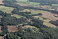 Ketteringham Hall, aerial 2017 (1) - geograph.org.uk - 5525957.jpg 800 × 533; 116 KB
-
 Ketteringham Hall, aerial 2017 (2) - geograph.org.uk - 5525967.jpg 640 × 427; 73 KB
-
 Ketteringham Hall, aerial 2017 (3) - geograph.org.uk - 5525986.jpg 800 × 533; 93 KB
-
 Ketteringham Lane Bridge, A11 - geograph.org.uk - 2595433.jpg 640 × 430; 65 KB
-
 Ketteringham Lane Bridge, A11 - geograph.org.uk - 2704394.jpg 640 × 430; 52 KB
-
 Ketteringham Park (information board) - geograph.org.uk - 4845250.jpg 1,700 × 956; 1.51 MB
-
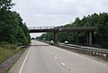 Ketteringham Road Bridge, A11 - geograph.org.uk - 3803141.jpg 640 × 430; 56 KB
-
 Ketteringham Village Hall - geograph.org.uk - 1768973.jpg 1,600 × 1,200; 407 KB
-
 Ketteringham Village Hall - geograph.org.uk - 4518193.jpg 1,024 × 768; 405 KB
-
 Ketteringham village hall in The Street - geograph.org.uk - 1625707.jpg 640 × 452; 111 KB
-
 Ketteringham village hall in The Street - geograph.org.uk - 1744461.jpg 640 × 480; 101 KB
-
 Ketteringham War Memorial - geograph.org.uk - 4518321.jpg 2,592 × 3,456; 831 KB
-
 Ketteringham Well - geograph.org.uk - 27680.jpg 640 × 480; 116 KB
-
 Ketteringham Well - geograph.org.uk - 5968799.jpg 4,440 × 3,330; 5.67 MB
-
 Lake in Ketteringham Hall Park - geograph.org.uk - 4840769.jpg 640 × 480; 377 KB
-
 Lake south of Ketteringham Hall - geograph.org.uk - 4840768.jpg 640 × 480; 396 KB
-
 Lane down to the railway - geograph.org.uk - 3269300.jpg 1,200 × 1,600; 532 KB
-
 Layby, A11 - geograph.org.uk - 3368393.jpg 640 × 430; 57 KB
-
 Layby, A11 - geograph.org.uk - 3803152.jpg 640 × 430; 57 KB
-
 Layby, A11 - geograph.org.uk - 3803396.jpg 640 × 473; 45 KB
-
 Life belt beside path - geograph.org.uk - 4845217.jpg 640 × 360; 362 KB
-
 Line To Wymondham - geograph.org.uk - 913532.jpg 640 × 480; 84 KB
-
 Lodge Farm Cottages - geograph.org.uk - 3895104.jpg 640 × 480; 235 KB
-

-
 Meadow east of Station Cottages - geograph.org.uk - 1608065.jpg 640 × 452; 107 KB
-
 Mess hall on Site 6 - geograph.org.uk - 4795752.jpg 640 × 622; 604 KB
-
 Monument near Ketteringham - geograph.org.uk - 5305370.jpg 640 × 480; 165 KB
-
 Moss-covered blast shelter - geograph.org.uk - 4795725.jpg 640 × 540; 616 KB
-

-
 Oilseed rape crop - geograph.org.uk - 3895131.jpg 640 × 480; 222 KB
-
 Oilseed rape crop by Ketteringham - geograph.org.uk - 3895112.jpg 640 × 380; 180 KB
-
 Old Aircraft Hangar - geograph.org.uk - 1962477.jpg 640 × 480; 84 KB
-
 Old bridge over railway line - geograph.org.uk - 1085665.jpg 640 × 480; 118 KB
-

-

-

-

-

-
 Old cartsheds at Highash Farm - geograph.org.uk - 5968770.jpg 4,288 × 3,216; 2.94 MB
-
 Old concreted road - geograph.org.uk - 4353000.jpg 640 × 480; 494 KB
-
 Old farm accommodation bridge - geograph.org.uk - 1931201.jpg 800 × 531; 164 KB
-
 Old fence post in School Wood - geograph.org.uk - 4352745.jpg 635 × 640; 693 KB
-

-
 Overgrown blast shelter on Site 6 - geograph.org.uk - 4795744.jpg 640 × 496; 529 KB
-
 Panels of stained glass - geograph.org.uk - 4840729.jpg 640 × 494; 442 KB
-

-
 Pasture by Ketteringham Hall - geograph.org.uk - 4352810.jpg 640 × 414; 417 KB


_-_geograph.org.uk_-_5189164.jpg)


_-_geograph.org.uk_-_5525957.jpg)
_-_geograph.org.uk_-_5525967.jpg)
_-_geograph.org.uk_-_5525986.jpg)


_-_geograph.org.uk_-_4845250.jpg)


