Category:Kerkstraat 41, Vollenhove
Jump to navigation
Jump to search
| Object location | | View all coordinates using: OpenStreetMap |
|---|
 | |||||
| Upload media | |||||
| Instance of |
| ||||
|---|---|---|---|---|---|
| Location | Vollenhove, Vollenhove | ||||
| Street address |
| ||||
| Located on street |
| ||||
| Heritage designation |
| ||||
 | |||||
|
This is a category about rijksmonument number 10566
|
| Address |
|
Media in category "Kerkstraat 41, Vollenhove"
The following 10 files are in this category, out of 10 total.
-
 Gevel - Vollenhove - 20245182 - RCE.jpg 881 × 1,200; 209 KB
-
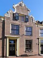 Kerkstraat41 Vollenhove.jpg 1,368 × 1,824; 408 KB
-
 Overzicht Kerkstraat - Vollenhove - 20244884 - RCE.jpg 1,188 × 1,200; 327 KB
-
 Overzicht van de halsgevel met rococo-omlijsting - Vollenhove - 20378928 - RCE.jpg 1,200 × 1,200; 302 KB
-
 Overzicht voorgevels - Vollenhove - 20350521 - RCE.jpg 1,186 × 1,200; 325 KB
-
 Vollenhove 064.JPG 3,264 × 2,448; 1.8 MB
-
 Vollenhove 065.JPG 2,448 × 3,264; 1.88 MB
-
 Vollenhove 069.JPG 3,264 × 2,448; 1.85 MB
-
 Voorgevels - Vollenhove - 20245179 - RCE.jpg 809 × 1,200; 213 KB
-
 Voorgevels - Vollenhove - 20245180 - RCE.jpg 809 × 1,200; 212 KB


