Category:Kerkstraat 23, Arnhem
Jump to navigation
Jump to search
| Object location | | View all coordinates using: OpenStreetMap |
|---|
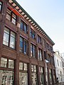
building in Arnhem, Netherlands  | |||||
| Upload media | |||||
| Instance of | |||||
|---|---|---|---|---|---|
| Location | Arnhem, Gelderland, Netherlands | ||||
| Street address |
| ||||
| Located on street | |||||
| Heritage designation |
| ||||
 | |||||
|
This is a category about rijksmonument number 516887
|
| Address |
|
Media in category "Kerkstraat 23, Arnhem"
The following 13 files are in this category, out of 13 total.
-
 Achtergevel rechts achtergevel Kerkstr. 21-22 - Arnhem - 20025443 - RCE.jpg 1,200 × 788; 231 KB
-
 Arnhem - Kerkstraat 23 - 1.jpg 2,592 × 1,944; 1.58 MB
-
 Arnhem - Kerkstraat 23 - 2.jpg 2,592 × 1,944; 1.56 MB
-
 Arnhem - Kerkstraat 23 - 3.jpg 1,944 × 2,592; 1.23 MB
-
 Arnhem - Kerkstraat 23 - 4.jpg 1,944 × 2,592; 1.22 MB
-
 Gevelsteen achtergevel - Arnhem - 20025438 - RCE.jpg 1,192 × 1,200; 479 KB
-
 Gevelsteen in achtergevel - Arnhem - 20025439 - RCE.jpg 1,200 × 800; 308 KB
-
 Linker zijgevel - Arnhem - 20025440 - RCE.jpg 790 × 1,200; 260 KB
-
 Linker zijgevel - Arnhem - 20025441 - RCE.jpg 792 × 1,200; 270 KB
-
 Linkerzijgevel - Arnhem - 20025445 - RCE.jpg 1,200 × 788; 202 KB
-
 Linkerzijgevel - Arnhem - 20025446 - RCE.jpg 788 × 1,200; 251 KB
-
 Tot eind voorgevels - Arnhem - 20025437 - RCE.jpg 1,198 × 1,200; 309 KB
-
 Voorgevel - Arnhem - 20025442 - RCE.jpg 806 × 1,200; 201 KB


