Category:Kerkstraat 196, Amsterdam
Jump to navigation
Jump to search
| Object location | | View all coordinates using: OpenStreetMap |
|---|
building in Amsterdam, Netherlands .JPG) | |||||
| Upload media | |||||
| Instance of | |||||
|---|---|---|---|---|---|
| Location | Amsterdam, North Holland, Netherlands | ||||
| Street address |
| ||||
| Located on street | |||||
| Heritage designation |
| ||||
 | |||||
|
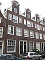
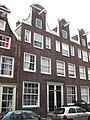
This is a category about rijksmonument number 2914
|
| Address |
|
Media in category "Kerkstraat 196, Amsterdam"
The following 3 files are in this category, out of 3 total.
-
 Kerkstraat 196 (midden).JPG 1,944 × 2,592; 621 KB
-
 Kerkstraat 198 (links).JPG 1,944 × 2,592; 631 KB
-
 Kerkstraat 200, 198, 196, 194 en 192.JPG 2,592 × 1,944; 615 KB
.JPG)
