Category:Kerkstraat 17, Deurne
Jump to navigation
Jump to search
| Object location | | View all coordinates using: OpenStreetMap |
|---|
 | |||||
| Upload media | |||||
| Instance of | |||||
|---|---|---|---|---|---|
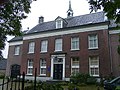
| Location | Deurne, North Brabant, Netherlands | ||||
| Street address |
| ||||
| Located on street |
| ||||
| Heritage designation |
| ||||
 | |||||
|
This is a category about rijksmonument number 12371
|
| Address |
|
Media in category "Kerkstraat 17, Deurne"
The following 3 files are in this category, out of 3 total.
-
 12371 voormalige pastorie Deurne.jpg 5,064 × 3,684; 13.98 MB
-
 PastorieDeurne.jpg 550 × 413; 62 KB
-
 Voorgevel - Deurne - 20053772 - RCE.jpg 1,200 × 807; 197 KB

