Category:Kerkbuurt (Westzaan)
Jump to navigation
Jump to search
| Object location | | View all coordinates using: OpenStreetMap |
|---|
 | |||||
| Upload media | |||||
| Instance of | |||||
|---|---|---|---|---|---|
| Location | Zaanstad, North Holland, Netherlands | ||||
 | |||||
Subcategories
This category has the following 12 subcategories, out of 12 total.
K
- Kerkbuurt 1, Westzaan (3 F)
- Kerkbuurt 11, Westzaan (12 F)
- Kerkbuurt 15, Westzaan (8 F)
- Kerkbuurt 19, Westzaan (2 F)
- Kerkbuurt 25, Westzaan (7 F)
- Kerkbuurt 26, Westzaan (2 F)
- Kerkbuurt 3, Westzaan (7 F)
- Kerkbuurt 30, Westzaan (2 F)
- Kerkbuurt 32, Westzaan (3 F)
- Kerkbuurt 41, Westzaan (11 F)
- Kerkbuurt 6, Westzaan (4 F)
- Kerkbuurt 7, Westzaan (39 F)
Media in category "Kerkbuurt (Westzaan)"
The following 28 files are in this category, out of 28 total.
-
 Brug van Allanstraat naar Kerkbuurt - Westzaan - 20255321 - RCE.jpg 1,200 × 961; 220 KB
-
 Gevel - Westzaan - 20255188 - RCE.jpg 1,200 × 948; 280 KB
-
 Nieuwe Zijde 58, achterzijde - Westzaan - 20255248 - RCE.jpg 1,200 × 1,189; 434 KB
-
 Nieuwe Zijde 58, voorgevel - Westzaan - 20255247 - RCE.jpg 1,200 × 1,186; 340 KB
-
 Verbindingsbrug tussen Allanstraat en Kerkbuurt - Westzaan - 20255320 - RCE.jpg 1,200 × 947; 244 KB
-
 Voorgevel nr. GX 6 - Westzaan - 20479336 - RCE.jpg 1,200 × 900; 297 KB
-
 Voorgevel nr. GX 7 - Westzaan - 20479335 - RCE.jpg 1,200 × 900; 257 KB
-
 Westzaan - J.J. Allanstraat - View NNW on Weelbrug & Kerkbuurt 1 & 3.jpg 3,897 × 5,847; 15.76 MB
-
 Westzaan - J.J. Allanstraat - View NNW on Weelbrug & Kerkbuurt 1 & 4.jpg 5,649 × 3,765; 16.44 MB
-
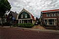
 Westzaan - Kerkbuurt - Torenstraat - View West on Protestant Church 1740.jpg 5,808 × 3,871; 16.57 MB
-
 Westzaan - Kerkbuurt - View East.jpg 5,761 × 3,840; 21.25 MB
-
 Westzaan - Kerkbuurt - View ENE on wooden house Kerkbuurt 16.jpg 5,984 × 3,988; 15.05 MB
-

-

-

-
 Westzaan - Kerkbuurt - View NW.jpg 5,936 × 3,957; 14.68 MB
-
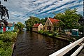
 Westzaan - Kerkbuurt - View South on Weelbrug.jpg 3,966 × 5,951; 14.67 MB
-

-
 Westzaan - Kerkbuurt - View South.jpg 5,984 × 3,988; 14.31 MB
-
 Westzaan - Kerkbuurt - View SSW on Kerkbuurt 15.jpg 5,875 × 3,916; 15.99 MB
-
 Westzaan - Kerkbuurt - View WNW on wooden house Kerkbuurt 11 & Kerkbuurt 15.jpg 5,789 × 3,858; 12.28 MB
-
 Westzaan - Kerkbuurt - Weelbrug - J.J. Allanstraat - View West.jpg 5,804 × 3,868; 17.94 MB
-
 Westzaan - Kerkbuurt - Weelbrug - J.J. Allanstraat - View WSW.jpg 5,837 × 3,891; 15.89 MB
-
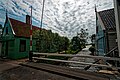
 Westzaan - Kerkbuurt 20 - View East.jpg 3,887 × 5,832; 14.96 MB
-
 Westzaan - Kerkstraat - Kerkbuurt - View SW on Protestant Church 1740.jpg 5,934 × 3,955; 17.57 MB
-
 Westzaan - Wooden House Kerkbuurt 6 - View NE.jpg 5,804 × 3,868; 15.84 MB
-
 Westzaan, Kerkbuurt, Het Raadhuis, c. 1900-1930.jpg 1,712 × 1,144; 344 KB
-
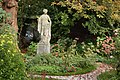 Westzaan-Kerkbuurt 2 Tuinbeeld Ceres.jpg 2,368 × 1,572; 997 KB


_1781-1783_by_Johan_Samuel_Creutz_01.jpg)
_1781-1783_by_Johan_Samuel_Creutz_02.jpg)
_1781-1783_by_Johan_Samuel_Creutz_03.jpg)


