Category:Kerk van Sint-Jans Onthoofding, Gemert
Jump to navigation
Jump to search
| Object location | | View all coordinates using: OpenStreetMap |
|---|
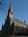
church building in Gemert-Bakel, Netherlands  | |||||
| Upload media | |||||
| Instance of | |||||
|---|---|---|---|---|---|
| Dedicated to | |||||
| Location | Gemert, Gemert | ||||
| Street address |
| ||||
| Located on street |
| ||||
| Architect | |||||
| Heritage designation |
| ||||
| Inception |
| ||||
| Significant event |
| ||||
| Religion or worldview | |||||
| official website | |||||
 | |||||
Nederlands: Afbeeldingen van de Sint Jans Onthoofdingkerk - anno 1853 gevestigd aan het Kerkepad 4 in Gemert in de provincie Noord-Brabant in het zuiden van Nederland
|
This is a category about rijksmonument number 16050
|
| Address |
|
Subcategories
This category has only the following subcategory.
Media in category "Kerk van Sint-Jans Onthoofding, Gemert"
The following 39 files are in this category, out of 39 total.
-
 16050 St. Jan de Doperkerk.jpg 4,219 × 4,994; 15.18 MB
-
 Exterieur naar het oosten - Gemert - 20076973 - RCE.jpg 970 × 1,200; 166 KB
-
 Exterieur noord-zijde naar het zuid-oosten - Gemert - 20076974 - RCE.jpg 966 × 1,200; 223 KB
-
 Exterieur, overzicht naar het zuid-westen - Gemert - 20076971 - RCE.jpg 965 × 1,200; 202 KB
-
 Exterieur, zuid-oost zijde - Gemert - 20076972 - RCE.jpg 969 × 1,200; 263 KB
-
 Gemert Rijksmonument 16050 Kerk van St.Jans onthoofding façade.JPG 2,736 × 3,648; 3.49 MB
-
 Kap - Gemert - 20076984 - RCE.jpg 1,173 × 1,200; 288 KB
-
 Kap - Gemert - 20076985 - RCE.jpg 1,200 × 1,200; 269 KB
-
 Kap - Gemert - 20076986 - RCE.jpg 1,200 × 1,200; 241 KB
-
 Kap - Gemert - 20076987 - RCE.jpg 1,200 × 1,184; 262 KB
-
 Kap - Gemert - 20076988 - RCE.jpg 1,197 × 1,200; 259 KB
-
 Kerk van Sint-Jans Onthoofding P1050898.JPG 2,448 × 3,264; 3.64 MB
-
 Kerk van Sint-Jans Onthoofding P1050901.JPG 2,448 × 3,264; 3.62 MB
-
 Kerk van Sint-Jans Onthoofding P1050902.JPG 2,448 × 3,264; 3.47 MB
-
 Kerk van Sint-Jans Onthoofding P1050903.JPG 2,448 × 3,264; 3.88 MB
-
 Kerk van Sint-Jans Onthoofding P1050904.JPG 2,448 × 3,264; 3.73 MB
-
 Kerk van Sint-Jans Onthoofding P1050905.JPG 2,448 × 3,264; 3.7 MB
-
 Kerk van Sint-Jans Onthoofding P1050907.JPG 2,448 × 3,264; 3.72 MB
-
 Overzicht van de noord-oostgevel - Gemert - 20379783 - RCE.jpg 1,194 × 1,200; 249 KB
-
 Overzicht van de oostgevel - Gemert - 20379782 - RCE.jpg 1,192 × 1,200; 230 KB
-
 Overzicht van de zuid-westgevel met neogotische kerktoren - Gemert - 20379784 - RCE.jpg 1,191 × 1,200; 203 KB
-
 Overzicht van de zuid-westgevel met neogotische kerktoren - Gemert - 20379785 - RCE.jpg 1,200 × 1,196; 256 KB
-
 Overzicht zuidwestgevel met kerktoren en kerkhof - Gemert - 20348296 - RCE.jpg 1,184 × 1,200; 412 KB
-
 Pinakel op de noord-west hoek van de kerk - Gemert - 20076975 - RCE.jpg 966 × 1,200; 163 KB
-
 Raam boven kap - Gemert - 20076982 - RCE.jpg 1,200 × 1,196; 231 KB
-
 Raam in kap - Gemert - 20076981 - RCE.jpg 1,200 × 1,200; 255 KB
-
 Ramen - Gemert - 20076983 - RCE.jpg 1,200 × 1,200; 236 KB
-
 Schildering in bidkapel - Gemert - 20076990 - RCE.jpg 801 × 1,200; 325 KB
-
 T.T RK Kerk Gemert (1).JPG 2,048 × 3,072; 1.29 MB
-
 T.T RK Kerk Gemert (10).JPG 3,072 × 2,048; 1.16 MB
-
 T.T RK Kerk Gemert (2).JPG 2,048 × 3,072; 1.18 MB
-
 T.T RK Kerk Gemert (3).JPG 2,048 × 3,072; 1.23 MB
-
 T.T RK Kerk Gemert (4).JPG 3,072 × 2,048; 1.16 MB
-
 T.T RK Kerk Gemert (5).JPG 2,048 × 3,072; 1.02 MB
-
 T.T RK Kerk Gemert (6).JPG 3,072 × 2,048; 1.28 MB
-
 T.T RK Kerk Gemert (7).JPG 2,048 × 3,072; 1.05 MB
-
 T.T RK Kerk Gemert (8).JPG 2,048 × 3,072; 1.1 MB
-
 T.T RK Kerk Gemert (9).JPG 2,048 × 3,072; 1.12 MB
-
 Tekening van de kerk vanuit het zuidwesten - Gemert - 20076989 - RCE.jpg 1,200 × 803; 182 KB


.JPG)
.JPG)
.JPG)
.JPG)
.JPG)
.JPG)
.JPG)
.JPG)
.JPG)
.JPG)
