Category:Kerk Vrije Zendingsgemeente (Ossenzijl)
Jump to navigation
Jump to search
| Object location | | View all coordinates using: OpenStreetMap |
|---|
building in Steenwijkerland, Netherlands  | |||||
| Upload media | |||||
| Instance of | |||||
|---|---|---|---|---|---|
| Location | Ossenzijl, Steenwijkerland, Overijssel, Netherlands | ||||
| Street address |
| ||||
| Located on street |
| ||||
| Heritage designation |
| ||||
 | |||||
|
This is a category about rijksmonument number 468534
|
| Address |
|
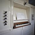
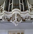
Media in category "Kerk Vrije Zendingsgemeente (Ossenzijl)"
The following 4 files are in this category, out of 4 total.
-
 Interieur, aanzicht orgel, orgelnummer 1842 - Ossenzijl - 20356732 - RCE.jpg 956 × 1,200; 152 KB
-
-
-
 Ossenzijl-vrije zendingsgemeente.jpg 2,560 × 1,920; 2.19 MB


