Category:Kerk, Ryptsjerk
Jump to navigation
Jump to search
| Object location | | View all coordinates using: OpenStreetMap |
|---|
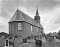
church building in Tytsjerksteradiel, Netherlands  | |||||
| Upload media | |||||
| Instance of | |||||
|---|---|---|---|---|---|
| Location | Ryptsjerk, Tytsjerksteradiel, Friesland, Netherlands | ||||
| Street address |
| ||||
| Located on street |
| ||||
| Heritage designation |
| ||||
| Inception |
| ||||
| official website | |||||
 | |||||
Nederlands: Hervormde kerk
|
This is a category about rijksmonument number 35677
|
| Address |
|
Media in category "Kerk, Ryptsjerk"
The following 16 files are in this category, out of 16 total.
-
 Exterieur naar het zuiden - Rijperkerk - 20187379 - RCE.jpg 963 × 1,200; 260 KB
-
 Exterieur NOORDGEVEL, OOSTGEVEL - Rijperkerk - 20286981 - RCE.jpg 1,200 × 948; 206 KB
-
 Exterieur OVERZICHT, ZUIDGEVEL, WESTGEVEL - Rijperkerk - 20286980 - RCE.jpg 1,197 × 1,200; 333 KB
-
 Exterieur ZUIDGEVEL, OOSTGEVEL - Rijperkerk - 20286982 - RCE.jpg 953 × 1,200; 265 KB
-
 Interieur naar het oosten - Rijperkerk - 20187380 - RCE.jpg 961 × 1,200; 203 KB
-
 Interieur naar het westen - Rijperkerk - 20187381 - RCE.jpg 1,200 × 966; 201 KB
-
 Interieur, aanzicht orgel, orgelnummer 1264 - Ryptsjerk - 20417582 - RCE.jpg 764 × 1,200; 185 KB
-
 INTERIEUR, NAAR HET OOSTEN - Rijperkerk - 20286984 - RCE.jpg 1,200 × 951; 217 KB
-
 INTERIEUR, NAAR HET WESTEN - Rijperkerk - 20286983 - RCE.jpg 1,200 × 958; 227 KB
-
 INTERIEUR, ORGEL - Rijperkerk - 20286985 - RCE.jpg 951 × 1,200; 226 KB
-
 INTERIEUR, PREEKSTOEL - Rijperkerk - 20286986 - RCE.jpg 955 × 1,200; 203 KB
-
 Protestantske tsjerke fan Ryptsjerk.jpg 2,000 × 1,333; 1.82 MB
-
 Protestânske tsjerke fan Ryptsjerk.jpg 4,750 × 3,393; 14.22 MB
-
 Rijperkerk, de kerk van Rijperkerk RM35677 IMG 7626 2020-09-20 11.09.jpg 5,395 × 3,597; 9.9 MB
-
 Ryptsjerk, PKN-tsjerke.jpg 2,000 × 1,335; 963 KB
-
 Ryptsjerk, Slachtedyk, Protestantske tsjerke.jpg 2,000 × 1,334; 1.81 MB


