Category:Kentucky Route 28
Jump to navigation
Jump to search
 | number: | (twenty-eight) |
|---|---|---|
| State highways in Kentucky: | 8 · 9 · 10 · 11 · 13 · 15 · 17 · 19 · 20 · 21 · 22 · 28 · 30 · 32 · 33 · 34 · 35 · 36 · 39 · 40 · 44 · 48 |
highway in Kentucky | |||||
| Upload media | |||||
| Instance of | |||||
|---|---|---|---|---|---|
| Location | Kentucky | ||||
| Transport network |
| ||||
| Owned by | |||||
| Maintained by | |||||
| Length |
| ||||
| |||||
Subcategories
This category has only the following subcategory.
Media in category "Kentucky Route 28"
The following 12 files are in this category, out of 12 total.
-
 A Masterful Retreat historical marker.jpg 6,016 × 4,000; 6.44 MB
-
 Booneville United Methodist Church.jpg 4,000 × 6,016; 6.23 MB
-
 Buckhorn Elementary School.jpg 6,016 × 4,000; 6.73 MB
-
 Buckhorn post office 41721.jpg 6,016 × 4,000; 6.81 MB
-
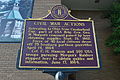 Civil War Actions marker in Booneville.jpg 6,016 × 4,000; 6.37 MB
-
 County Named 1843 historical marker.jpg 6,016 × 4,000; 7.04 MB
-
 Cow Creek Regular Baptist Church.jpg 6,016 × 4,000; 6.3 MB
-
 Elongated circle 28.svg 600 × 600; 7 KB
-
 MOYERS BUILDING.jpg 1,840 × 2,250; 400 KB
-
 Owsley County Courthouse from southwest.jpg 6,016 × 4,000; 6.46 MB
-
 Owsley County Elementary School.jpg 6,016 × 4,000; 6.3 MB
-
 Owsley County Kentucky Courthouse.jpg 2,048 × 1,536; 467 KB


