Category:Kennoway
Jump to navigation
Jump to search
village in Fife, Scotland, UK  Leven Road, Kennoway | |||||
| Upload media | |||||
| Instance of | |||||
|---|---|---|---|---|---|
| Location |
| ||||
| Population |
| ||||
| Elevation above sea level |
| ||||
 | |||||
English: Kennoway is a village in Fife, Scotland, near the larger population centres in the area of Leven and Methil. It is about three miles inland from the Firth of Forth, north of Leven. This position gave it importance in the old days while travelling by coach, for the stage road ran through Kennoway from the ferry at Pettycur, through Ceres, and on to St. Andrews.
Media in category "Kennoway"
The following 16 files are in this category, out of 16 total.
-
 Balgriebank - geograph.org.uk - 269881.jpg 640 × 480; 60 KB
-
 Devon Quarry - geograph.org.uk - 122077.jpg 640 × 480; 62 KB
-
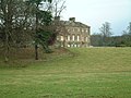 Durie House - geograph.org.uk - 111748.jpg 640 × 480; 106 KB
-
 Farmland by Duniface - geograph.org.uk - 138900.jpg 640 × 480; 305 KB
-
 Hill Road, Kennoway - geograph.org.uk - 111718.jpg 640 × 480; 76 KB
-
 Kennoway - geograph.org.uk - 3653875.jpg 640 × 480; 259 KB
-
 Lalathan - geograph.org.uk - 121678.jpg 640 × 480; 74 KB
-
 Langside Hill - geograph.org.uk - 121670.jpg 640 × 480; 62 KB
-
 Leven Road, Kennoway.jpg 640 × 480; 79 KB
-
 New roof on old walls - geograph.org.uk - 111734.jpg 640 × 480; 91 KB
-
 Newton Hall - geograph.org.uk - 152597.jpg 640 × 480; 325 KB
-
 Newton Hall farmland - geograph.org.uk - 152591.jpg 640 × 480; 364 KB
-
 North Mains - geograph.org.uk - 269868.jpg 640 × 480; 82 KB
-
 Pylons - geograph.org.uk - 269869.jpg 640 × 480; 42 KB
-
 Towards St Brendan's Well - geograph.org.uk - 269885.jpg 640 × 480; 122 KB
-
 Track to Meggie Den - geograph.org.uk - 269889.jpg 640 × 480; 138 KB


