Category:Kempston
Jump to navigation
Jump to search
town and civil parish located in Bedfordshire, England   | |||||
| Upload media | |||||
| Instance of | |||||
|---|---|---|---|---|---|
| Location | Bedford, Bedfordshire, East of England, England | ||||
| Located in or next to body of water | |||||
| Population |
| ||||
| Said to be the same as | Kempston (Wikimedia duplicated page, civil parish) | ||||
 | |||||
Deutsch: Kempston (Ausgesprochen: „Kemstun“) ist eine Stadt in der englischen Grafschaft Bedfordshire. Kempston galt einst als größtes Dorf von Großbritannien, ist jetzt jedoch eine Stadt mit eigener Verwaltung. 2001 hatte die Stadt etwa 19.000 Einwohner. Kempston bildet einen Teil der Grenze der Grafschaft. Die Stadt gilt als Studentenwohnheim für die nahe gelegenen Städte Bedford und Milton Keynes.
English: Kempston (pronounced "Kemstun") is a town in Bedfordshire, England. Once known as the largest village in England, Kempston is now a town with its own town council. It has a population of about 20,000, and together with Bedford, it forms an urban area with around 100,000 inhabitants, which is the sole urban area in the Borough of Bedford. Kempston serves principally as a dormitory town for Bedford and for Milton Keynes, which is about ten miles away.
Italiano: Kempston è una cittadina di 19.440 abitanti della contea del Bedfordshire, in Inghilterra.
Nederlands: Kempston is een plaats in het bestuurlijke gebied Bedford, in het Engelse graafschap Bedfordshire. De plaats telt 19.440 inwoners.
Norsk bokmål: Kempston er en by i Bedfordshire, England. Den ligger rett ved Bedford, og de to byene har tilsammen omkring 100 000 innbyggere av totalt omkring 150 000 i distriktet. Byen regnes som en forstad til Bedford, men det er også mange som pendler til Milton Keynes eller London.
Polski: Kempston – miasto w Wielkiej Brytanii, w Anglii, w hrabstwie Bedfordshire. Razem z Bedford tworzy konurbację liczącą 100 tys. mieszkańców, jako samodzielny ośrodek miejski liczy 19 440 mieszkańców. Miasto jest sypialnią dla położonego w pobliżu Milton Keynes.
Português: Kempston é uma cidade em Bedfordshire, Inglaterra. Outrora conhecida como "a maior aldeia da Inglaterra", Kempston é agora um cidade com sua própria câmara municipal. Possui uma população de cerca de 20.000 habitantes, e, juntamente com Bedford, forma uma área urbana com cerca de 100.000 habitantes, a qual é a única área urbana no Borough de Bedford. Kempston serve principalmente como cidade-dormitório para Bedford e para Milton Keynes, que dista cerca de dez milhas.
Română: Kempston este un oraş în comitatul Bedfordshire, regiunea East, Anglia. Oraşul se află în districtul Bedford.
Subcategories
This category has the following 4 subcategories, out of 4 total.
Media in category "Kempston"
The following 146 files are in this category, out of 146 total.
-
 A421 at Marsh Leys Junction - geograph.org.uk - 5624243.jpg 640 × 428; 72 KB
-
 Abbott Crescent at the junction of Woburn Road - geograph.org.uk - 5428738.jpg 2,048 × 1,536; 996 KB
-
 Addison Howard Park, Kempston - geograph.org.uk - 5572991.jpg 1,990 × 1,454; 1.32 MB
-
 AddisonParkTrunkBench.JPG 3,248 × 1,856; 2.73 MB
-
 Ampthill Road, Kempston - geograph.org.uk - 2714050.jpg 3,264 × 2,448; 4.91 MB
-
 Autumn colour, Bedford - geograph.org.uk - 3188056.jpg 640 × 480; 96 KB
-
 Bedford Road, Kempston - geograph.org.uk - 3188069.jpg 640 × 480; 60 KB
-
 Bedford Road, Kempston - geograph.org.uk - 5132581.jpg 3,264 × 2,448; 2.45 MB
-
 BedfordRoadLowerSchoolKempston.JPG 1,280 × 960; 1.19 MB
-
 Box End Rd, B560 - geograph.org.uk - 5005173.jpg 640 × 426; 56 KB
-
 Brighton Bound - geograph.org.uk - 689195.jpg 640 × 427; 58 KB
-
 BronzePouchMountKempston.JPG 1,328 × 1,312; 480 KB
-
 Carnell Close, Kempston - geograph.org.uk - 2292102.jpg 640 × 480; 96 KB
-
 Church Walk footpath in Kempston - geograph.org.uk - 6603835.jpg 1,024 × 768; 247 KB
-
 College Street - geograph.org.uk - 4157679.jpg 640 × 480; 70 KB
-
 College Street - geograph.org.uk - 4157684.jpg 640 × 480; 71 KB
-
 Communication Mast - geograph.org.uk - 3586332.jpg 480 × 640; 73 KB
-
 Cosmic Avenue - geograph.org.uk - 4157662.jpg 640 × 480; 99 KB
-
 Cycle path, Bedford - geograph.org.uk - 3188097.jpg 480 × 640; 63 KB
-
 Ditmas Avenue, Bedford - geograph.org.uk - 3188141.jpg 640 × 480; 59 KB
-
 Elstow Road, Kempston - geograph.org.uk - 2714046.jpg 3,264 × 2,448; 3.57 MB
-
 Embankment by the Midland Main Line - geograph.org.uk - 4741125.jpg 640 × 363; 41 KB
-
 Eugster Avenue, Kempston - geograph.org.uk - 2292084.jpg 640 × 480; 66 KB
-
 Flats on Woburn Road, Kempston - geograph.org.uk - 5428739.jpg 2,032 × 1,514; 828 KB
-
 Football pitch and bowls club - geograph.org.uk - 6004091.jpg 1,600 × 1,066; 256 KB
-
 Footbridge over the River Great Ouse - geograph.org.uk - 4982839.jpg 640 × 426; 81 KB
-
 Footpath by the pines - geograph.org.uk - 6004084.jpg 1,066 × 1,600; 395 KB
-
 Footpath to Church End - geograph.org.uk - 3676954.jpg 1,200 × 1,600; 777 KB
-
 Footpath to Kempston - geograph.org.uk - 4982809.jpg 640 × 426; 115 KB
-
 Footpath to Kempston - geograph.org.uk - 4982810.jpg 640 × 426; 125 KB
-
 Footpath to Kempston - geograph.org.uk - 4982817.jpg 640 × 426; 133 KB
-
 Glyn Hopkin on Woburn Road, Kempston - geograph.org.uk - 5428737.jpg 2,048 × 1,536; 1.48 MB
-
 Greenview Close - geograph.org.uk - 4982826.jpg 640 × 426; 69 KB
-
 Guru Nanak Gurdwara temple, Bedford - geograph.org.uk - 3188051.jpg 640 × 480; 60 KB
-
 HandAxeBedfordMuseum.JPG 2,706 × 1,513; 737 KB
-
 Hillgrounds Road - geograph.org.uk - 4281848.jpg 3,264 × 2,448; 3.86 MB
-
 Houses at The Hornbeams - geograph.org.uk - 2714030.jpg 3,264 × 2,448; 4.19 MB
-
 Houses under construction - geograph.org.uk - 5711040.jpg 640 × 480; 195 KB
-
 Houses, Kempston Mill - geograph.org.uk - 4982835.jpg 640 × 426; 117 KB
-
 Housing development on the site of Kempston Mill - geograph.org.uk - 2720745.jpg 1,600 × 1,200; 479 KB
-
 In the Ouse Valley - geograph.org.uk - 4982806.jpg 640 × 426; 105 KB
-
 Gateway to The Keep - geograph.org.uk - 527342.jpg 640 × 427; 67 KB
-
 Kempston - geograph.org.uk - 460536.jpg 640 × 480; 92 KB
-
 Kempston - geograph.org.uk - 460566.jpg 640 × 480; 87 KB
-
 Kempston Barracks - geograph.org.uk - 527339.jpg 640 × 427; 86 KB
-
 Kempston Church End.jpg 4,080 × 3,060; 8 MB
-
 Kempston Police Station - geograph.org.uk - 5570315.jpg 2,048 × 1,536; 935 KB
-
 Kempston Pool - geograph.org.uk - 4281847.jpg 3,264 × 2,448; 3.96 MB
-
 Kempston Town Council offices.jpg 3,060 × 4,080; 2.23 MB
-
 Kempston Weir - geograph.org.uk - 2009080.jpg 792 × 528; 522 KB
-
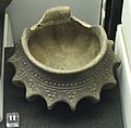
 KempstonAngloSaxonBurialUrn.JPG 1,014 × 1,142; 210 KB
-
 KempstonBarracksArms.JPG 2,848 × 2,136; 2.91 MB
-
 KempstonBarracksGardenPlaques.JPG 2,848 × 2,136; 2.87 MB
-
 KempstonDesirePath1.JPG 4,000 × 3,000; 4.44 MB
-
 KempstonFireStation.JPG 1,280 × 960; 624 KB
-
 KempstonMarina.JPG 1,280 × 960; 520 KB
-
 KempstonOuseSunset.JPG 3,264 × 2,080; 3.42 MB
-
 KempstonPool.JPG 1,280 × 960; 311 KB
-
 KempstonTownHall.JPG 1,280 × 960; 221 KB
-
 KempstonTramwayDetailFromOS84.png 578 × 564; 642 KB
-
 KemptonEVCharger.JPG 2,192 × 2,992; 3.13 MB
-
 KFC at Interchange Retail Park - geograph.org.uk - 2714130.jpg 3,264 × 2,448; 3.81 MB
-
 King Street, Kempston, Bedford - geograph.org.uk - 3188073.jpg 640 × 480; 55 KB
-
 LikelySiteOfKempstonTramwayTerminus.png 646 × 597; 694 KB
-
 Map of Kempston, Bedfordshire in 1908.JPG 500 × 314; 68 KB
-
 Market area outside Sainsbury's, Kempston - geograph.org.uk - 6377152.jpg 1,024 × 768; 151 KB
-
 Mill Lane - geograph.org.uk - 4982830.jpg 640 × 426; 94 KB
-
 Narrow lane, Kempston - geograph.org.uk - 4982823.jpg 640 × 426; 106 KB
-
 Narrow lane, Kempston - geograph.org.uk - 4982825.jpg 640 × 426; 94 KB
-

-
 New housing by the Ouse Valley Way - geograph.org.uk - 5835055.jpg 1,600 × 1,066; 413 KB
-
 New housing, Bedford - geograph.org.uk - 3188104.jpg 640 × 480; 55 KB
-
 Open space on the edge of Kempston - geograph.org.uk - 4982807.jpg 640 × 426; 75 KB
-
 Ouse Valley Way - geograph.org.uk - 4986304.jpg 640 × 426; 84 KB
-
 Parade of shops, Kempston, Bedford - geograph.org.uk - 3188065.jpg 640 × 480; 53 KB
-
 Parkside Care Home on Bedford Road - geograph.org.uk - 5572990.jpg 2,034 × 1,518; 994 KB
-
 Path by the river, Bedford - geograph.org.uk - 3188059.jpg 640 × 480; 113 KB
-
 Playground and pines - geograph.org.uk - 6004087.jpg 1,600 × 1,066; 426 KB
-
 Pledgers bakery, Kempston (51007388827).jpg 3,024 × 4,032; 4.48 MB
-
 Pylon by The Great Ouse - geograph.org.uk - 5834774.jpg 1,600 × 1,066; 339 KB
-
 River Great Ouse - geograph.org.uk - 3676957.jpg 1,600 × 1,067; 474 KB
-
 River Great Ouse - geograph.org.uk - 4597660.jpg 2,000 × 1,500; 453 KB
-
 River Great Ouse - geograph.org.uk - 4599020.jpg 2,000 × 1,500; 695 KB
-
 River Great Ouse - geograph.org.uk - 4599027.jpg 2,000 × 1,500; 414 KB
-
 River Great Ouse - geograph.org.uk - 4599037.jpg 2,000 × 1,500; 708 KB
-
 River Great Ouse - geograph.org.uk - 4982846.jpg 640 × 426; 76 KB
-
 River Great Ouse - geograph.org.uk - 4986295.jpg 640 × 426; 118 KB
-
 River Great Ouse - geograph.org.uk - 4986297.jpg 640 × 426; 129 KB
-
 River Great Ouse - geograph.org.uk - 4986300.jpg 640 × 426; 118 KB
-
 River Great Ouse - geograph.org.uk - 4986302.jpg 640 × 426; 121 KB
-
 River Great Ouse - geograph.org.uk - 5835065.jpg 1,600 × 1,066; 494 KB
-
 Riverview Way - geograph.org.uk - 4982829.jpg 640 × 335; 51 KB
-
 Roundabout on Cemetery Road, Kempston - geograph.org.uk - 5570190.jpg 2,014 × 1,490; 815 KB
-
 Roundabout on The Branston Way, Kempston - geograph.org.uk - 5428729.jpg 2,048 × 1,536; 1.49 MB
-
 Roundabout on Woburn Road, Kempston - geograph.org.uk - 5309317.jpg 2,048 × 1,536; 876 KB
-
 SaxonLoomweights.JPG 1,712 × 2,816; 1.32 MB
-
 Sculpture on Roundabout - geograph.org.uk - 1355791.jpg 427 × 640; 44 KB
-
 Sexton Avenue - geograph.org.uk - 4157651.jpg 640 × 480; 79 KB
-
 SilverBroochPlateKempston.JPG 1,328 × 1,376; 498 KB
-
 SmallLongBroochesKempston.JPG 459 × 204; 47 KB
-
 Snow in Kempston, Feb 2009.JPG 2,048 × 1,536; 857 KB
-
 Snow in Springfield Avenue, Kempston, Bedfordshire, UK, 2nd February 2009.JPG 3,296 × 2,472; 3.45 MB
-
 Sports Ground, Kempston - geograph.org.uk - 4982820.jpg 640 × 426; 78 KB
-
 Sports Ground, Kempston - geograph.org.uk - 4982821.jpg 640 × 426; 80 KB
-
 Spring Road, Bedford - geograph.org.uk - 3188062.jpg 640 × 480; 51 KB
-
 SpringfieldCopShop.JPG 1,280 × 960; 340 KB
-
 St John's Avenue, Kempston - geograph.org.uk - 5570316.jpg 2,048 × 1,536; 1.55 MB
-
 St John's Avenue, Kempston - geograph.org.uk - 5570317.jpg 2,048 × 1,536; 1.46 MB
-
 Swans on the River Great Ouse - geograph.org.uk - 4597655.jpg 2,000 × 1,500; 806 KB
-
 T K Maxx, Interchange Retail Park - geograph.org.uk - 2745946.jpg 1,024 × 681; 139 KB
-
 The Dell, Bedford - geograph.org.uk - 3188156.jpg 640 × 480; 81 KB
-
 The Half Moon Inn on High Street in Kempston - geograph.org.uk - 6603831.jpg 1,024 × 736; 185 KB
-
 The Parish Church of the Transfiguration, Kempston, Bedford.jpg 3,648 × 2,736; 3.83 MB
-
 The Saxon Centre, Kempston - geograph.org.uk - 5132572.jpg 3,264 × 2,448; 1.9 MB
-
 The Spinney (51006575333).jpg 3,024 × 4,032; 7.29 MB
-
 TheWellingtonKempston.JPG 3,264 × 2,448; 3.55 MB
-
 VegetableShelfMistGenerator.JPG 3,264 × 2,448; 3.59 MB
-
 Wakeboarder - Box End Water Park November 2009 (4087508562).jpg 2,048 × 1,365; 3.44 MB
-
 Wakeboarding - Box End Park September 2009 (3915961337).jpg 2,048 × 1,365; 463 KB
-
 Wakeboarding - Box End Park September 2009 (3916743728).jpg 2,048 × 1,365; 456 KB
-
 Wakeboarding - Box End Park September 2009 (3916744568).jpg 2,048 × 1,365; 438 KB
-
 Wakeboarding - Box End Park September 2009 (3916745528).jpg 2,048 × 1,365; 611 KB
-
 Wakeboarding - Box End Park September 2009 (3916747472).jpg 2,048 × 1,365; 502 KB
-
 Wakeboarding - Box End Park September 2009 (3936074317).jpg 2,048 × 1,366; 492 KB
-
 Wakeboarding - Box End Park September 2009 (3936854134).jpg 2,048 × 1,366; 397 KB
-
 Wakeboarding - Box End Park September 2009 (3936855218).jpg 2,048 × 1,366; 537 KB
-
 Wakeboarding - Box End Park September 2009 (3936855654).jpg 2,048 × 1,366; 636 KB
-
 Wakeboarding - Box End Water Park, Kempston (4398640897).jpg 2,048 × 1,366; 494 KB
-
 Wakeboarding - Box End Water Park, Kempston (4398641463).jpg 2,048 × 1,366; 489 KB
-
 Wakeboarding - Box End Water Park, Kempston (4399407238).jpg 2,048 × 1,366; 512 KB
-
 Wenlock Road, Bedford - geograph.org.uk - 3188088.jpg 640 × 480; 61 KB
-
 White Van on the A421 - geograph.org.uk - 551697.jpg 640 × 480; 76 KB
-
 WindowUrnKempston.JPG 1,936 × 1,904; 1.02 MB
-
 Wyatt Road, Bedford - geograph.org.uk - 3188076.jpg 640 × 480; 50 KB
-
 Field at Kempston - geograph.org.uk - 551694.jpg 640 × 480; 72 KB
-
 Interchange Retail Park - geograph.org.uk - 549857.jpg 640 × 480; 67 KB
-
 Interchange Retail Park, Kempston - geograph.org.uk - 549852.jpg 640 × 480; 104 KB
-
 Interchange Retail Park, Kempston - geograph.org.uk - 551691.jpg 640 × 480; 68 KB
-
 Kempston High Street - geograph.org.uk - 406452.jpg 640 × 480; 79 KB
-
 Kempston House - geograph.org.uk - 363318.jpg 640 × 480; 116 KB
-
 Kempston Swimming Pool - geograph.org.uk - 527333.jpg 640 × 427; 65 KB
-
 Playing Fields - geograph.org.uk - 460558.jpg 640 × 480; 68 KB
-
 Pond on scrubland - geograph.org.uk - 549874.jpg 640 × 480; 65 KB
-

-
 Top marks for the planners - geograph.org.uk - 407393.jpg 640 × 512; 113 KB
-
 Vicarage Farm - geograph.org.uk - 460528.jpg 640 × 480; 128 KB


.jpg)


.jpg)


.jpg)
.jpg)
.jpg)
.jpg)
.jpg)
.jpg)
.jpg)
.jpg)
.jpg)
.jpg)
.jpg)
.jpg)
.jpg)


