Category:Kemnay
Jump to navigation
Jump to search
town in Aberdeenshire, Scotland, UK  | |||||
| Upload media | |||||
| Instance of | |||||
|---|---|---|---|---|---|
| Location |
| ||||
| Population |
| ||||
| Different from | |||||
 | |||||
Subcategories
This category has the following 2 subcategories, out of 2 total.
F
- Fetternear Palace (13 F)
W
- Kemnay War Memorial (3 F)
Media in category "Kemnay"
The following 63 files are in this category, out of 63 total.
-
 "Splitting the winds" at Gallows Hill - geograph.org.uk - 1093761.jpg 640 × 480; 103 KB
-
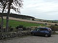
 A car dealership outside Kemnay - geograph.org.uk - 21141.jpg 640 × 358; 82 KB
-
 Abandoned farm buildings - geograph.org.uk - 502982.jpg 640 × 401; 91 KB
-
 Bristow Cottage - geograph.org.uk - 458283.jpg 640 × 480; 143 KB
-
 Farmland in the Don Valley - geograph.org.uk - 11508.jpg 640 × 480; 86 KB
-
 Farmland near West Aquhorthies - geograph.org.uk - 11507.jpg 640 × 480; 103 KB
-
 Fetternear - Burnhervie Footpath - geograph.org.uk - 163616.jpg 640 × 440; 157 KB
-
 Fetternear Fruit Farm - geograph.org.uk - 1093782.jpg 640 × 480; 53 KB
-
 Fetternear House and Bishop's Palace - geograph.org.uk - 163612.jpg 428 × 640; 147 KB
-
 Graveyard of Fetternear chapel. - geograph.org.uk - 142045.jpg 640 × 432; 134 KB
-
 Kemnay abdnshire.jpg 1,408 × 841; 222 KB
-
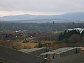
 Kemnay Aberdeenshire cropped.jpg 2,448 × 2,004; 1.51 MB
-
 Kemnay Aberdeenshire.jpg 2,448 × 3,264; 2.85 MB
-
 Mediaeval Tourney at Castle Fraser - geograph.org.uk - 254581.jpg 640 × 480; 123 KB
-
 Road sign to Castle Fraser - geograph.org.uk - 458254.jpg 640 × 480; 130 KB
-
 The road to Kemnay - geograph.org.uk - 11504.jpg 640 × 480; 158 KB
-
 West entrance to Castle Fraser - geograph.org.uk - 458257.jpg 640 × 480; 127 KB
-
 A copse between Greenburn and Achath - geograph.org.uk - 458281.jpg 640 × 480; 116 KB
-
 A roadside cottage - geograph.org.uk - 458289.jpg 640 × 499; 64 KB
-
 Aberdeenshire Farming Country - geograph.org.uk - 613497.jpg 640 × 480; 84 KB
-
 Access road to West Mains - geograph.org.uk - 458272.jpg 640 × 453; 114 KB
-
 Access to Achath farm - geograph.org.uk - 458279.jpg 640 × 480; 138 KB
-
 Access to Glack farm - geograph.org.uk - 458278.jpg 640 × 480; 151 KB
-

-
 Backhill - geograph.org.uk - 458256.jpg 640 × 477; 81 KB
-
 Backhill of Glack - geograph.org.uk - 458286.jpg 640 × 480; 82 KB
-
 Balgorkar Stone Circle and Outliers - geograph.org.uk - 613479.jpg 640 × 480; 80 KB
-
 Bankhead Pool, River Don at Kemnay. - geograph.org.uk - 163607.jpg 427 × 640; 141 KB
-
 Bremner Way - geograph.org.uk - 347080.jpg 640 × 480; 62 KB
-
 Burnhervie Suspension Bridge - geograph.org.uk - 342629.jpg 640 × 480; 148 KB
-
 Burnhervie-Chapel of Garioch road - geograph.org.uk - 503001.jpg 640 × 426; 81 KB
-
-
 Church at Blairdaff - geograph.org.uk - 11468.jpg 640 × 385; 129 KB
-
 Cot Town trig - geograph.org.uk - 124869.jpg 640 × 480; 91 KB
-

-
 Duckpond at Greenmoss Farm - geograph.org.uk - 613491.jpg 640 × 480; 72 KB
-
 Entrance to Courtcairn farm - geograph.org.uk - 458274.jpg 640 × 480; 138 KB
-
 Farm Access - geograph.org.uk - 502953.jpg 640 × 426; 113 KB
-
 Gallows Hill Wood - geograph.org.uk - 642612.jpg 640 × 480; 100 KB
-
 Hill of Corskie cottage - geograph.org.uk - 458290.jpg 640 × 418; 54 KB
-
 House at Upper Coulee - geograph.org.uk - 28868.jpg 640 × 480; 120 KB
-
 Junction of B993 and B994 - geograph.org.uk - 648589.jpg 640 × 480; 62 KB
-
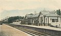
 Kemnay Academy - geograph.org.uk - 21153.jpg 640 × 325; 69 KB
-
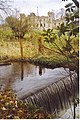
 Kemnay Bridge - geograph.org.uk - 163598.jpg 640 × 439; 134 KB
-
 Kemnay Quarry - geograph.org.uk - 504656.jpg 640 × 360; 255 KB
-
 Milton farm - geograph.org.uk - 44498.jpg 640 × 426; 97 KB
-
 Minor road near Burnhervie - geograph.org.uk - 617652.jpg 640 × 480; 126 KB
-
 Remains of an old mill, by Burnhervie - geograph.org.uk - 502977.jpg 640 × 426; 99 KB
-
 River Don - geograph.org.uk - 613440.jpg 640 × 480; 90 KB
-
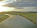 River Don - geograph.org.uk - 85512.jpg 640 × 480; 114 KB
-
 River Don from Kemnay bridge - geograph.org.uk - 536628.jpg 640 × 480; 147 KB
-
-

-
 Road from Castle Fraser - geograph.org.uk - 458250.jpg 640 × 480; 110 KB
-
 Road from Inverurie to Burnhervie - geograph.org.uk - 502940.jpg 640 × 426; 133 KB
-
 South Lodge, Castle Fraser - geograph.org.uk - 458275.jpg 640 × 480; 124 KB
-

-
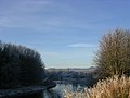
 The River Don at Kemnay - geograph.org.uk - 21135.jpg 640 × 480; 69 KB
-
 The track leading to Mellanbrae - geograph.org.uk - 613435.jpg 640 × 480; 81 KB
-

-
 West Lodge, Castle Fraser - geograph.org.uk - 458271.jpg 640 × 459; 77 KB
-
 Wikes Cottage - geograph.org.uk - 458291.jpg 640 × 480; 79 KB
-
 Wilmore Cottage - geograph.org.uk - 458287.jpg 640 × 480; 152 KB


