Category:Kellereigebäude und Hexenturm (Hofheim am Taunus)
Jump to navigation
Jump to search
| Object location | | View all coordinates using: OpenStreetMap |
|---|
Cultural heritage monument in Hofheim am Taunus, Hesse, Germany  | |||||
| Upload media | |||||
| Instance of | |||||
|---|---|---|---|---|---|
| Location | Hofheim am Taunus, Main-Taunus-Kreis, Darmstadt Government Region, Hesse, Germany | ||||
| Street address |
| ||||
| Heritage designation | |||||
 | |||||
This is the category of the Hessian Kulturdenkmal (cultural monument) with the ID 46043 (Wikidata)
|
Media in category "Kellereigebäude und Hexenturm (Hofheim am Taunus)"
The following 5 files are in this category, out of 5 total.
-
 Hexenturm Hofheim am Taunus.jpg 2,848 × 4,288; 6.4 MB
-
 Hexenturm Hofheim Gedenktafel.jpg 2,145 × 2,645; 3.96 MB
-
 Hofheim, Kellereigebäude, Rückseite.jpg 6,208 × 3,592; 18.75 MB
-
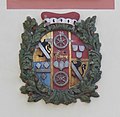 Hofheim, Kellereigebäude, Wappen über der Tür.JPG 1,224 × 1,192; 618 KB
-
 Hofheim, Kellereigebäude.JPG 4,608 × 3,456; 4.11 MB


