Category:Keizersgracht 622, Amsterdam
Jump to navigation
Jump to search
| Object location | | View all coordinates using: OpenStreetMap |
|---|
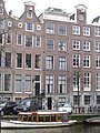
building in Amsterdam, Netherlands .JPG) | |||||
| Upload media | |||||
| Instance of | |||||
|---|---|---|---|---|---|
| Location | Amsterdam, North Holland, Netherlands | ||||
| Street address |
| ||||
| Located on street | |||||
| Heritage designation |
| ||||
 | |||||
|
This is a category about rijksmonument number 2678
|
| Address |
|
Media in category "Keizersgracht 622, Amsterdam"
The following 8 files are in this category, out of 8 total.
-
 Amsterdam - Keizersgracht 622 en 620.JPG 3,056 × 4,592; 5.37 MB
-
 Amsterdam - Keizersgracht 624.JPG 3,056 × 4,592; 5.07 MB
-
 Keizersgracht 620 (rechts).JPG 1,944 × 2,592; 757 KB
-
 Keizersgracht 622 (links).JPG 1,944 × 2,592; 762 KB
-
 Keizersgracht 624 (links).JPG 1,944 × 2,592; 721 KB
-
 Keizersgracht 626 (links).JPG 1,944 × 2,592; 747 KB
-
 Overzicht - Amsterdam - 20018221 - RCE.jpg 957 × 1,200; 262 KB
-
 Voorgevels - Amsterdam - 20018224 - RCE.jpg 808 × 1,200; 198 KB


.JPG)
.JPG)
.JPG)

