Category:Keizersgracht 608, Amsterdam
Jump to navigation
Jump to search
| Object location | | View all coordinates using: OpenStreetMap |
|---|
 | |||||
| Upload media | |||||
| Instance of |
| ||||
|---|---|---|---|---|---|
| Location | Amsterdam, North Holland, Netherlands | ||||
| Street address |
| ||||
| Located on street | |||||
| Heritage designation |
| ||||
 | |||||
|
This is a category about rijksmonument number 2671
|
| Address |
|
Media in category "Keizersgracht 608, Amsterdam"
The following 22 files are in this category, out of 22 total.
-
 Amsterdam - Keizersgracht 606.JPG 3,056 × 4,592; 4.56 MB
-
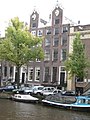
 Amsterdam - Keizersgracht 608.JPG 3,056 × 4,592; 4.89 MB
-

-

-
 INTERIEUR, ACHTERKAMER, ZOGENAAMD WITJE BOVEN DEUR - Amsterdam - 20280729 - RCE.jpg 1,200 × 1,195; 268 KB
-
 INTERIEUR, ACHTERKAMER, ZOGENAAMD WITJE BOVEN DEUR - Amsterdam - 20280730 - RCE.jpg 1,187 × 1,200; 283 KB
-

-
 INTERIEUR, OVERZICHT GANG - Amsterdam - 20280725 - RCE.jpg 952 × 1,200; 203 KB
-
 Keizersgracht 608-610.JPG 1,944 × 2,592; 788 KB
-
 Overzicht - Amsterdam - 20018221 - RCE.jpg 957 × 1,200; 262 KB
-
 Pand Keizersgracht, J.B. Polak (kop), Bestanddeelnr 918-9682.jpg 2,608 × 2,591; 1.14 MB
-
 Pand Keizersgracht, J.B. Polak (kop), Bestanddeelnr 918-9683.jpg 2,608 × 2,591; 1.1 MB
-
 Pand Keizersgracht, J.H. Jansen (kop), Bestanddeelnr 918-9680.jpg 2,608 × 2,591; 1.11 MB
-
 Pand Keizersgracht, J.H. Jansen (kop), Bestanddeelnr 918-9681.jpg 2,608 × 2,591; 1.09 MB
-
 Pand Keizersgracht, Polak en Van Gennep , opdracht Fries Koerier, Bestanddeelnr 918-9674.jpg 2,608 × 2,591; 1.41 MB
-

-
 Pand Keizersgracht, R.O. van Gennep (kop), Bestanddeelnr 918-9678.jpg 2,608 × 2,591; 1.2 MB
-
 Pand Keizersgracht, R.O. van Gennep (kop), Bestanddeelnr 918-9679.jpg 2,608 × 2,591; 1.25 MB
-
 Pand Keizersgracht, v.l.n.r. Jansen, Polak en Van Gennep, Bestanddeelnr 918-9676.jpg 2,608 × 2,591; 1.19 MB
-
 Pand Keizersgracht, v.l.n.r. Jansen, Polak en Van Gennep, Bestanddeelnr 918-9677.jpg 2,608 × 2,591; 1.24 MB
-
 Stadsarchief Amsterdam, Afb 012000007713.jpg 2,040 × 2,763; 705 KB
-
 Stadsarchief Amsterdam, Afb 012000007715.jpg 2,122 × 2,748; 905 KB


_-_Amsterdam_-_20280727_-_RCE.jpg)


,_Bestanddeelnr_918-9682.jpg)
,_Bestanddeelnr_918-9683.jpg)
,_Bestanddeelnr_918-9680.jpg)
,_Bestanddeelnr_918-9681.jpg)


,_Bestanddeelnr_918-9678.jpg)
,_Bestanddeelnr_918-9679.jpg)


