Category:Keizersgracht 399, Amsterdam
Jump to navigation
Jump to search
| Object location | | View all coordinates using: OpenStreetMap |
|---|
 | |||||
| Upload media | |||||
| Instance of |
| ||||
|---|---|---|---|---|---|
| Location | Amsterdam, North Holland, Netherlands | ||||
| Street address |
| ||||
| Located on street | |||||
| Heritage designation |
| ||||
 | |||||
|
This is a category about rijksmonument number 2337
|
| Address |
|
Media in category "Keizersgracht 399, Amsterdam"
The following 30 files are in this category, out of 30 total.
-
 Amsterdam - Keizersgracht 397.JPG 3,056 × 4,592; 4.43 MB
-
 Amsterdam - Keizersgracht 399.JPG 3,056 × 4,592; 4.85 MB
-
 Amsterdam 4001 08.jpg 5,472 × 3,648; 6.91 MB
-
 Int. begane grond, gang - Amsterdam - 20320459 - RCE.jpg 1,190 × 1,200; 176 KB
-
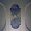
 Int. begane grond, gang, beschilderd luik - Amsterdam - 20320458 - RCE.jpg 1,200 × 1,200; 206 KB
-
 Int. begane grond, gang, beschilderd luik - Amsterdam - 20320469 - RCE.jpg 1,196 × 1,200; 145 KB
-
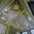
 Int. begane grond, gang, plafondschildering - Amsterdam - 20320460 - RCE.jpg 1,183 × 1,200; 236 KB
-
 Int. begane grond, gang, plafondschildering - Amsterdam - 20320461 - RCE.jpg 1,173 × 1,200; 208 KB
-
 Int. begane grond, gang, plafondschildering - Amsterdam - 20320462 - RCE.jpg 1,190 × 1,200; 181 KB
-
 Int. begane grond, gang, plafondschildering - Amsterdam - 20320467 - RCE.jpg 1,193 × 1,200; 170 KB
-
 Int. begane grond, gang, plafondschildering - Amsterdam - 20320471 - RCE.jpg 1,195 × 1,200; 217 KB
-
 Int. begane grond, gang, plafondschildering - Amsterdam - 20320472 - RCE.jpg 1,196 × 1,200; 182 KB
-

-
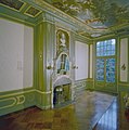
 Int. bel-etage, grote zaal, schouwpartij - Amsterdam - 20320453 - RCE.jpg 1,185 × 1,200; 278 KB
-
 Int. bel-etage, grote zaal, schouwpartij - Amsterdam - 20320466 - RCE.jpg 1,194 × 1,200; 221 KB
-
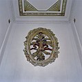
 Int. hal, ornament - Amsterdam - 20320463 - RCE.jpg 1,190 × 1,200; 247 KB
-
 Int. hal, ornament - Amsterdam - 20320464 - RCE.jpg 1,194 × 1,200; 230 KB
-
 Int. hal, plafond - Amsterdam - 20320470 - RCE.jpg 1,196 × 1,200; 155 KB
-
 Int. trap - Amsterdam - 20320455 - RCE.jpg 1,188 × 1,200; 195 KB
-
 Int. trap - Amsterdam - 20320457 - RCE.jpg 1,190 × 1,200; 202 KB
-
 Int. trap, detail - Amsterdam - 20320456 - RCE.jpg 1,188 × 1,200; 207 KB
-
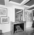 Int. tuinkamer ( onder de grote zaal), schouwpartij - Amsterdam - 20320454 - RCE.jpg 1,186 × 1,200; 227 KB
-
 Interieur, begane grond, gang - Amsterdam - 20320468 - RCE.jpg 1,194 × 1,200; 136 KB
-
-
 Kenau Simonsdr Hasselaar.jpg 1,960 × 2,500; 1.46 MB
-
 ParamountAmsterdam.jpg 2,117 × 2,754; 835 KB
-
 Stadsarchief Amsterdam, Afb 012000007772.jpg 2,098 × 2,826; 1.09 MB
-
 Stadsarchief Amsterdam, Afb 012000007778.jpg 1,008 × 1,392; 286 KB
-
 Voorgevel - Amsterdam - 20018161 - RCE.jpg 1,200 × 1,179; 404 KB
-
 Wikimedia-nl-hackathon-november-2012-01.JPG 3,168 × 4,752; 5.89 MB


,_schouwpartij_-_Amsterdam_-_20320454_-_RCE.jpg)


