Category:Keevil
Jump to navigation
Jump to search
village in the United Kingdom  | |||||
| Upload media | |||||
| Instance of | |||||
|---|---|---|---|---|---|
| Location | Wiltshire, South West England, England | ||||
| official website | |||||
 | |||||
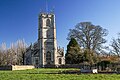
English: Keevil is a small village and a civil parish in Wiltshire, England. The village has approximately 400 inhabitants; its population has remained fairly steady since 1800. A small spike its population was post World War 2 when the barracks of RAF Keevil were used as a temporary home for Polish refugees. Nowadays the small Ministry of Defence airfield located nearby (RAF Keevil) is used for gliding at weekends.
Nederlands: Keevil is een dorp (village) en civil parish in de unitary authority Wiltshire, in het Engelse graafschap Wiltshire. De civil parish telt
Subcategories
This category has the following 4 subcategories, out of 4 total.
Media in category "Keevil"
The following 200 files are in this category, out of 205 total.
(previous page) (next page)-
 2010 , A timely warning on the lane from Hurst Farms - geograph.org.uk - 2059488.jpg 1,600 × 1,067; 644 KB
-

-
 2010 , Choice on a bridleway - geograph.org.uk - 1970733.jpg 800 × 482; 122 KB
-

-
 2010 , Herd near Hurst Farms - geograph.org.uk - 2060714.jpg 3,878 × 2,718; 3.62 MB
-
 2010 , Lane to Hurst Farms - geograph.org.uk - 2059474.jpg 800 × 482; 118 KB
-

-
 2010 , Private road to New Hurst Farm - geograph.org.uk - 2060731.jpg 800 × 533; 165 KB
-

-
 A gate on the way - geograph.org.uk - 5607885.jpg 4,320 × 3,240; 4.82 MB
-
 Across the field - geograph.org.uk - 5605908.jpg 4,320 × 3,240; 3.06 MB
-
 Across the field - geograph.org.uk - 5607886.jpg 4,320 × 3,240; 4.46 MB
-
 Across the field - geograph.org.uk - 5608256.jpg 4,320 × 3,240; 4.11 MB
-
 At the end of Martins Road, Keevil - geograph.org.uk - 1077610.jpg 640 × 497; 230 KB
-
 Barley beside the path - geograph.org.uk - 3567907.jpg 1,920 × 1,080; 1.94 MB
-
 Becoming overgrown - geograph.org.uk - 5606731.jpg 4,320 × 3,240; 4.45 MB
-
 Bridleway at Ashton Mill Farm - geograph.org.uk - 201138.jpg 640 × 480; 85 KB
-
 Bridleway meets the road - geograph.org.uk - 5606769.jpg 4,320 × 3,240; 4.21 MB
-
 Bridleway to Bulkington (1) - geograph.org.uk - 5605932.jpg 4,320 × 3,240; 5.25 MB
-
 Bridleway to Bulkington (2) - geograph.org.uk - 5605936.jpg 4,320 × 3,240; 4.18 MB
-
 Butts Lane near Keevil - geograph.org.uk - 1077581.jpg 640 × 516; 255 KB
-
 Byway near Keevil - geograph.org.uk - 1437598.jpg 480 × 640; 157 KB
-
 Byway through the trees - geograph.org.uk - 3567909.jpg 850 × 1,280; 1.85 MB
-
 Byway to Steeple Ashton - geograph.org.uk - 1073199.jpg 640 × 502; 266 KB
-
 Change fields - geograph.org.uk - 5604950.jpg 4,320 × 3,240; 5.24 MB
-
 Change sides - geograph.org.uk - 5605925.jpg 4,320 × 3,240; 4.71 MB
-
-
 Cyclist on Main Street, Keevil - geograph.org.uk - 1604010.jpg 640 × 496; 207 KB
-
 East on Main Street, Keevil - geograph.org.uk - 1617147.jpg 640 × 480; 189 KB
-

-
 End of the byway - geograph.org.uk - 5604946.jpg 4,320 × 3,240; 6.45 MB
-
 Farm buildings - geograph.org.uk - 5604951.jpg 4,320 × 3,240; 4.86 MB
-
 Farm outbuilding - geograph.org.uk - 5608822.jpg 4,320 × 3,240; 4.18 MB
-
 Fenced bridleway - geograph.org.uk - 5608115.jpg 4,320 × 3,240; 4.35 MB
-
 Field and barn by Trowbridge Road - geograph.org.uk - 3622984.jpg 640 × 427; 52 KB
-
 Field near Great Hinton - geograph.org.uk - 2128214.jpg 1,024 × 768; 265 KB
-
 Field near Pinkney Farm - geograph.org.uk - 3622985.jpg 640 × 427; 63 KB
-
-
 Footpath and field - geograph.org.uk - 4026622.jpg 1,280 × 853; 851 KB
-
 Footpath crosses road - geograph.org.uk - 5608837.jpg 4,320 × 3,240; 2.28 MB
-
 Footpath meets byway - geograph.org.uk - 5604945.jpg 4,320 × 3,240; 4.84 MB
-
 Footpath not reinstated (1) - geograph.org.uk - 5605893.jpg 4,320 × 3,240; 4.12 MB
-
 Footpath not reinstated (2) - geograph.org.uk - 5605894.jpg 4,320 × 3,240; 2.71 MB
-
 Footpath through the barley - geograph.org.uk - 3567906.jpg 1,271 × 1,919; 2.32 MB
-
 Footpath to Keevil - geograph.org.uk - 5608804.jpg 4,320 × 3,240; 3.68 MB
-
 Former chapel and school (geograph 5608845).jpg 4,320 × 3,240; 3.86 MB
-
 Four ways to go (1) - geograph.org.uk - 5605915.jpg 4,320 × 3,240; 3.31 MB
-
 Four ways to go (2) - geograph.org.uk - 5605917.jpg 4,320 × 3,240; 4.5 MB
-
 Four ways to go (3) - geograph.org.uk - 5605918.jpg 4,320 × 3,240; 4.89 MB
-
 Four ways to go (3) - geograph.org.uk - 5606756.jpg 4,320 × 3,240; 3.92 MB
-
 Four ways to go (4) - geograph.org.uk - 5605919.jpg 4,320 × 3,240; 5.08 MB
-
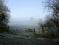
 Frost and mist come to Keevil. - geograph.org.uk - 1073210.jpg 640 × 478; 170 KB
-
 Frosty field seen from the A361 - geograph.org.uk - 1612960.jpg 640 × 513; 172 KB
-

-
 Gate and stile near Keevil - geograph.org.uk - 1077587.jpg 640 × 489; 195 KB
-
 Gently flows the stream - geograph.org.uk - 5604957.jpg 4,320 × 3,240; 4.59 MB
-
 Good morning girls - geograph.org.uk - 5604960.jpg 4,320 × 3,240; 2.74 MB
-
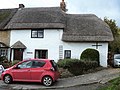
 In Keevil Village - geograph.org.uk - 86580.jpg 640 × 480; 87 KB
-
 Inside St Leonard, Keevil (i) - geograph.org.uk - 5710083.jpg 453 × 640; 39 KB
-
 Inside St Leonard, Keevil (ii) - geograph.org.uk - 5710084.jpg 480 × 640; 50 KB
-
 Inside St Leonard, Keevil (iii) - geograph.org.uk - 5710086.jpg 480 × 640; 56 KB
-
 Inside St Leonard, Keevil (iv) - geograph.org.uk - 5710087.jpg 480 × 640; 40 KB
-
 Inside St Leonard, Keevil (v) - geograph.org.uk - 5710098.jpg 640 × 480; 56 KB
-
 Into Keevil from the east - geograph.org.uk - 1617152.jpg 640 × 496; 206 KB
-
 Junction of the lane to Keevil Airfield - geograph.org.uk - 1232932.jpg 640 × 513; 180 KB
-

-
 Keevil Airfield (1) - geograph.org.uk - 5604948.jpg 4,320 × 3,240; 2.56 MB
-
 Keevil Airfield (2) - geograph.org.uk - 5604949.jpg 4,320 × 3,240; 2.36 MB
-
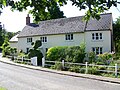
 Keevil houses (13) (geograph 5608853).jpg 3,854 × 2,891; 3.33 MB
-
 Keevil houses (15) - geograph.org.uk - 5608872.jpg 4,320 × 3,240; 3.03 MB
-
 Keevil houses (5) (geograph 5603172).jpg 4,320 × 3,240; 3.66 MB
-
 Keevil houses (7) - geograph.org.uk - 5604938.jpg 4,320 × 3,240; 3.12 MB
-
 Keevil houses (8) (geograph 5604939).jpg 4,320 × 3,240; 4.3 MB
-
 Keevil housess (geograph 5603163).jpg 4,320 × 3,240; 4.36 MB
-
 Keevil housess (geograph 5603164).jpg 4,224 × 3,167; 2.76 MB
-
 Keevil housess (geograph 5603167).jpg 4,320 × 3,240; 3.76 MB
-
 Keevil housess (geograph 5603169).jpg 4,320 × 3,240; 3.54 MB
-
 Keevil housess (geograph 5604937).jpg 4,320 × 3,240; 4.31 MB
-
 Keevil housess (geograph 5608830).jpg 4,320 × 3,240; 3.94 MB
-
 Keevil housess (geograph 5608833).jpg 4,320 × 3,240; 3.68 MB
-
 Keevil housess (geograph 5608835).jpg 4,320 × 3,240; 3.95 MB
-
 Keevil housess (geograph 5608842).jpg 4,320 × 3,240; 3.43 MB
-
 Keevil housess (geograph 5608871).jpg 4,320 × 3,240; 2.79 MB
-
 Keevil Wick Farm in winter - geograph.org.uk - 1073222.jpg 640 × 515; 155 KB
-
 Lane past Pinkney Farm - geograph.org.uk - 1073231.jpg 640 × 521; 179 KB
-
 Lane to Seend Park Farm with cyclist - geograph.org.uk - 1612957.jpg 640 × 481; 160 KB
-
 Little used - geograph.org.uk - 5604961.jpg 4,320 × 3,240; 2.88 MB
-
 Longleaze Farm - geograph.org.uk - 5608869.jpg 4,219 × 3,165; 2.7 MB
-
 Longleaze Farmhouse (1) - geograph.org.uk - 5608866.jpg 4,071 × 3,053; 2.53 MB
-
 Longleaze Farmhouse (2) - geograph.org.uk - 5608867.jpg 4,320 × 3,240; 3.84 MB
-
 Main Street Great Hinton looking towards Trowbridge Road - geograph.org.uk - 5083954.jpg 2,048 × 1,536; 1.51 MB
-
 Main Street leading to Great Hinton - geograph.org.uk - 5083953.jpg 2,048 × 1,536; 1.56 MB
-
 Main Street, Keevil - geograph.org.uk - 723811.jpg 640 × 480; 95 KB
-
 Manor Farm - geograph.org.uk - 5607888.jpg 4,320 × 3,240; 3.43 MB
-
 Martins Lane (1) - geograph.org.uk - 5604940.jpg 4,320 × 3,240; 5.47 MB
-
 Martins Lane (2) - geograph.org.uk - 5604943.jpg 4,320 × 3,240; 4.82 MB
-
 Martins Lane (3) - geograph.org.uk - 5604944.jpg 4,113 × 3,084; 5.41 MB
-
 Minor road into Keevil - geograph.org.uk - 1617082.jpg 640 × 503; 203 KB
-
 Minor road leading to Keevil - geograph.org.uk - 4026633.jpg 1,280 × 1,920; 1.95 MB
-
 Muddy way - geograph.org.uk - 5604952.jpg 4,320 × 3,240; 5.21 MB
-
 No one told the cow - geograph.org.uk - 5604954.jpg 4,219 × 3,165; 2.51 MB
-
 No through way - geograph.org.uk - 5605896.jpg 4,219 × 3,165; 3.65 MB
-
 Not this way - geograph.org.uk - 5604959.jpg 4,320 × 3,240; 3.71 MB
-
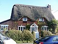
 Old Cobblers Cottage, Keevil - geograph.org.uk - 1437614.jpg 640 × 480; 173 KB
-
 Oliver's Castle from near Keevil Airfield - geograph.org.uk - 5604956.jpg 4,320 × 3,240; 3.66 MB
-
 On Main Street, Keevil - geograph.org.uk - 1614908.jpg 640 × 488; 227 KB
-
 One man and his dog - geograph.org.uk - 1617103.jpg 640 × 504; 180 KB
-
 Ordnance Survey Cut Mark - geograph.org.uk - 2822897.jpg 4,000 × 3,000; 4.19 MB
-
 Over the brook - geograph.org.uk - 5607889.jpg 4,320 × 3,240; 4.31 MB
-
 Over the ditch - geograph.org.uk - 5608253.jpg 4,320 × 3,240; 4.36 MB
-
 Over the stream - geograph.org.uk - 5606739.jpg 4,320 × 3,240; 3.44 MB
-
 Over the stream - geograph.org.uk - 5606771.jpg 4,320 × 3,240; 4.81 MB
-
 Oxen Leaze Farm (1) - geograph.org.uk - 5606733.jpg 3,971 × 2,978; 1.94 MB
-
 Oxen Leaze Farm (2) - geograph.org.uk - 5606735.jpg 4,320 × 3,240; 3.08 MB
-
 Parachutists near Seend Cleeve - geograph.org.uk - 2111242.jpg 640 × 388; 139 KB
-
 Pasture at the end of Butts Lane - geograph.org.uk - 1077591.jpg 640 × 527; 206 KB
-
 Path meet the road - geograph.org.uk - 5608802.jpg 4,320 × 3,240; 3.62 MB
-
 Pumping Station - geograph.org.uk - 5608828.jpg 4,320 × 3,240; 4.53 MB
-
 RAF Keevil - geograph.org.uk - 5608870.jpg 2,923 × 2,192; 2.23 MB
-
 Rush hour in Keevil - geograph.org.uk - 5703204.jpg 640 × 480; 88 KB
-
 Semington Brook and Seend Head - geograph.org.uk - 2813814.jpg 1,920 × 1,280; 1.2 MB
-
 Silver Jubilee Commemoration Plaque - geograph.org.uk - 1617117.jpg 640 × 477; 230 KB
-
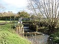 Sluice on Semington Brook (1) - geograph.org.uk - 5607881.jpg 4,320 × 3,240; 5.14 MB
-
 Sluice on Semington Brook (2) - geograph.org.uk - 5607882.jpg 4,320 × 3,240; 4 MB
-
 Sluice on Semington Brook (3) - geograph.org.uk - 5607883.jpg 3,240 × 4,320; 3.27 MB
-
 Sluice on Semington Brook (4) - geograph.org.uk - 5607884.jpg 4,320 × 3,240; 3.72 MB
-
 St Leonard, Keevil, altar - geograph.org.uk - 5710076.jpg 640 × 480; 66 KB
-
 St Leonard, Keevil, churchyard (a) - geograph.org.uk - 5703205.jpg 640 × 480; 52 KB
-
 St Leonard, Keevil, churchyard (b) - geograph.org.uk - 5709459.jpg 640 × 480; 56 KB
-
 St Leonard, Keevil, churchyard (c) - geograph.org.uk - 5709460.jpg 640 × 480; 67 KB
-
 St Leonard, Keevil, churchyard (d) - geograph.org.uk - 5709461.jpg 640 × 480; 90 KB
-
 St Leonard, Keevil, font - geograph.org.uk - 5709465.jpg 640 × 480; 75 KB
-
 St Leonard, Keevil, incumbency board - geograph.org.uk - 5710073.jpg 480 × 640; 67 KB
-
 St Leonard, Keevil, memorial (a) - geograph.org.uk - 5709466.jpg 640 × 480; 62 KB
-
 St Leonard, Keevil, memorial (b) - geograph.org.uk - 5709467.jpg 480 × 640; 44 KB
-
 St Leonard, Keevil, memorial (c) - geograph.org.uk - 5709468.jpg 640 × 453; 51 KB
-
 St Leonard, Keevil, memorial (d) - geograph.org.uk - 5709469.jpg 480 × 640; 43 KB
-
 St Leonard, Keevil, memorial (e) - geograph.org.uk - 5709470.jpg 480 × 640; 37 KB
-
 St Leonard, Keevil, memorial (f) - geograph.org.uk - 5709471.jpg 480 × 640; 43 KB
-
 St Leonard, Keevil, memorial (g) - geograph.org.uk - 5709472.jpg 480 × 640; 39 KB
-
 St Leonard, Keevil, memorial (h) - geograph.org.uk - 5709475.jpg 480 × 640; 54 KB
-
 St Leonard, Keevil, memorial (i) - geograph.org.uk - 5709477.jpg 452 × 640; 72 KB
-
 St Leonard, Keevil, memorial (j) - geograph.org.uk - 5709473.jpg 385 × 640; 39 KB
-
 St Leonard, Keevil, memorial (k) - geograph.org.uk - 5710079.jpg 480 × 640; 77 KB
-
 St Leonard, Keevil, memorial (l) - geograph.org.uk - 5710081.jpg 480 × 640; 46 KB
-
 St Leonard, Keevil, memorial (m) - geograph.org.uk - 5710096.jpg 640 × 480; 89 KB
-
 St Leonard, Keevil, north door - geograph.org.uk - 5709464.jpg 480 × 640; 52 KB
-
 St Leonard, Keevil, organ - geograph.org.uk - 5710075.jpg 480 × 640; 64 KB
-
 St Leonard, Keevil, pulpit - geograph.org.uk - 5710078.jpg 480 × 640; 54 KB
-

-

-

-

-

-
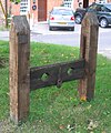
 Stocks, Keevil - geograph.org.uk - 1437611.jpg 640 × 480; 159 KB
-
 Stocks, Keevil, Wiltshire.jpg 1,419 × 1,704; 531 KB
-
 Straight across - geograph.org.uk - 5608800.jpg 3,240 × 4,320; 3.97 MB
-
 Straw bales in the corner of a field - geograph.org.uk - 1612958.jpg 640 × 530; 168 KB
-
 The driveway to the farm - geograph.org.uk - 5605921.jpg 4,320 × 3,240; 4.7 MB
-
 The lane from Oxen Leaze Farm - geograph.org.uk - 4027208.jpg 1,280 × 853; 1.2 MB
-
 The lane to Oxen Leaze Farm - geograph.org.uk - 1077631.jpg 640 × 499; 144 KB
-
 The Old Bakery, Keevil - geograph.org.uk - 1437607.jpg 640 × 480; 127 KB
-
 The Old Stables (geograph 5608859).jpg 4,320 × 3,240; 3.69 MB
-
 The postman cometh, to Keevil - geograph.org.uk - 1604000.jpg 640 × 515; 205 KB
-
 The road to Bulkington - geograph.org.uk - 762226.jpg 640 × 480; 329 KB
-
 The Shed at Pooh Corner - geograph.org.uk - 1079317.jpg 640 × 564; 174 KB
-
 Three ways to go (1) - geograph.org.uk - 5605898.jpg 4,320 × 3,240; 4.26 MB
-
 Three ways to go (1) - geograph.org.uk - 5605927.jpg 4,069 × 3,051; 4.85 MB
-
 Three ways to go (2) - geograph.org.uk - 5605899.jpg 4,320 × 3,240; 4.48 MB
-
 Three ways to go (2) - geograph.org.uk - 5605929.jpg 4,320 × 3,240; 5.28 MB
-
 Three ways to go (3) - geograph.org.uk - 5605900.jpg 4,320 × 3,240; 4.55 MB
-
 Three ways to go (3) - geograph.org.uk - 5605931.jpg 4,320 × 3,240; 4.47 MB
-
 Through the hedgerow - geograph.org.uk - 5608261.jpg 4,320 × 3,240; 4.24 MB
-
 Through the hedgerow with difficulty (1) - geograph.org.uk - 5605905.jpg 3,240 × 4,320; 5.16 MB
-
 Through the hedgerow with difficulty (2) - geograph.org.uk - 5605906.jpg 4,320 × 3,240; 5.36 MB
-
 Towards the farms (2) - geograph.org.uk - 5606763.jpg 4,320 × 3,240; 3.18 MB
-
 Towards the plain - geograph.org.uk - 5605938.jpg 4,320 × 3,240; 4.9 MB
-
 Towmead Lane - geograph.org.uk - 3567912.jpg 1,278 × 1,920; 2.98 MB
-
 Townmead Lane (1) - geograph.org.uk - 5608807.jpg 4,320 × 3,240; 5.27 MB
-
 Townmead Lane (2) - geograph.org.uk - 5608809.jpg 4,320 × 3,240; 5.06 MB
-
 Townmead Lane (3) - geograph.org.uk - 5608810.jpg 4,320 × 3,240; 5.84 MB
-
 Townmead Lane (4) - geograph.org.uk - 5608814.jpg 4,320 × 3,240; 4.89 MB
-
 Track to the airfield - geograph.org.uk - 5604953.jpg 4,320 × 3,240; 4.79 MB
-
 Tractor on a minor road near Bulkington - geograph.org.uk - 1604295.jpg 640 × 532; 161 KB
-
 Trowbridge Road, Seend Cleeve - geograph.org.uk - 5087501.jpg 2,048 × 1,536; 1.51 MB
-
 Trowbridge Road, Seend Cleeve - geograph.org.uk - 5087506.jpg 2,048 × 1,536; 1.44 MB
-
 Two stiles - geograph.org.uk - 5608263.jpg 4,320 × 3,240; 4.93 MB
-
 View across fields from the Bridleway - geograph.org.uk - 2843968.jpg 1,920 × 1,280; 1.06 MB
-
 Village Green and stocks, Keevil - geograph.org.uk - 1617134.jpg 640 × 486; 201 KB
-
 Village hall - geograph.org.uk - 5603174.jpg 4,320 × 3,240; 2.85 MB
-
 Village sign - geograph.org.uk - 5608824.jpg 4,320 × 3,240; 3.29 MB
-
 West on Main Street, Keevil - geograph.org.uk - 1617098.jpg 640 × 499; 222 KB
-
 Wick Leaze Farm - geograph.org.uk - 5606765.jpg 4,137 × 3,102; 2.79 MB
-
 WWII Wiltshire, RAF Keevil Battle HQ (1) - geograph.org.uk - 5674260.jpg 640 × 359; 287 KB
-
 WWII Wiltshire, RAF Keevil Battle HQ (2) - geograph.org.uk - 5674273.jpg 640 × 433; 390 KB
-
 WWII Wiltshire, RAF Keevil Battle HQ (3) - geograph.org.uk - 5674281.jpg 420 × 640; 500 KB
-
 WWII Wiltshire, RAF Keevil Battle HQ (4) - geograph.org.uk - 5674289.jpg 640 × 427; 363 KB
-
 An old farmhouse, ruined - geograph.org.uk - 1053436.jpg 640 × 455; 266 KB
-
 Back Street, Great Hinton - geograph.org.uk - 811080.jpg 640 × 480; 152 KB
-
 Burdock near Great Hinton - geograph.org.uk - 1437833.jpg 640 × 480; 218 KB


_-_geograph.org.uk_-_5605932.jpg)
_-_geograph.org.uk_-_5605936.jpg)


_-_geograph.org.uk_-_5674306.jpg)


_-_geograph.org.uk_-_5605893.jpg)
_-_geograph.org.uk_-_5605894.jpg)


.jpg)
_-_geograph.org.uk_-_5605915.jpg)
_-_geograph.org.uk_-_5605917.jpg)
_-_geograph.org.uk_-_5605918.jpg)
_-_geograph.org.uk_-_5606756.jpg)
_-_geograph.org.uk_-_5605919.jpg)


_-_geograph.org.uk_-_5710083.jpg)
_-_geograph.org.uk_-_5710084.jpg)
_-_geograph.org.uk_-_5710086.jpg)
_-_geograph.org.uk_-_5710087.jpg)
_-_geograph.org.uk_-_5710098.jpg)


_-_geograph.org.uk_-_5604948.jpg)
_-_geograph.org.uk_-_5604949.jpg)
_(geograph_5608853).jpg)
_-_geograph.org.uk_-_5608872.jpg)
_(geograph_5603172).jpg)
_-_geograph.org.uk_-_5604938.jpg)
_(geograph_5604939).jpg)
.jpg)
.jpg)
.jpg)
.jpg)
.jpg)
.jpg)
.jpg)
.jpg)
.jpg)
.jpg)


_-_geograph.org.uk_-_5608866.jpg)
_-_geograph.org.uk_-_5608867.jpg)


_-_geograph.org.uk_-_5604940.jpg)
_-_geograph.org.uk_-_5604943.jpg)
_-_geograph.org.uk_-_5604944.jpg)


_-_geograph.org.uk_-_5606733.jpg)
_-_geograph.org.uk_-_5606735.jpg)


_-_geograph.org.uk_-_5607881.jpg)
_-_geograph.org.uk_-_5607882.jpg)
_-_geograph.org.uk_-_5607883.jpg)
_-_geograph.org.uk_-_5607884.jpg)

_-_geograph.org.uk_-_5703205.jpg)
_-_geograph.org.uk_-_5709459.jpg)
_-_geograph.org.uk_-_5709460.jpg)
_-_geograph.org.uk_-_5709461.jpg)


_-_geograph.org.uk_-_5709466.jpg)
_-_geograph.org.uk_-_5709467.jpg)
_-_geograph.org.uk_-_5709468.jpg)
_-_geograph.org.uk_-_5709469.jpg)
_-_geograph.org.uk_-_5709470.jpg)
_-_geograph.org.uk_-_5709471.jpg)
_-_geograph.org.uk_-_5709472.jpg)
_-_geograph.org.uk_-_5709475.jpg)
_-_geograph.org.uk_-_5709477.jpg)
_-_geograph.org.uk_-_5709473.jpg)
_-_geograph.org.uk_-_5710079.jpg)
_-_geograph.org.uk_-_5710081.jpg)
_-_geograph.org.uk_-_5710096.jpg)


_-_geograph.org.uk_-_5710089.jpg)
_-_geograph.org.uk_-_5710090.jpg)
_-_geograph.org.uk_-_5710091.jpg)
_-_geograph.org.uk_-_5710092.jpg)
_-_geograph.org.uk_-_5710095.jpg)


.jpg)


_-_geograph.org.uk_-_5605898.jpg)
_-_geograph.org.uk_-_5605927.jpg)
_-_geograph.org.uk_-_5605899.jpg)
_-_geograph.org.uk_-_5605929.jpg)
_-_geograph.org.uk_-_5605900.jpg)
_-_geograph.org.uk_-_5605931.jpg)

_-_geograph.org.uk_-_5605905.jpg)
_-_geograph.org.uk_-_5605906.jpg)
_-_geograph.org.uk_-_5606763.jpg)


_-_geograph.org.uk_-_5608807.jpg)
_-_geograph.org.uk_-_5608809.jpg)
_-_geograph.org.uk_-_5608810.jpg)
_-_geograph.org.uk_-_5608814.jpg)


_-_geograph.org.uk_-_5674260.jpg)
_-_geograph.org.uk_-_5674273.jpg)
_-_geograph.org.uk_-_5674281.jpg)
_-_geograph.org.uk_-_5674289.jpg)


