Category:Kearton
Jump to navigation
Jump to search
village in United Kingdom | |||||
| Upload media | |||||
| Instance of | |||||
|---|---|---|---|---|---|
| Location | Richmondshire, North Yorkshire, Yorkshire and the Humber, England | ||||
 | |||||
English: Kearton is a hamlet in the Yorkshire Dales, North Yorkshire, England, near Low Row and Reeth.
Media in category "Kearton"
The following 15 files are in this category, out of 15 total.
-
 Barn near Kearton - geograph.org.uk - 2406419.jpg 640 × 481; 78 KB
-
 Barney Beck - geograph.org.uk - 1198126.jpg 640 × 427; 112 KB
-
 Barney Beck formed - geograph.org.uk - 1198067.jpg 640 × 427; 69 KB
-
 Bench Mark, Kearton - geograph.org.uk - 2406423.jpg 640 × 480; 126 KB
-
 Field Barn on Calver - geograph.org.uk - 816989.jpg 640 × 480; 98 KB
-
 Flue, Surrender Smelting Mill - geograph.org.uk - 839360.jpg 427 × 640; 333 KB
-
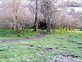 Footpath near Kearton - geograph.org.uk - 2406411.jpg 640 × 481; 105 KB
-
 On the bridleway to Fore Gill Gate - geograph.org.uk - 815946.jpg 480 × 640; 83 KB
-
 Ruined Wall, Mill Gill - geograph.org.uk - 839191.jpg 640 × 427; 377 KB
-
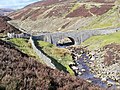 Surrender Bridge - geograph.org.uk - 1192303.jpg 640 × 480; 135 KB
-
 Surrender Bridge - geograph.org.uk - 839342.jpg 427 × 640; 329 KB
-
 Surrender Mill - geograph.org.uk - 950829.jpg 640 × 421; 68 KB
-
 Surrender Smelt Mill - geograph.org.uk - 892181.jpg 609 × 406; 245 KB
-
 Towards Surrender Mill - geograph.org.uk - 1016876.jpg 640 × 623; 109 KB
-
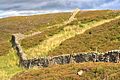 Wall Near Surrender Bridge - geograph.org.uk - 892174.jpg 640 × 427; 273 KB


