Category:Katholisches Pfarramt Radibor
Jump to navigation
Jump to search
| Object location | | View all coordinates using: OpenStreetMap |
|---|
Media in category "Katholisches Pfarramt Radibor"
The following 7 files are in this category, out of 7 total.
-
 Radibor - Kirchweg - Katholisches Pfarramt 01 ies.jpg 5,616 × 3,744; 8.62 MB
-
 Radibor - Kirchweg - Katholisches Pfarramt 02 ies.jpg 5,616 × 3,744; 8.26 MB
-
 Radibor - Kirchweg - Katholisches Pfarramt 03 ies.jpg 5,616 × 3,744; 13.21 MB
-
 Radibor - Kirchweg - Katholisches Pfarramt 04 ies.jpg 5,616 × 3,744; 8.59 MB
-
 Radibor - Kirchweg - Katholisches Pfarramt 05 ies.jpg 5,616 × 3,744; 5.48 MB
-
 Radibor-Pfarrei-Rosenkranzkönigin.jpg 1,889 × 2,519; 1.8 MB
-
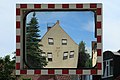
 Radibor-Pfarrhaus.jpg 3,192 × 2,394; 1.65 MB


