Category:Katholische Kirche St. Josef (Schlatt)
Jump to navigation
Jump to search
| Object location | | View all coordinates using: OpenStreetMap |
|---|
church building in Schlatt-Haslen in the canton of Appenzell Innerrhoden, Switzerland   | |||||
| Upload media | |||||
| Instance of | |||||
|---|---|---|---|---|---|
| Part of | |||||
| Location | Schlatt-Haslen, Appenzell Innerrhoden, Switzerland | ||||
| Street address |
| ||||
| Architect | |||||
| Heritage designation | |||||
| Inception |
| ||||
 | |||||
Media in category "Katholische Kirche St. Josef (Schlatt)"
The following 12 files are in this category, out of 12 total.
-
 Katholische Kirche St. Josef Schlatt P1031071.jpg 5,184 × 3,888; 9.83 MB
-
 Katholische Kirche St. Josef Schlatt P1031277.jpg 5,184 × 3,888; 8.44 MB
-
 Katholische Kirche St. Josef Schlatt P1031281.jpg 5,184 × 3,888; 8.78 MB
-
 Katholische Kirche St. Josef Schlatt P1031283.jpg 3,888 × 5,184; 9.21 MB
-
 Kirche Schlatt AI - Taufstein (Hochformat).jpg 3,000 × 4,000; 4.65 MB
-
 Kirche Schlatt AI - Taufstein.jpg 4,000 × 3,000; 4.73 MB
-
 Kirche Schlatt AI Innenraum.jpg 4,000 × 3,000; 4.73 MB
-
 Kirche Schlatt AI.jpg 4,000 × 3,000; 4.75 MB
-
 Kirche und Schulhaus Schlatt AI.jpg 4,000 × 3,000; 4.71 MB
-
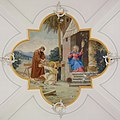 Schlatt Gewoelbegemaelde.jpg 2,087 × 2,087; 1.27 MB
-
 Schlatt Kaltenbacher 1917.jpg 1,225 × 1,588; 1.13 MB
-
 Schlatt Kirche innen.jpg 3,299 × 2,199; 1.92 MB


.jpg)


