Category:Kasteel de Hooge Vuursche
Jump to navigation
Jump to search
| Object location | | View all coordinates using: OpenStreetMap |
|---|
 | |||||
| Upload media | |||||
| Instance of | |||||
|---|---|---|---|---|---|
| Part of | |||||
| Location | Baarn, Utrecht, Netherlands | ||||
| Street address |
| ||||
| Located on street |
| ||||
| Architectural style | |||||
| Architect | |||||
| Heritage designation |
| ||||
| Inception |
| ||||
 | |||||
|
This is a category about rijksmonumentcomplex number 511670
|
Landhuis
|
This is a category about rijksmonument number 511671
|
Toegangshek
|
This is a category about rijksmonument number 511672
|
Historische aanleg
|
This is a category about rijksmonument number 511673
|
| Address |
|
Subcategories
This category has only the following subcategory.
G
Media in category "Kasteel de Hooge Vuursche"
The following 28 files are in this category, out of 28 total.
-
 Achtertuin - Hooge Vuursche - 20114825 - RCE.jpg 1,199 × 1,200; 286 KB
-
 Eduard Cuypers - Landhuis De Hooge Vuursche te Baarn 001.jpg 1,697 × 1,047; 761 KB
-
 Eduard Cuypers - Landhuis De Hooge Vuursche te Baarn 004.jpg 803 × 586; 268 KB
-
 Eetzaal (in neo-rococostijl) - Hooge Vuursche - 20114826 - RCE.jpg 1,197 × 1,200; 274 KB
-
 Eetzaal - Hooge Vuursche - 20114827 - RCE.jpg 1,190 × 1,200; 256 KB
-
 Eetzaal, deurpartij - Hooge Vuursche - 20114829 - RCE.jpg 1,197 × 1,200; 270 KB
-
 Eetzaal, plafond - Hooge Vuursche - 20114830 - RCE.jpg 1,190 × 1,200; 219 KB
-
 Eetzaal, schouw - Hooge Vuursche - 20114828 - RCE.jpg 1,195 × 1,200; 253 KB
-
 Hooge Vuursche 1.jpg 545 × 294; 142 KB
-
 Hooge Vuursche tuin.jpg 2,100 × 1,476; 761 KB
-
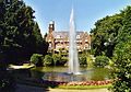
 Hooge Vuursche.jpg 450 × 350; 186 KB
-

-

-

-
 HUA-95091-Gezicht in een laan in het park van het huis de Hooge Vuursche I te Baarn.jpg 3,871 × 2,360; 2.11 MB
-
 HUA-95092-Gezicht op de vijver in het park van het huis de Hooge Vuursche I te Baarn.jpg 3,803 × 2,324; 1.8 MB
-
 HUA-95093-Gezicht in een laan in het park van het huis de Hooge Vuursche I te Baarn.jpg 3,784 × 2,373; 1.94 MB
-

-
 Noord-oost gevel - Hooge Vuursche - 20114820 - RCE.jpg 1,190 × 1,200; 323 KB
-
 Noord-west gevel - Hooge Vuursche - 20114821 - RCE.jpg 1,200 × 1,198; 354 KB
-
 Overzicht noordzijde - Hooge Vuursche - 20114818 - RCE.jpg 1,200 × 1,195; 328 KB
-
 Overzicht vanuit het noord-oosten - Hooge Vuursche - 20114819 - RCE.jpg 1,188 × 1,200; 365 KB
-
 Overzicht voorzijde - Hooge Vuursche - 20114816 - RCE.jpg 1,200 × 1,181; 363 KB
-
 Plattegrond - Hooge Vuursche - 20114814 - RCE.jpg 957 × 1,200; 236 KB
-
 Voorgevel - Hooge Vuursche - 20114817 - RCE.jpg 1,200 × 1,198; 316 KB
-
 Voortuin - Hooge Vuursche - 20114824 - RCE.jpg 1,194 × 1,200; 249 KB
-
 Westgevel - Hooge Vuursche - 20114822 - RCE.jpg 1,192 × 1,200; 395 KB
-
 Zuid-oost gevel - Hooge Vuursche - 20114823 - RCE.jpg 1,199 × 1,200; 392 KB


_-_Hooge_Vuursche_-_20114826_-_RCE.jpg)


