Category:Kasteel Keppel
Jump to navigation
Jump to search
| Object location | | View all coordinates using: OpenStreetMap |
|---|
| Upload media | |||||
| Instance of | |||||
|---|---|---|---|---|---|
| Part of | |||||
| Location | Laag-Keppel, Bronckhorst, Gelderland, Netherlands | ||||
| Street address |
| ||||
| Located on street |
| ||||
| Heritage designation |
| ||||
 | |||||
|
This is a category about rijksmonumentcomplex number 528691
|
Tuinsieraad:
|
This is a category about rijksmonument number 22832
|
Diensthuisje:
|
This is a category about rijksmonument number 22834
|
Kasteel:
|
This is a category about rijksmonument number 528692
|
Historische tuin- en parkaanleg:
|
This is a category about rijksmonument number 528693
|
Bijgebouw:
|
This is a category about rijksmonument number 528694
|
Dienstwoning:
|
This is a category about rijksmonument number 528695
|
Koetshuis:
|
This is a category about rijksmonument number 528696
|
Toegangshek met brug:
|
This is a category about rijksmonument number 528697
|
Voetbrug met hek:
|
This is a category about rijksmonument number 528698
|
Dam:
|
This is a category about rijksmonument number 528699
|
| Address |
|
Subcategories
This category has the following 4 subcategories, out of 4 total.
F
- Follega molen, Laag-Keppel (28 F)
G
- Grote schuur, Keppel (9 F)
K
- Koetshuis, Keppel (4 F)
T
- Toegangshek, Keppel (8 F)
Media in category "Kasteel Keppel"
The following 150 files are in this category, out of 150 total.
-
 20150410 Kasteel Keppel1.jpg 3,672 × 4,896; 2.53 MB
-
 20150410 Kasteel Keppel2.jpg 3,672 × 4,896; 1.48 MB
-
 20150410 Kasteel Keppel3.jpg 4,896 × 3,672; 1.81 MB
-
 6998 Laag-Keppel, Netherlands - panoramio (5).jpg 2,336 × 4,160; 5.26 MB
-
 Bronckhost Wikivoyage Banner.jpg 4,000 × 586; 400 KB
-

-
 Detail buitenmuur - Laag-Keppel - 20401552 - RCE.jpg 801 × 1,200; 267 KB
-
 Detail torentje - Laag-Keppel - 20128336 - RCE.jpg 1,200 × 958; 381 KB
-
 Details - Laag-Keppel - 20128362 - RCE.jpg 1,200 × 788; 220 KB
-
 Details - Laag-Keppel - 20128363 - RCE.jpg 1,200 × 788; 176 KB
-
 Details - Laag-Keppel - 20128364 - RCE.jpg 1,200 × 788; 254 KB
-
 Details - Laag-Keppel - 20128365 - RCE.jpg 1,200 × 788; 271 KB
-
 Details - Laag-Keppel - 20128366 - RCE.jpg 788 × 1,200; 199 KB
-
 Details - Laag-Keppel - 20128367 - RCE.jpg 1,200 × 788; 187 KB
-
 Details - Laag-Keppel - 20128368 - RCE.jpg 1,200 × 788; 189 KB
-
 Details - Laag-Keppel - 20128369 - RCE.jpg 1,200 × 788; 211 KB
-
 Details - Laag-Keppel - 20128370 - RCE.jpg 1,200 × 800; 238 KB
-
 Details - Laag-Keppel - 20128371 - RCE.jpg 800 × 1,200; 263 KB
-
 Details - Laag-Keppel - 20128372 - RCE.jpg 787 × 1,200; 243 KB
-
 Details - Laag-Keppel - 20128373 - RCE.jpg 792 × 1,200; 226 KB
-
 Details - Laag-Keppel - 20128374 - RCE.jpg 797 × 1,200; 251 KB
-
 Details - Laag-Keppel - 20128375 - RCE.jpg 1,200 × 800; 222 KB
-
 Details - Laag-Keppel - 20128376 - RCE.jpg 1,200 × 800; 263 KB
-
 Details - Laag-Keppel - 20128377 - RCE.jpg 795 × 1,200; 232 KB
-
 Details - Laag-Keppel - 20128378 - RCE.jpg 789 × 1,200; 236 KB
-
 Details - Laag-Keppel - 20128379 - RCE.jpg 1,200 × 781; 182 KB
-
 Details - Laag-Keppel - 20128380 - RCE.jpg 1,200 × 800; 264 KB
-
 Exterieur - Laag-Keppel - 20128326 - RCE.jpg 1,200 × 895; 217 KB
-
 Exterieur - Laag-Keppel - 20128327 - RCE.jpg 957 × 1,200; 291 KB
-
 Exterieur - Laag-Keppel - 20128354 - RCE.jpg 1,200 × 983; 263 KB
-
 Exterieur - Laag-Keppel - 20128355 - RCE.jpg 1,200 × 968; 287 KB
-
 Exterieur - Laag-Keppel - 20128356 - RCE.jpg 1,200 × 973; 196 KB
-
 Exterieur ACHTERGEVEL - Laag-Keppel - 20289175 - RCE.jpg 1,198 × 1,200; 423 KB
-
 Exterieur FRONTON, DETAIL - Laag-Keppel - 20289165 - RCE.jpg 1,197 × 1,200; 326 KB
-
 Exterieur FRONTON, DETAIL - Laag-Keppel - 20289166 - RCE.jpg 1,200 × 1,183; 275 KB
-
 Exterieur FRONTON, DETAIL - Laag-Keppel - 20289167 - RCE.jpg 1,200 × 1,200; 249 KB
-
 Exterieur FRONTON, DETAIL - Laag-Keppel - 20289168 - RCE.jpg 1,200 × 1,194; 297 KB
-
 Exterieur FRONTON, DETAIL - Laag-Keppel - 20289169 - RCE.jpg 1,200 × 1,195; 363 KB
-
 Exterieur FRONTON, DETAIL - Laag-Keppel - 20289170 - RCE.jpg 1,200 × 1,197; 402 KB
-
 Exterieur FRONTON, DETAIL - Laag-Keppel - 20289171 - RCE.jpg 1,200 × 1,197; 353 KB
-
 Exterieur FRONTON, OVERZICHT - Laag-Keppel - 20289162 - RCE.jpg 1,200 × 1,178; 296 KB
-
 Exterieur FRONTON, OVERZICHT - Laag-Keppel - 20289163 - RCE.jpg 1,200 × 1,197; 283 KB
-
 Exterieur FRONTON, OVERZICHT - Laag-Keppel - 20289164 - RCE.jpg 1,200 × 1,183; 282 KB
-

-

-

-
 Exterieur LINKER ZIJGEVEL - Laag-Keppel - 20289174 - RCE.jpg 1,200 × 1,199; 417 KB
-
 Exterieur OVERZICHT - Laag-Keppel - 20263394 - RCE.jpg 806 × 1,200; 305 KB
-
 Exterieur OVERZICHT LINKER ZIJGEVEL - Laag-Keppel - 20263397 - RCE.jpg 783 × 1,200; 283 KB
-
 Exterieur RECHTER ZIJGEVEL - Laag-Keppel - 20289173 - RCE.jpg 1,193 × 1,200; 369 KB
-
 Exterieur VOORGEVEL - Laag-Keppel - 20289172 - RCE.jpg 1,200 × 1,181; 373 KB
-
 Exterieur VOORGEVEL, HOEKTOREN, SOFFIET - Laag-Keppel - 20289177 - RCE.jpg 1,185 × 1,200; 457 KB
-
 Exterieur VOORGEVEL, TOPGEVEL, DETAIL - Laag-Keppel - 20289176 - RCE.jpg 1,200 × 1,183; 333 KB
-
 Exterieur VOORGEVEL, TOPGEVEL, DETAIL - Laag-Keppel - 20289178 - RCE.jpg 1,200 × 788; 213 KB
-
 Exterieur VOORGEVEL, TOPGEVEL, DETAIL - Laag-Keppel - 20289179 - RCE.jpg 1,200 × 788; 220 KB
-
 Exterieur VOORGEVEL, TOPGEVEL, DETAIL - Laag-Keppel - 20289180 - RCE.jpg 1,200 × 788; 217 KB
-
 Gedeelte van de buitenzijde - Laag-Keppel - 20415628 - RCE.jpg 951 × 1,200; 322 KB
-
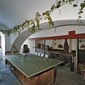
 Gewelfde zaal - Laag-Keppel - 20128339 - RCE.jpg 1,200 × 949; 225 KB
-

-
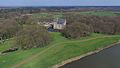
 Gezicht op Kasteel vanuit park - Laag-Keppel - 20382599 - RCE.jpg 1,200 × 1,200; 278 KB
-
 Gietijzeren hek en paal - Laag-Keppel - 20128381 - RCE.jpg 1,200 × 1,192; 425 KB
-
 Gietijzeren paal - Laag-Keppel - 20128382 - RCE.jpg 1,200 × 1,192; 282 KB
-
 Interieur - Laag-Keppel - 20128350 - RCE.jpg 984 × 1,200; 283 KB
-
 Interieur - Laag-Keppel - 20128351 - RCE.jpg 971 × 1,200; 171 KB
-
 Interieur - Laag-Keppel - 20128352 - RCE.jpg 972 × 1,200; 202 KB
-
 Interieur - Laag-Keppel - 20128353 - RCE.jpg 1,200 × 964; 222 KB
-
 Interieur hal met stucplafond - Laag-Keppel - 20382639 - RCE.jpg 1,200 × 1,200; 220 KB
-
 Interieur hal met stucwerk - Laag-Keppel - 20382601 - RCE.jpg 1,200 × 1,200; 221 KB
-
 Interieur hal met zicht op trap - Laag-Keppel - 20382606 - RCE.jpg 1,200 × 1,200; 284 KB
-
 Interieur kelder met kruisgewelven - Laag-Keppel - 20382594 - RCE.jpg 1,200 × 1,200; 231 KB
-
 Interieur kelder, overzicht keuken - Laag-Keppel - 20382640 - RCE.jpg 1,200 × 1,200; 217 KB
-
 Interieur muziekkamer met stucplafond - Laag-Keppel - 20382609 - RCE.jpg 1,200 × 1,200; 273 KB
-
 Interieur muziekkamer met stucplafond - Laag-Keppel - 20382621 - RCE.jpg 1,200 × 1,200; 280 KB
-

-
 Interieur, doopvont - Laag-Keppel - 20128341 - RCE.jpg 951 × 1,200; 238 KB
-
 Interieur, overzicht Blauwe kamer met stucwerk - Laag-Keppel - 20382595 - RCE.jpg 1,200 × 1,200; 258 KB
-
 Interieur, overzicht Blauwe kamer met stucwerk - Laag-Keppel - 20382596 - RCE.jpg 1,200 × 1,200; 273 KB
-
 Interieur, overzicht paardenstal - Laag-Keppel - 20382591 - RCE.jpg 1,200 × 1,200; 287 KB
-
 Interieur, overzicht schouw in muziekkamer - Laag-Keppel - 20382623 - RCE.jpg 1,200 × 1,200; 299 KB
-
 Kasteel Keppel 150630 (1).JPG 6,000 × 4,000; 9.48 MB
-
 Kasteel Keppel 150630 (10).JPG 6,000 × 4,000; 9.97 MB
-
 Kasteel Keppel 150630 (11).JPG 6,000 × 4,000; 7.99 MB
-
 Kasteel Keppel 150630 (12).JPG 4,000 × 6,000; 6.79 MB
-
 Kasteel Keppel 150630 (13).JPG 6,000 × 4,000; 9.19 MB
-
 Kasteel Keppel 150630 (2).JPG 6,000 × 4,000; 6.41 MB
-
 Kasteel Keppel 150630 (3).JPG 4,000 × 6,000; 6.65 MB
-
 Kasteel Keppel 150630 (4).JPG 4,000 × 6,000; 5.46 MB
-
 Kasteel Keppel 150630 (5).JPG 6,000 × 4,000; 7.44 MB
-
 Kasteel Keppel 150630 (6).JPG 6,000 × 4,000; 7.15 MB
-
 Kasteel Keppel 150630 (8).JPG 6,000 × 4,000; 8.8 MB
-
 Kasteel Keppel 150630 (9).JPG 6,000 × 4,000; 6.6 MB
-
 Kasteel keppel 2007.jpg 400 × 300; 96 KB
-
 Kasteel Keppel JUL17.jpg 6,000 × 4,000; 14.19 MB
-
 Kasteel keppel.jpg 766 × 490; 518 KB
-
 Kasteel Keppel.jpg 4,000 × 2,257; 1.1 MB
-
 Kastiel Keppel.jpg 2,000 × 1,385; 1.85 MB
-
 Keppel bijgebouw.JPG 3,648 × 2,432; 4.18 MB
-
 Keppel bouwhuis.jpg 2,142 × 1,470; 491 KB
-
 Keppel koetshuis.jpg 2,136 × 1,482; 693 KB
-
 Keppel park.jpg 2,136 × 1,476; 664 KB
-
 Keppel.jpg 2,136 × 1,470; 459 KB
-
 Laag Keppel (Bronckhorst) Dorpsstraat pomp22832 (1).jpg 4,288 × 2,848; 3.05 MB
-
 Laag Keppel (Bronckhorst) Dorpsstraat x 22831.jpg 4,288 × 2,848; 2.96 MB
-

-
 Met inrijhek - Laag-Keppel - 20128421 - RCE.jpg 1,200 × 811; 258 KB
-
 Overzicht - Laag-Keppel - 20128344 - RCE.jpg 894 × 1,200; 238 KB
-
 Overzicht - Laag-Keppel - 20128345 - RCE.jpg 894 × 1,200; 310 KB
-
 Overzicht achterzijde - Laag-Keppel - 20382635 - RCE.jpg 1,200 × 1,200; 447 KB
-
 Overzicht achterzijde koetshuis - Laag-Keppel - 20382647 - RCE.jpg 1,200 × 926; 270 KB
-
 Overzicht achterzijde koetshuis - Laag-Keppel - 20382649 - RCE.jpg 1,200 × 926; 234 KB
-

-

-
 Overzicht koetshuis vanuit het park - Laag-Keppel - 20382598 - RCE.jpg 1,200 × 1,200; 480 KB
-
 Overzicht laan in het park - Laag-Keppel - 20382593 - RCE.jpg 1,200 × 1,200; 511 KB
-
 Overzicht op binnenplaats van het kasteel - Laag-Keppel - 20382590 - RCE.jpg 1,200 × 1,200; 380 KB
-
 Overzicht park - Laag-Keppel - 20382620 - RCE.jpg 1,200 × 1,200; 305 KB
-
 Overzicht park - Laag-Keppel - 20382642 - RCE.jpg 1,200 × 1,200; 314 KB
-
 Overzicht park met op de achtergrond Kasteel Keppel - Laag-Keppel - 20382600 - RCE.jpg 1,200 × 1,200; 319 KB
-

-
 Overzicht rechter zijgevel met slotgracht - Laag-Keppel - 20382643 - RCE.jpg 926 × 1,200; 249 KB
-
 Overzicht voorgevel - Laag-Keppel - 20382615 - RCE.jpg 1,200 × 1,200; 379 KB
-
 Overzicht voorgevel en toren gezien vanaf oprijlaan - Laag-Keppel - 20382597 - RCE.jpg 1,200 × 1,200; 378 KB
-
 Pomp aan de Dorpsstr. bij oprijlaan Kasteel - Laag-Keppel - 20128384 - RCE.jpg 807 × 1,200; 256 KB
-
 Prent 1743 - Laag-Keppel - 20128357 - RCE.jpg 1,200 × 981; 248 KB
-
 Prent, door C.Pronk 1730 - Laag-Keppel - 20128359 - RCE.jpg 1,200 × 970; 196 KB
-
 Prent, door C.Pronk 1730 - Laag-Keppel - 20128360 - RCE.jpg 1,200 × 973; 188 KB
-
 Prent, door C.Pronk 1730 - Laag-Keppel - 20128361 - RCE.jpg 1,200 × 966; 224 KB
-
 Prent, door J.de Beyer - Laag-Keppel - 20128348 - RCE.jpg 1,200 × 968; 228 KB
-
 Prent, door J.de Beyer - Laag-Keppel - 20128349 - RCE.jpg 1,200 × 970; 236 KB
-
 Prent, van Agteren, 1730 - Laag-Keppel - 20128358 - RCE.jpg 1,200 × 985; 214 KB
-
 Tafel - Laag-Keppel - 20128340 - RCE.jpg 1,200 × 948; 234 KB
-
 Toren gezien vanaf de binnenplaats - Laag-Keppel - 20382589 - RCE.jpg 1,200 × 1,200; 334 KB
-
 Torenkamer naast Balzaal - Laag-Keppel - 20128342 - RCE.jpg 937 × 1,200; 201 KB
-
 Uitwendig - Laag-Keppel - 20128328 - RCE.jpg 960 × 1,200; 264 KB
-
 Uitwendig - Laag-Keppel - 20128329 - RCE.jpg 1,200 × 945; 294 KB
-
 Uitwendig - Laag-Keppel - 20128330 - RCE.jpg 956 × 1,200; 308 KB
-
 Uitwendig - Laag-Keppel - 20128331 - RCE.jpg 956 × 1,200; 304 KB
-
 Uitwendig - Laag-Keppel - 20128332 - RCE.jpg 959 × 1,200; 325 KB
-
 Uitwendig - Laag-Keppel - 20128333 - RCE.jpg 955 × 1,200; 282 KB
-
 Uitwendig - Laag-Keppel - 20128334 - RCE.jpg 953 × 1,200; 247 KB
-
 Uitwendig - Laag-Keppel - 20128335 - RCE.jpg 955 × 1,200; 263 KB
-
 Voorburcht - Laag-Keppel - 20128337 - RCE.jpg 961 × 1,200; 328 KB
-
 Voorgevel met ingangspartij en brug - Laag-Keppel - 20128347 - RCE.jpg 894 × 1,200; 330 KB
-
 Voorgevel van bijgebouw bij de ingang - Laag-Keppel - 20381981 - RCE.jpg 1,200 × 1,200; 416 KB
-
 Wilhelminabrug met toegangshek - Laag-Keppel - 20382592 - RCE.jpg 1,200 × 1,200; 419 KB
-
 Winter 2010 075.JPG 640 × 480; 79 KB
-
 Zicht op voorgevel en rechter zijgevel - Laag-Keppel - 20128346 - RCE.jpg 1,200 × 894; 333 KB
-
 Zicht op voorgevel en tuin - Laag-Keppel - 20322848 - RCE.jpg 1,200 × 784; 185 KB
-
 Zijgevel - Keppel - 20471028 - RCE.jpg 1,200 × 900; 139 KB
-
 Zijgevel links - Laag-Keppel - 20322845 - RCE.jpg 1,200 × 787; 168 KB


.jpg)


.JPG)
.JPG)
.JPG)
.JPG)
.JPG)
.JPG)
.JPG)
.JPG)
.JPG)
.JPG)
.JPG)
.JPG)


_Dorpsstraat_pomp22832_(1).jpg)
_Dorpsstraat_x_22831.jpg)


