Category:Kasteel De Raay, Baarlo
Jump to navigation
Jump to search
| Object location | | View all coordinates using: OpenStreetMap |
|---|
castle in Baarlo, Netherlands  | |||||
| Upload media | |||||
| Instance of | |||||
|---|---|---|---|---|---|
| Location | Baarlo, Maasbree, Limburg, Netherlands | ||||
| Street address |
| ||||
| Located on street | |||||
| Heritage designation |
| ||||
 | |||||
|
This is a category about rijksmonument number 26536
|
| Address |
|
Subcategories
This category has the following 2 subcategories, out of 2 total.
Media in category "Kasteel De Raay, Baarlo"
The following 55 files are in this category, out of 55 total.
-
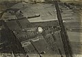 NIMH - 2011 - 9900-014 - Aerial photograph of Baarlo, The Netherlands.jpg 4,000 × 2,753; 2.15 MB
-
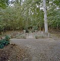 Begraafplaats van de nonnen - Baarlo - 20329032 - RCE.jpg 1,191 × 1,200; 437 KB
-
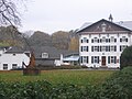 De Raay.JPG 2,048 × 1,536; 930 KB
-
 Exterieur achtergevel, gedeelte - Baarlo - 20322737 - RCE.jpg 800 × 1,200; 185 KB
-
 Exterieur achtergevel, gedeelte - Baarlo - 20322739 - RCE.jpg 1,183 × 1,200; 304 KB
-
 Exterieur achtergevel, gedeelte - Baarlo - 20322740 - RCE.jpg 1,190 × 1,200; 303 KB
-
 Exterieur linker zijgevel, gedeelte - Baarlo - 20322734 - RCE.jpg 1,200 × 1,195; 384 KB
-
 Exterieur linker zijgevel, gedeelte - Baarlo - 20322735 - RCE.jpg 1,188 × 1,200; 412 KB
-
 Exterieur linker zijgevel, gedeelte - Baarlo - 20322749 - RCE.jpg 1,188 × 1,200; 292 KB
-
 Exterieur overzicht achtergevel met gedeelte bijgebouw - Baarlo - 20322736 - RCE.jpg 1,188 × 1,200; 362 KB
-
 Exterieur overzicht linker zijgevel - Baarlo - 20322741 - RCE.jpg 1,200 × 801; 180 KB
-
 Exterieur overzicht rechter zijgevel - Baarlo - 20322732 - RCE.jpg 804 × 1,200; 219 KB
-
 Exterieur overzicht voorgevel - Baarlo - 20322730 - RCE.jpg 1,200 × 805; 187 KB
-
 Exterieur rechter zijgevel, gedeelte - Baarlo - 20322733 - RCE.jpg 1,190 × 1,200; 320 KB
-
 Exterieur rechter zijgevel, gedeelte - Baarlo - 20322750 - RCE.jpg 1,197 × 1,200; 224 KB
-
 Exterieur rechter zijgevel, gedeelte - Baarlo - 20322751 - RCE.jpg 1,192 × 1,200; 307 KB
-
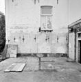
 Exterieur schelpengrot - Baarlo - 20322811 - RCE.jpg 1,189 × 1,200; 404 KB
-
 Exterieur schelpengrot, detail - Baarlo - 20322813 - RCE.jpg 1,188 × 1,200; 451 KB
-
 Exterieur voorgevel, gevelsteen - Baarlo - 20322731 - RCE.jpg 1,188 × 1,200; 293 KB
-
 Huis de Raay, voorgevel - Maasbree - 20144416 - RCE.jpg 1,200 × 804; 290 KB
-
 Huis de Raay, zijaanzicht - Maasbree - 20144415 - RCE.jpg 1,200 × 804; 215 KB
-

-
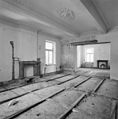
 Interieur begane grond, kamer met schouw - Baarlo - 20322759 - RCE.jpg 1,181 × 1,200; 222 KB
-
 Interieur begane grond, kamer met schouw - Baarlo - 20322762 - RCE.jpg 1,183 × 1,200; 236 KB
-
 Interieur begane grond, kamers met schouw - Baarlo - 20322761 - RCE.jpg 1,185 × 1,200; 246 KB
-

-
 Interieur begane grond, plafond kamer, detail - Baarlo - 20322765 - RCE.jpg 1,200 × 1,200; 315 KB
-
 Interieur begane grond, plafond kamer, detail - Baarlo - 20322766 - RCE.jpg 1,197 × 1,200; 349 KB
-
 Interieur begane grond, plafond portaal - Baarlo - 20322764 - RCE.jpg 1,186 × 1,200; 181 KB
-

-

-
 Interieur eerste verdieping, muurkast in noordgevel - Baarlo - 20322789 - RCE.jpg 1,183 × 1,200; 319 KB
-

-

-

-

-

-

-

-
 Interieur kelder, noordoostelijk vertrek - Baarlo - 20322798 - RCE.jpg 1,183 × 1,200; 357 KB
-
 Interieur kelder, oostelijke middenkelder - Baarlo - 20322803 - RCE.jpg 1,187 × 1,200; 304 KB
-
 Interieur kelder, overzicht gang - Baarlo - 20322801 - RCE.jpg 1,188 × 1,200; 178 KB
-
 Interieur kelder, voormalige schouw - Baarlo - 20322799 - RCE.jpg 1,179 × 1,200; 259 KB
-
 Interieur kelder, voormalige zuidgevel - Baarlo - 20322797 - RCE.jpg 1,130 × 1,200; 244 KB
-
 Interieur kelder, zuidelijk gedeelte - Baarlo - 20322802 - RCE.jpg 1,190 × 1,200; 252 KB
-
 Interieur oostelijk bijgebouw, kapconstructie - Baarlo - 20322805 - RCE.jpg 1,188 × 1,200; 263 KB
-
 Interieur oostelijk bijgebouw, kapconstructie - Baarlo - 20322806 - RCE.jpg 1,182 × 1,200; 288 KB
-
 Interieur oostelijk bijgebouw, kapconstructie - Baarlo - 20322808 - RCE.jpg 1,181 × 1,200; 238 KB
-
 Interieur overzicht bovenste zolder - Baarlo - 20322795 - RCE.jpg 1,187 × 1,200; 247 KB
-
 Interieur overzicht bovenste zolder - Baarlo - 20322796 - RCE.jpg 1,186 × 1,200; 239 KB
-
 Interieur zolder met voormalige zuidgevel - Baarlo - 20322794 - RCE.jpg 1,185 × 1,200; 238 KB
-
 Interieur zolder, overzicht in oostelijke richting - Baarlo - 20322792 - RCE.jpg 1,179 × 1,200; 248 KB
-
 Interieur zolder, overzicht in oostelijke richting - Baarlo - 20322793 - RCE.jpg 1,174 × 1,200; 257 KB
-
 Interieur, schoorsteenmantel - Baarlo - 20026869 - RCE.jpg 1,200 × 854; 190 KB
-
 Kasteel De Raay.JPG 3,264 × 2,448; 4.99 MB


