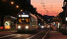
Category:Karlsruhe Tullastraße/Alter Schlachthof (tram stop)

From Wikimedia Commons, the free media repository
Jump to navigation Jump to search
<nowiki>Karlsruhe Tullastraße/Alter Schlachthof; Tullastraße/Alter Schlachthof; Tullastraße/Alter Schlachthof; Karlsruhe Tullastraße/Alter Schlachthof; Straßenbahnhaltestelle in Karlsruhe; tram stop in Karlsruhe, Germany</nowiki>
Karlsruhe Tullastraße/Alter Schlachthof 
tram stop in Karlsruhe, Germany
Upload media
Instance of
Named after
LocationKarlsruhe, Karlsruhe Government Region, Baden-Württemberg, Germany
Transport network
Operator
Adjacent station
  • Karlsruhe Gottesauer Platz/BGV (Karlsruhe Albtalbahnhof, S 4)
  • Karlsruhe Weinweg (Öhringen-Cappel, S 4)
  • Karlsruhe Essenweinstraße (Spöck Richard-Hecht-Schule, S 2)
  • Karlsruhe Gottesauer Platz/BGV (Wörth (Rhein) Badepark, S 5)
  • Karlsruhe Gottesauer Platz/BGV (Mörsch Bach-West, S 2)
  • Karlsruhe Gottesauer Platz/BGV (Karlsruhe-Neureut Heide, line 1)
  • Karlsruhe Weinweg (Pforzheim Central Station, S 5)
  • Karlsruhe Weinweg (Durlach Turmberg, line 1)
  • Karlsruhe Gottesauer Platz/BGV (Knielingen Nord, line 2)
  • Karlsruhe Weinweg (Wolfartsweier Nord, line 2)
  • Karlsruhe Schloss Gottesaue (Karlsruhe Rheinhafen, line 5)
  • Karlsruhe Weinweg (Durlach Bahnhof, line 5)
  • Karlsruhe Schloss Gottesaue (Karlsruhe Rheinhafen, line 17)
  • Karlsruhe Essenweinstraße (Karlsruhe-Waldstadt Europäische Schule, line 17)
  • Karlsruhe Essenweinstraße (Karlsruhe-Waldstadt Europäische Schule, line 18)
  • Karlsruhe Weinweg (Durlach Turmberg, line 18)
Map49° 00′ 22.68″ N, 8° 25′ 53.76″ E
Authority file
Wikidata Q112624014
OpenStreetMap relation ID: 3690943
Edit infobox data on Wikidata

Media in category "Karlsruhe Tullastraße/Alter Schlachthof (tram stop)"

The following 5 files are in this category, out of 5 total.