Category:Karl Spruner von Merz
Jump to navigation
Jump to search
English: Karl Spruner von Merz or Karl von Spruner (1803-1892) was a German cartographer and scholar.
German cartographer (1803-1892) | |||||
| Upload media | |||||
| Date of birth | 15 November 1803 Stuttgart | ||||
|---|---|---|---|---|---|
| Date of death | 24 August 1892 Munich | ||||
| Country of citizenship | |||||
| Occupation | |||||
| Child |
| ||||
| |||||
Subcategories
This category has the following 3 subcategories, out of 3 total.
Pages in category "Karl Spruner von Merz"
This category contains only the following page.
Media in category "Karl Spruner von Merz"
The following 54 files are in this category, out of 54 total.
-
1855 Spruner Map of the Americas up to 1776 - Geographicus - AmericaBis1776-spruner-1855.jpg 3,500 × 4,523; 3.08 MB
-
1865 Spruner Map of Arabia and Egypt in Antiquity - Geographicus - Arabia-spruner-1865.jpg 3,500 × 2,649; 2.26 MB
-
1865 Spruner Map of France or Gallia in Roman Times - Geographicus - Gallia-spruner-1865.jpg 3,500 × 2,799; 2.51 MB
-
1865 Spruner Map of Germany in Antiquity - Geographicus - Germania-spruner-1865.jpg 3,500 × 2,900; 2.28 MB
-
1865 Spruner Map of Greece, Marathon.jpg 714 × 675; 543 KB
-
1865 Spruner Map of India and Southeast Asia - Geographicus - India-spruner-1865.jpg 3,500 × 2,890; 2.26 MB
-
1865 Spruner Map of Italy under Augustus Caesar - Geographicus - Italia-spruner-1865.jpg 3,500 × 2,766; 2.59 MB
-
1865 Spruner Map of Persia in Antiquity - Geographicus - Persia-spruner-1865.jpg 3,500 × 2,717; 2.26 MB
-
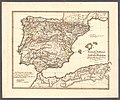
1865 Spruner Map of Spain and Portugal - Geographicus - Hispania-spruner-1865.jpg 3,500 × 2,827; 2.52 MB
-
1865 Spruner Map of the Balkans - Geographicus - Pannonia-spruner-1865.jpg 3,500 × 2,923; 3.15 MB
-
AMBS by Karl von Spruner.jpg 1,000 × 1,215; 458 KB
-
Britannia et Hibernia - Roman Britain and Ireland (Spruner-Menke, Atlas Atiquus, 1865).jpg 5,590 × 6,398; 23.1 MB
-
Die Reiche der Nordmannen vom VIIIten bis in's XIIte Jahrdndt (1854).jpg 7,991 × 6,498; 6.64 MB
-
Die Völker und Reiche der Slaven zwichen Elbe und Don bis 1125 - Chrobacia.jpg 1,296 × 1,320; 703 KB
-
Europa im Anfange des sechsten Jahrhunderts de Karl von Spruner.jpg 8,656 × 7,097; 13.09 MB
-
Greece at the time of the Dorian Migration (Spruner-Menke, Atlas Antiquus, 1865).jpg 6,935 × 5,554; 28.82 MB
-
Greece, Epirus after the Persian War (Spruner-Menke, Atlas Antiquus, 1865).jpg 5,674 × 6,439; 26.18 MB
-
Ituräa.jpg 335 × 583; 199 KB
-
K.v. Spruner's histor. Atlas Nº 3 - Europa im Anfange des VI. Jahrhunderts.jpg 11,305 × 9,355; 15.11 MB
-
K.v. Spruner's histor. Atlas Nº 40 - Die iberische Halbinsel nach ihrer Kirchlichen Eintheilung.jpg 11,449 × 9,541; 16.18 MB
-
Phantom islands in 1855 Spruner Map of Australia and Polynesia.jpg 408 × 266; 17 KB
-
Stylized cartouche in an Armenia map by Spruner.jpg 295 × 182; 19 KB
-
Trachonitis zur Römerzeit.jpg 1,181 × 766; 928 KB


