Category:Karl-Borchert-Straße (Weimar)
Jump to navigation
Jump to search
| Object location | | View all coordinates using: OpenStreetMap |
|---|
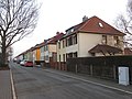
street in Weimar, Thuringia, Germany | |||||
| Upload media | |||||
| Instance of | |||||
|---|---|---|---|---|---|
| Named after |
| ||||
| Location | Weimar, Thuringia, Germany | ||||
 | |||||
Media in category "Karl-Borchert-Straße (Weimar)"
The following 2 files are in this category, out of 2 total.
-
 Karl-Borchert-Straße (Weimar).jpg 5,184 × 3,888; 8.16 MB
-
 Schild Karl-Borchert-Straße (Weimar).jpg 4,823 × 861; 3.07 MB
.jpg)
.jpg)