Category:Kapelle an der Grenzstraße (Saeffelen)
Jump to navigation
Jump to search
| Object location | | View all coordinates using: OpenStreetMap |
|---|
| Upload media | |||||
| Instance of | |||||
|---|---|---|---|---|---|
| Location | Saeffelen, Selfkant, Heinsberg, Cologne Government Region, North Rhine-Westphalia, Germany | ||||
| Heritage designation | |||||
 | |||||
Media in category "Kapelle an der Grenzstraße (Saeffelen)"
The following 7 files are in this category, out of 7 total.
-
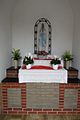
 Saeffelen Kapelle an der Grenzstraße Altar.JPG 1,200 × 800; 79 KB
-
 Saeffelen Kapelle an der Grenzstraße Ansicht.JPG 800 × 1,200; 206 KB
-
 Saeffelen Kapelle an der Grenzstraße Eingang.JPG 800 × 1,200; 163 KB
-
 Saeffelen Kapelle an der Grenzstraße Innenansicht.JPG 800 × 1,200; 93 KB
-
 Saeffelen Kapelle an der Grenzstraße Madonna.JPG 800 × 1,200; 89 KB
-
 Saeffelen Kapelle an der Grenzstraße Schmuckgitter.JPG 1,200 × 800; 120 KB
-
 Saeffelen Kapelle an der Grenzstraße Seitenansicht.JPG 800 × 1,200; 182 KB


