Category:Kapelle St.-Michael-Straße (Schützendorf, Mechernich)
Jump to navigation
Jump to search
| Object location | | View all coordinates using: OpenStreetMap |
|---|
Media in category "Kapelle St.-Michael-Straße (Schützendorf, Mechernich)"
The following 7 files are in this category, out of 7 total.
-
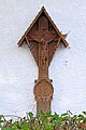
 Schützendorf Kapelle St.-Michael-Straße (01).jpg 4,950 × 3,462; 4.32 MB
-
 Schützendorf Kapelle St.-Michael-Straße (02).jpg 3,608 × 4,720; 4.07 MB
-
 Schützendorf Kapelle St.-Michael-Straße (03).jpg 3,320 × 4,456; 3.24 MB
-
 St. Michael (Schützendorf, Mechernich) 01.jpg 5,023 × 3,349; 6.68 MB
-
 St. Michael (Schützendorf, Mechernich) 02.jpg 5,098 × 3,399; 6.39 MB
-
 St. Michael (Schützendorf, Mechernich) 03.jpg 3,620 × 5,430; 6.85 MB
-
 St. Michael (Schützendorf, Mechernich) 04.jpg 3,746 × 5,619; 3.41 MB
.jpg)
.jpg)
.jpg)
_01.jpg)
_02.jpg)
_03.jpg)
_04.jpg)