Category:Kapelle Garstadt
Jump to navigation
Jump to search
| Object location | | View all coordinates using: OpenStreetMap |
|---|
Deutsch: Kapelle, an einem Waldweg links der Brunnholzstraße, Garstadt, Gemeinde Bergrheinfeld, Landkreis Schweinfurt, Unterfranken, Deutschland
| Upload media | |||||
| Instance of | |||||
|---|---|---|---|---|---|
| Location | Bergrheinfeld, Schweinfurt, Lower Franconia, Bavaria, Germany | ||||
 | |||||
Media in category "Kapelle Garstadt"
The following 3 files are in this category, out of 3 total.
-
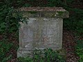 Bildstocksockel bei Kapelle Garstadt.jpg 3,804 × 2,853; 3.74 MB
-
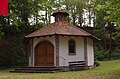 Kapelle Garstadt 2014 1.jpg 4,928 × 3,264; 6.76 MB
-
 Kapelle Garstadt 2014 2.jpg 4,928 × 3,264; 6.99 MB


