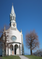
Category:Kapelle Dottenberg (St. Jost, Unter-Dottenberg, Adligenswil)
Jump to navigation
Jump to search
| Object location | | View all coordinates using: OpenStreetMap |
|---|
_auf_dem_Dottenberg_%C3%BCber_dem_Vierwaldst%C3%A4ttersee.jpg) | |||||
| Upload media | |||||
| Instance of | |||||
|---|---|---|---|---|---|
| Part of | |||||
| Location | Adligenswil, Luzern-Land Constituency, Lucerne, Switzerland | ||||
| Street address |
| ||||
| Heritage designation | |||||
 | |||||
Media in category "Kapelle Dottenberg (St. Jost, Unter-Dottenberg, Adligenswil)"
The following 2 files are in this category, out of 2 total.
-
 Dotteberg Kapelle St. Jost Adligenswil.png 556 × 789; 811 KB
-
 St. Jodokus (St. Jost) auf dem Dottenberg über dem Vierwaldstättersee.jpg 3,240 × 2,414; 4.54 MB
