Category:Kam Shan Road
Jump to navigation
Jump to search
| Object location | | View all coordinates using: OpenStreetMap |
|---|
 | |||||
| Upload media | |||||
| Instance of | |||||
|---|---|---|---|---|---|
| Named after | |||||
| Location | Tai Po District, New Territories, Hong Kong, PRC | ||||
 | |||||
中文:錦山路
Subcategories
This category has only the following subcategory.
Media in category "Kam Shan Road"
The following 3 files are in this category, out of 3 total.
-
 HK TaiPo KamShan TaiPoNormalSchoolMemorialSchool.JPG 3,264 × 2,448; 1,002 KB
-
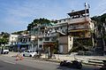 Kam Shan Village.jpg 5,959 × 3,935; 14.01 MB
-
 大埔太和林村河 - panoramio.jpg 4,000 × 2,250; 3.15 MB

