Category:Kaiserstraße 67 (Haan)
Jump to navigation
Jump to search
| Object location | | View all coordinates using: OpenStreetMap |
|---|
Media in category "Kaiserstraße 67 (Haan)"
The following 2 files are in this category, out of 2 total.
-
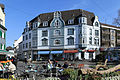 Haan - Friedrichstraße + Alter Markt 01 ies.jpg 5,616 × 3,746; 19.42 MB
-
 Haan, straatzicht Kaiserstrasse-Frierichstrasse foto6 2014-03-30 14.51.jpg 4,326 × 3,247; 9.14 MB

